
National Tragedy
Just a line
to hope you and yours are okay in this national period of mourning and
renewed determination. Likewise, we honor those who have worked so
hard to help preserve our lives and freedoms and to lead us in bringing
to justice the despotic perpetrators of our loss of lives and property.
...Temperatures
warm further...
...Dry conditions
prevail for most locations...
During this
rather uneventful summer weather, temps remained average to above normal
for most areas with rainfall in excess for the Northern Virginia, Raleigh,
Bristol, and Myrtle Beach areas with below normal amounts elsewhere in
our region. The warmest summer temperatures arrived late and occurred
during the first half of the month.
On the 10th
and early 11th, thunderstorms ended the heat wave over eastern Virginia
and sparked several house fires. This report came from Jason Breakiron
in Manassas, VA via the Internet on the 21st : "We have had close
to 8 inches of rain since Friday. 2.25" on Friday, 5.65" yesterday &
.20" so far today. Being a severe weather nut, I'm happy I
didn't chase
anything...just watched & watched people's reactions to the storms.
I just can't believe some people's actions; in one case I WITNESSED people
drive through a very fast moving water current. I only saw one driver
who pulled over & would not attempt to cross it."
Lightning killed
a Gloucester, VA woman on a boat in northern Norfolk waters on the 11th.
A young boy was struck and left numb on the 13th in Virginia Beach and
a report of another death due to lightning was received on the 20th.
Temperatures
began on the cooler-than-normal side for the first few days of the month
followed by a week-long period of the warmest summer temps. Temps
dropped back a bit during the latter half of the month but averaged about
normal with daytime highs slightly above normal and nighttime lows a bit
cooler than normal. The last 5 days brought rebounding temps which
were above normal for much of the area.
Patrick Maloit's AUGUST
2001 Hydrological Report Narrative Summary
http://tgsv5.nws.noaa.gov/er/akq/HYM/AugPre2001.htm
While most locations
received above normal precipitation for August across central...south central
and eastern Virginia...northeast North Carolina...and the lower Maryland
Eastern Shore...some locations received normal or below normal precipitation.
August 2001 precipitation totals ranged from 1.21 inches at Chase City
(Mecklenburg)...to 10.30 inches at Courtland (Southampton). While a trough
of low pressure produced scattered showers along the Mid Atlantic coast
on the 1st and 2nd...high pressure moved from the northeast to off the
Delmarva Coast. The high kept the region dry on the 3rd and 4th as it remained
offshore. A weak cold front passed across the region on the 5th producing
scattered showers and thunderstorms across the Mid-Atlantic states. This
included the 24 hour rainfall maxima for the month of 0.83 inches at Alberta
(Brunswick). High pressure built in behind the front and quickly moved
offshore by the 6th. The Mid Atlantic states remained relatively dry through
the 9th under the influence of this high. A trough of low pressure moved
across the region on the 10th...followed by a cold front on the 11th. This
front then lifted north as a warm front on the 12th. Another cold front
then crossed through Maryland...Virginia and the Carolinas from the 13th
to the 14th. The rapid succession of troughs of low pressure and fronts
across the region from the 10th to the 14th produced several 24-hour precipitation
maxima for the month. These included: 3.70 inches at Warsaw (Richmond County
- 10/1th)...2.28 inches at Wakefield (Sussex - 11th)...1.45 inches at Amelia
(Amelia - 11/12th)...1.63 inches at Assateague Island (Worcester - 12th)...3.47
inches at Sandston (Henrico - 12/13th)...4.50 inches at Princess Anne (Somerset
- 13th)...and 2.05 inches at Edenton (Chowan - 13/14th). High pressure
built in behind the front from the Great Lakes on the 14th...slowly sliding
southeast to near Cape Hatteras the morning of the 17th. A cold front slowly
moved through the region from the west from late on the 17th to the 18th...before
moving back north of the region as a warm front on the 19th...bringing
showers and thunderstorms with it. This precipitation resulted in some
24-hour rainfall maxima for August...including 1.92 inches at Smithfield
(Isle of Wight - 17th)...3.30 inches at Lawrenceville (Brunswick - 17/18th)...2.49
inches at Stoney Creek (Sussex - 18th)...1.87 inches at Holland (Suffolk
- 18/19th)...and 1.15 inches at Wallaceton/Lake Drummond (Chesapeake -
19th). (continued >>> ) |

ACON
- VA/NC/SC
The Atlantic
Coast Observer Network:
Virginia,
North Carolina, South Carolina
http://www.pilot.infi.net/~bsmoot/acon.htm
SUMMARY OF
CLIMATOLOGICAL DATA
AUGUST
2001
Patrick Maloit's summary
continued...
A cold front
then crossed the region from the 20th into the 21st...with the precipitation
associated with this producing a 24-hour precipitation maxima for the month
at Jackson (Northampton NC) of 0.93 inches (20th-21st). High pressure built
in behind the front from the Ohio Valley on the 21st...then slowly moved
to Georgia by the 23rd. Meanwhile...an upper level disturbance moved across
the region from the 22nd to the 23rd causing scattered showers and thunderstorms...including
a 24 hour precipitation maxima at Louisa of 1.09 inches (22nd-23rd). A
cold front slowly moved across the region from late on the 23rd through
the 24th. The showers and thunderstorms with this front produced a few
precipitation maxima for the month including 1.49 inches at Pamplin City
(Prince Edward - 23rd/24th). Behind the front...high pressure moved in
from Canada...sliding southeast to the Canadian maritime provinces by the
26th. A cold front crossed the Mid Atlantic states from the 27th to the
29th. The 24-hour precipitation maxima for August associated with it included
1.92 inches at Winterpock (Chesterfield - 27/28th). The front stalled out
across the piedmont region on the 29th...before finally moving offshore
as cold front from the 30th to the 31st as high pressure built down from
New England on the 31st. The passage of the front caused the final precipitation
maxima for August of 1.54 inches at Williamsburg (30th/31st).
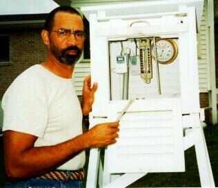
Member Profile: Merriell
A. Jay, Roxboro, NC
Longtime group
member Merriell sends us some info on his weather station and his involvement
in weather study: "Studying the weather has been an interesting hobby for
me since the mid 1970s. One of the most fascinating things about
weather is the constant changes it presents along with the many variables
... making each day special and different. It was in 1975 when I
began to find out more details about weather. Reading any weather
related books, watching TV weather broadcasts, and listening to some of
the older generations of farmers talk about weather was my first start.
I began to study more about the many different weather phenomena and what
caused them to occur. My interest grew more and more as I studied
more. So, at that point, I decided to purchase some instruments and
a weather shelter to set up my own backyard weather station. I lived
in Durham, North Carolina at the time my observations began. I made
and recorded my observations three to four times each day for eighteen
years in Durham. I moved to Roxboro in Winter 1993 and set up my
new weather station there. I have instruments to measure wind, temperature,
humidity, air pressure, and precipitation. I want to convert to a
wireless station in the near future. I still make three to four observations
per day and record them on a customized weather log. I enjoy observing
the weather just as much now as I did on that first day in 1975."
ACON VA/NC/SC Welcomes
Newest Member Scott M. Lancey and WREL
Radio, Lexington
This summary
brings the first of many reports from Scott in Lexington. He has
maintained a database there since 1996. Lexington, VA is home to
the Keydets of Virginia Military Institute. Asked for his pic, but
he said radio station guys- unlike TV celebs- don't have them! To
locate Lexington, VA (not KY or NC), click
here!

Left out, but not forgotten!!
Myrtle Beach Tornadoes of July 6th, 2001
As I finished-up
July's summary, I completely forgot about the article and links about the
tornado outbreak in the Myrtle Beach, SC area of early July. So,
you can read all about it and see the fantastic collection of related pics
by revisiting last month's publication. Just click here, http://www.geocities.com/SiliconValley/1667/acon/jul01.htm
or go directly to NWS ILM's web site article http://nwsilm.wilmington.net/archive/07-06-01/.
|

For ACON
VA/NC/SC Recent Weather News, Search CNN
http://www.cnn.com/WEATHER
ACON
VA/NC/SC Member Station Extremes - August 2001
|
State
|
Maximum Temperature
|
Minimum
Temperature
|
Warmest
Average
Temperature
|
Coldest
Average
Temperature
|
Maximum
Precipitation
|
Minimum
Precipitation
|
|
Virginia
|
98°
Richmond (RMD), Wakefield, Newport
News, Hampton
|
50°
Blacksburg
|
80.5°
Hampton
|
71.6°
Blacksburg
|
7.57"
Centreville
|
1.29"
Charlottesville
|
|
North Carolina
|
100°
Raleigh (RDU)
|
53°
Asheville, Brevard
|
79.6°
Charlotte, Raleigh (RDU)
|
71.8°
Brevard
|
6.28"
Lumberton
|
0.64"
Charlotte
|
|
South Carolina
|
99°
Florence
|
61°
Greenville-Spartanburg
|
82.2°
Columbia
|
78.6°
Greenville-Spartanburg
|
6.09"
North Myrtle Beach
|
1.01"
Greenville-Spartanburg
|
Virginia:
Annandale - "August was
a warm wet month. Rainfall was about 1 inch above the average & the
mean temp was about 2° above the average. The max temp of 96°
for the month was the highest in Aug. since '97.
The lowest max temp. was 79°
equaled the highest ever for August. The month had 30 days that the
max temp. was >= 80° which is the most for Aug. since 1993.
Also, the 77° min on the 9th tied the August record for the highest
minimum temp. The lowest temp in August was 62° which
was the highest minimum by 3° ever recorded at this station in the
last 21 years. The old record was 59°. There
were only 6 days the temp went below 65° which is also a 21 year
record. Highest mean for the date of August 9th was 86.5°,
the highest in since 1988. The 1.38" of rain on the 10th
was the heaviest daily rainfall total for an August day since
1997. The 4.23" precip total for August was the
6th greatest in the last 21 years for the month.
The 30.43" barometer reading on August 1st was the highest in August since
1986 when it was 30.45 inches. August also had
the lowest average wind speed since 1998."
[ + + ] - notes form Lowell
Arlington - NWS WBC's Dewey
Walston reports: "After a cool June and July...temperatures in August
averaged slightly above normal. The highest temperature of the summer
occurred on August 8th and 9th at 97 degrees. There were only 6 days
this month in which the temperature reached 90f or higher. There have only
been 16 days this year on which the temperature reached 90 degrees or higher.
Normally...we get 38 days each year on which the temperature reaches 90
degrees or higher. After a wet June and July...precipitation in August
was below normal. Precipitation for the entire summer ended up above normal."
The average wind speed was 7.3 mph. [+ -]
Ashburn - Gary emails these
notes: "Another relatively unremarkable month as meteorological summer
comes to a close. As with July, a wetter than normal month, rainfall being
2.56 above normal. Despite the significant heat wave on the 5th
through the 10th (which I was privileged to miss, thanks to for-once well
timed business travel) average temperatures were only 1.9 degrees above
normal. The heat index reached 109º on the 9th. Often
predicted thunderstorms or thundershowers generally did not make an appearance;
only 6 days with any observable thunder. Winds again pretty calm,
with average windspeed of only 1.1 MPH. Dominant direction was SSE,
with strong secondary direction of WNW." [ + + ]
Blacksburg - Temps were 2.0°
above normal while precip was 0.77" below normal. - NWS Blacksburg [+
-]
Bridgewater - Clayton email
us that: "The temperature for the month was 2.7 degrees above normal.
The rainfall was 1.12 inches above normal. This is only the second month
so far this year with precipitation above normal. In spite of a wet August,
the yearly total precipitation is 2.65 inches below normal. The barometer
readings changed very little during the month. There were only two readings
below 30.00 inches. Most of the readings were between
30.00 inches and 30.11 inches." [+
+]
Centreville - Paul notes: "August
finished warmer than usual by about three per cent and a lot wetter by
182 per cent. While it remained dry for the first nine days, we coupled
that with six days of the warmest temperatures this summer to complain
about. Over a span of nearly one week our average daily high for
that period came in at 94.3°. To ease the pain it might be helpful
to note that our overall daily high and low of 86° and 67°, and
our coolest temperature of 57° all occurred within the same nine-day
period. There was a teaser of a rain event on the tenth with 0.30
inches and helped to drop temperatures by 15° in an hour. The
next day was the one to claim all responsibility for breaking the hot and
dry spell with our average monthly rainfall of 4.16 inches accumulating
in just 2.5 hours. It took six more hours to pick up the remaining
quarter inch or so for the day but who cared, the ice trays were already
full. Another day of heavy rain occurred 12 days later and produced
2.39 inches in a hair over three hours for an average rate of 0.78 inches
per hour. Without six hot days in a row and a deluge to follow, everything
would have been about normal, and I wouldn't have much to write about except
to mention that our average nightly low was 3.7° above the 63°
norm." [+ +]
Charlottesville - Rainfall
for the month was 3.42" below normal. Average wind speed was 3.1 mph. -
NWS WBC [M -]
Dulles - NWS WBC reports
the mean temp was 2.3° in excess of the norm. Rainfall was in
excess of the normal by 0.61". [+ +]
Falls Church - Erica notes:
"August 2001 was a warmer than average month but wetter than average. The
storms of August 11 brought 3.05 of rain to my neck of the woods
.this
was the most rain in such a short period of time (2-3 hours) that I can
remember. My street was completely under water for a time and part of it
was closed for cleanup that next week. I also had some flooding in
part of my basement as a result. August 2001 will certainly go down as
a historical month for Falls Church!" - notes from Erica [ + + ]
Hampton - "Temperatures averaged
2.5° above normal while precipitation was 1.04" below normal.
No station records were tied or broken this month. I am looking forward
to refreshing fall weather soon!" - notes from Dave [
+ - ]
Harrisonburg - Terry reports:
"The high temperature of 92.2 on August 19 was the highest temperature
I have recorded this year. Recordable rain occurred on 14 of 31 days in
August. Rain on 11 of those 14 days was greater than .10 inch. The monthly
total for August of 4.85" made August the wettest month so far this year."
- notes from Terry
Herndon - "August rainfall
was .96 inches above normal. I had thunderstorms on the 10th, 11th, 13th,
20th, and 23rd. Temperatures averaged 1.1° above normal. Of note
was the 2.14 inches of rain in thunderstorms on the 23rd. The 90°+
temperatures on the 6th thru the 10th were my "heat wave" for the summer
of 2001. The peak wind gust of 25 mph was registered in a thunderstorm
on the 23rd." - from Russ
[+ +]
Louisa - "Gettin' kinda dry."
- report from Joe Bowers [M +]
Lexington - "This is the first
report from WREL Radio in Lexington, Virginia. Interesting
feature this month was precipitation. We recorded a total of 3.75"
for the month. Of this total, 3.42", or 01%, fell in three days.
One FROPA and two pulse thunderstorms produced this total; so, despite
the relatively high total, much of the month was dry. Also of note
was the heat wave from the 5th to the 10th. On the 9th, the highest
temperature of the year was recorded (92.5°F). That morning,
we recorded a dew point of 78°. This was the second highest dew
point at this station (from 1996 to present)." - Scott Lancey for WREL
Radio
Lynchburg - The mean temp was
0.1° above normal while precip was 1.39" below the norm. - NWS Blacksburg
[+
-]
Newport News - Gary writes:
"Our heat wave of the summer consisted of a 9-day period of above 90°
from the 5th through the 13th."
New Market - Joyce notes: "Early
morning off the 22nd we had an upper level wind of some kind that took
our roof off the big barn and also a large and very old walnut tree in
the back yard. It rolled the aluminum roof into a big ball and placed
it in the hay field about 100 to 150 feet away from the barn. Crazy
weather."
Norfolk - From NWS AKQ:
The monthly precip was 0.60" below normal while the monthly mean temp was
1.6° above normal. The average wind speed was 8.1 mph.
[+ +]
Portsmouth - The mean temperature
here was 1.1° above normal while precip was 69% of the norm (or -1.65").
The average wind speed was 2.3 mph from a dominant southerly direction.
Records: On the 9th, a new daily maximum minimum temperature record was
set with 79°, surpassing the 76° set in 1984. On the same
day (9th), the afternoon high temp was 96° which tied the previous
record established in 1977. Thunderstorm activity increased
with 8 storms noted. Two days reported more than one period of thunderstorms
with 6 days having convection. For the year rainfall was running
7.12" below normal (79 %). [ + - ]
Richmond - From NWS AKQ:
Richmond's rainfall was 2.73" below normal. Temps averaged 3.1°
below the norm. The average wind speed was 7.5 MPH. [-
-]
Mechanicsville - Glen
sends these notes: "T-storms on the 13th at 1835 hours produced downpours
and sharp lightning. T-storms also on the 10th, 23rd, and 27th with
sharp, bright lightning."
Roanoke - "Temperature
averages were 2.2° above normal. Rainfall was below normal (-1.82")
- notes NWS Blacksburg [+ -]
Roanoke - "A hot August with
below normal rainfall. The average temperature was 2° above normal.
A lack of thunderstorms was the most noteworthy feature." - notes from
Wendell.
[ + - ]
Woodstock - "August was
close to my 16 year average---a little wetter, a little warmer, but nothing
notable." - notes from Lauck
[ + +]
North Carolina:
Asheville - From NWS GSP: The
monthly mean temp was 1.8° above normal while rainfall was 1.49"
below normal. The average wind speed was 4.2 mph. [+ -]
Brevard - Bob sends these
notes via email: "Away from station August 6-15th and 23-29th, 17 recording
days, rainfall for the month 5.04", is complete. Rainfall for the month
is high for the past four years, but not unusually so for a month with
a ten year average rainfall of 7.20". Brevard is still 15%
short for the year. The month's average high temperatures, 80.8,
and low, 62.8 deg F are based upon less than half the number of observations
which
could have been made." [
M - ]
Charlotte - NWS GSP reports
the mean temp here was 1.3° above normal while precip was 3.09" below
normal. The average wind speed was 5.0 mph. [+ -]
Greensboro - Temperatures at
the Piedmont Triad International Airport averaged 1.3° above normal
while precip was 0.72" below the norm. The daily minimum temp record
on the 2nd was tied. The daily high minimum temp record was tied
on the 8th, 10th, and 29th. - From NWS RDU [+ -]
Lumberton - The average wind
speed was 3.2 MPH. - from NWS ILM
Raleigh (RAL) - Bob notes:
"August weather was similar to July with below number temps and above number
rainfall. No severe weather was observed however there were thunderstorms
recorded on 10 days. Year to date total for thunderstorms is now 35." [
- +]
Raleigh (RDU) - The monthly
mean temperature was 2.5° above normal and the total precip was 0.86"
above normal. August was tied for the 5th warmest on record at the
airport location dating to 1944. A daily high temp record was set
on the 9th and 10th. The daily high minimum temp record was tied
on the 10th, 29th, and 31st and set on the 20th. - from NWS RDU [+ +]
Roxboro - Merriell reports:
"August was mostly hot, hazy, and dry. Temperatures averaged 2.7°
above normal while precipitation total was less than ¼ normal August
precip." [+ - ]
Wilmington - "...Normal temperatures
for August...but continued drier than normal..." The average temperature
for
the month was 0.1 degrees above normal. The average high was 0.9
degrees warmer than normal...and the average
;ow temperature was 0.2 degrees below
normal. No temperature records were broken or tied for the month....although
Wilmington tied the record warm minimum temperature of 79 degrees on the
9th. This record was set in 1951.
Total rainfall was 1.32 inches below
normal. August was sunnier than normal. 80 percent of possible
sunshine was received (normal is 62 percent). The average wind
speed was 6.1 mph." - excerpts from NWS ILM's monthly summary
[+/- - ]
South Carolina:
Columbia
- NWS CAE reports the average relative humidity was 66% while the average
temperature was 2.5° above normal. Rainfall was 3.25" below normal.
For the year rainfall is running 12.61" below the normal. - NWS CAE[+
-]
Charleston
- From NWS CHS: The monthly mean temp was 1.0° below normal while precip
was 5.57" below the norm. The average wind speed was 6.8 mph. [- -]
Florence
- NWS ILM reports the mean temp here was 1.0° above normal
while rainfall was 1.97" below normal. The average wind speed was
5.9 mph. [+ -]
Greenville-Spartanburg-
The monthly temps averaged 1.5° above normal while total rainfall was
2.94" below normal. Yearly precip was running 7.93" below normal.
The average wind speed was 5.6 mph. - NWS GSP [ + -]
North Myrtle
Beach - From NWS ILM: Rainfall was 0.19" above normal.
Temps averaged 0.6° above normal. The average wind speed was
7.5 MPH. Records: Low temperature of 67° set on the 3rd.
The previous record was 68° set in 1998. [+ +]
Orangeburg
- The average relative humidity was 77%. (from NWS CAE)
Nearby Cities:
Tri-cities/Bristol area noted
temps averaging 0.9° above norm with total rainfall above normal (+0.12").
For the year, rainfall is 6.26" above normal. - from NWS Morristown,
TN [+ +]
(Please
note the column denotations table below.)
TEMPERATURES / WIND / ELEMENTS
VIRGINIA
STN  A      B    C    D      E F     G    H I  J K L  M     N  O P Q R R1 S
------------------------------------------------------------------------------
AHB 86.6  66.9  76.1  96.6   9 58.0  2   7  0  0 0 19 W    11  6 0 0 0  3 2400
ANN 85.29 68.97 77.13 96     9 62    2   5  0  0 0 28 W    10  7 0 0 0  1 2400
BCB             71.6  89     9 50   22             24      30             2400
BRI 86.2  64.6  75.4  95   7,9 56 21,22  5  0  0 0             6 0 0 0  2 0515/1600
CEN 86.4  66.5  76.5  97    10 57    2   6  0  0 0 18 159° 30  6 0 0 0  0 1200/2400
CHO 86.3  63.9  75.1  95     9           5  0  0 0 33 200° 30 14 0 0 0  9 2400
DCA 86.7  71.1  78.9  97   8,9 63    2   6  0  0 0 31 300° 13 11 0 0 0  0 2400
IAD 86.7  66.3  76.5  97     9 58   22   7  0  0 0 30 010° 23             2400
FCH 86.5  70.4  78.5  97     9 63    2   6  0  0 0             8 0 0 0  0 2400
HAM 86.9  74.1  80.5  98    10 62    1  10  0  0 0 38 W    13  4 0 0 0  1 2400
HRG 83.9  63.6  72.8  92.2   9 54.2 22   2  0  0 0 23 S    12  5 0 0 0  3 2400
HER 84.9  67.3  76.1  95.4   9 61.0 22   5  0  0 0 17      30  7 0 0 0 NR 2400
HRN 84.8  66.8  75.3  95.9   9 59.9 21   5  0  0 0 25 NNW  23  6 0 0 0  0 2400
LKU 88.1  64.5  75.3  97     9 54   21   7  0  0 0 17 SE   12  0 0 0 0  2 2400
LYH             74.7  94     9 53   21             35      27             2400
LXI 87.4  63.1  75.2  95.2   9 52.5 21   9  0  0 0 24 NW   23  7 0 0 0 11 2400
NEW 86.74 63.13 74.94 96     9 54  21-22 6  0  0 0 25 S    30 10 0 0 0 15 1700
NPN 87.8  69.3  78.6  98     9 58    1  11  0  0 0 39      13  6 0 0 0  0 2300
NOR 88.0  70.2  79.1  97  8,9, 60    1  11  0  0 0             5 0 0 0  0 2400
                            10
ORF 86.5  71.1  78.8  96  9,10 63    1   9  0  0 0 33 270° 13  9 0 0 0  0 2400
POR 87.2  71.1  79.1  96  9,10 62    1   8  0  0 0 23 SSW  13  6 0 0 0  0 2400
                                                   26 N     2
MEC 86    68    77    97     9 57    2   5  0  0 0             7 0 0 0  1 1800
RIC 85.8  64.0  74.9  95    11 53    3  11  0  0 0 39 010°  2  1 0 0 0  0 2400
RMD 88.5  69.8  79.2  98    10 62    2   8  0  0 0             4          2300
                            17
ROA             76.9  94     9 57   21             37      23             2400
ROK 87.3  65.3  76.3  95     9 54 21,22  6  0  0 0 29 NW   23  1 0 0 0  1 2200
AKQ 88.84 66.90 77.87 98  9,10 54    1  11  0  0 0                        2400
WOO 82.2  66.2  74.2  89  9,10 60 21,22  0  0  0 0             9 0 0 0 11 0800
WSH 85.3  65.4  75.4  94.6   9 59.1 22   5  0  0 0 13 NNW  13  8 0 0 0  0 2400
NORTH
CAROLINA
STN  A      B    C    D      E F    G     H I  J K L  M     N  O P Q R R1 S
------------------------------------------------------------------------------
AVL 83.0  64.6  73.8  89     9 53   22   0  0  0 0 29 320°                2400
BRE 80.8  62.8  71.8  86       53                  18                     1600
CLT 90.7  68.5  79.6  97     9 59   22  17  0  0 0 28 200°                2400
GSO 86.2  67.8  77.0  94     9 60    2                                    2400
LBT 89.3  69.4  79.3  98   8,9 62  3,26 13  0  0 0 47 290° 31 12 0 0 0  3 2400
RAL 88.5  66.2  72.4  96     9 56    2   9  0  0 0 21 S    30 10 0 0 0  1 1900
RDU 90.0  69.2  79.6 100     9 59    2                                    2400
ROX 87.8  67.3  77.6  95     9 59.0 22   8  0  0 0 28 NW   11  6 0 0 0  0 2100
ILM 88.3  70.8  79.5  96     8 62   26  10  0  0 0 38 180° 19 15 0 0 0  1 2400
SOUTH
CAROLINA
STN  A      B    C    D      E F    G    H  I  J K L  M     N  O P Q R R1 S
------------------------------------------------------------------------------
CAE 92.6  71.7  82.2  98  9,10 65 2,3,23                                  2400
CHS 89    72    80    94  9,28 67  2,26 17  0  0 0 36 250° 20             2400
CRE 86.5  71.9  79.2  92     8 62   26   2  0  0 0 36 220° 29  0 0 0 0  1 2400
FLO 91.0  70.0  80.5  99    17 62   26  18  0  0 0 39 190° 18  5 0 0 0  3 2400
GSP 87.7  69.5  78.6  96    27 61   22  12  0  0 0 45 240°                2400
OGB 88.5  70.1  79.3  96  9,28 64 2,3,26                                  2400
NEARBY
LOCATIONS
STN  A      B    C    D      E F    G    H  I  J K L  M     N  O P Q R R1 S
------------------------------------------------------------------------------
TRI 84.3  64.7  74.5  90 6,7,8 52   22   4  0  0 0                        2400
                             9
CHW 69.6  57.0  63.3  76.9   9 44.2 15   0  0  0 0                        2400
(Please
note the column denotations table below.)
PRECIPITATION
/ BAROMETRIC PRESSURE
VIRGINIA
STN  T     U       V      V1   W X   Y      Z  1  2 3    4    5      6       7        S
-----------------------------------------------------------------------------------------
AHB  6.56  3.01 11 3.26 11-12 10 2 30.59  0.0          0.0       30.366  1 29.789 27 2400
ANN  4.23  1.38 10 1.38    10 10 2 29.34  0.0          0.0 12.8  30.43   1 29.80  31 2400
BCB  2.81                                                                            2400
BRI  4.93  1.55 11 2.71 11-12 11 2 23.53  0.0          0.0  8.6  30.32     29.97     0515/1600
CEN  7.57  4.39 11 4.69 10-11  8 2 33.01  0.0          0.0 14.2  30.40   1 29.82  31 2400
CHO  1.29  0.48 11 0.77 11-12 12 0        0.0          0.0       30.36   1 29.80  31 2400
DCA  2.98  0.92 11 1.07 10-11 10 0 26.81  0.0          0.0  7.4  30.38   1 29.79  31 2400
IAD  4.55  1.63 23 1.63    23 10 2 28.81  0.0          0.0  9.8  30.37   1 29.78  31 2400
FCH  5.44  3.05 11 3.83 10-11  9 1 29.33  0.0          0.0 10.0                      2400
HAM  3.66  2.06 18 2.06    18  8 1 27.25  0.0          0.0  1.5  30.35   2 30.10   6 2400
HRG  4.45  1.12 12 1.17 12-13 11 1 21.25  0.0          0.0 10.4  30.40   1 29.88  19 2400
HER  6.62  2.80 11 2.80    11 10 2 34.09  0.0          0.0 15.4  30.39   1 29.72  31 2400
HRN  4.90  2.14 23 2.14    23 12 2 31.49  0.0          0.0 13.0  30.371  1 29.810 31 2400
LKU  2.31  1.09 23 1.09    23  5 1 25.22  0.0          0.0  3.0  30.38     29.81     2400
LYH  2.20                                                                            2400
LXI  3.75  1.42 23 1.48 23-24  8 2 28.58  0.0          0.0       30.38 1,2 29.84  19 2400
NEW  6.43  2.10 12            13 1 28.43  0.0          0.0 12.3                      1700
NPN  2.98  1.10 18 1.50 18-19 10 1 27.84  0.0          0.0  2.6  30.37   1 29.81  27 2300
NOR  2.64  1.43 18             9 1 28.83  0.0          0.0  1.3                      2400
ORF  4.21  2.06 18 2.06 17-18  9 1 28.23  0.0          0.0  1.6  30.37   1 29.84  31 2400
POR  3.69  1.35 18 1.35    18  9 1 26.12  0.0          0.0  1.6  30.329  1 29.807 14 2400
MEC  4.50  3.00 13 3.24 12-13  8 1 34.11  0.0          0.0  5.4  29.91 22, 29.33  10 1800
                                                                        25
RIC  2.73  1.94 29 1.96 28-29  8 1 21.81  0.0          0.0  3.3  30.32  31 29.69  11 2400
RMD  5.18  3.03 12             4 2 29.57  0.0          0.0  3.0                      2300
ROA  2.33                                                                            2400
ROK  3.00  1.31 01 1.31     1  7 1 27.03  0.0          0.0  7.4  30.30   1 29.89  19 2400
AKQ  6.24  2.28 11            13 2 28.78  0.0          0.0  8.0                   13 2400
WOO  4.37          1.12 19-20 14 1 26.32  0.0          0.0 17.8  30.68   2 30.10  23 0800
WSH  3.41  1.18 12 1.63 12-13  9 1 27.69  0.0          0.0  9.5  30.46   1 29.90  31 2400
NORTH
CAROLINA
STN  T     U       V      V1   W X   Y     Z   1  2 3  4     5       6       7        S
-----------------------------------------------------------------------------------------
AVL  3.20          1.08   3-4 14 0 25.76  0.0          0.0 15.5  30.35   1 29.85  19 2400
BRE  5.04                          34.19  0.0          0.0  8.5  30.48     30.09     1600
CLT  0.64          0.40 13-14 10 0 18.35  0.0          0.0  2.7  30.36   1 29.84  19 2400
GSO  3.09  1.24 11 1.24    11                                                        2400
LBT  6.28  3.11 18 3.12 18-19 13 2 29.84  0.0          0.0  0.0  30.34   1 29.87  14 2400
RAL  5.09          2.61 11-12 12 1 30.87  0.0          0.0  3.0  30.35   1 29.85  23 1900
RDU  4.88  2.11 11
ROX  1.14  0.69 11 0.69    11  7 0 29.82  0.0          0.0  0.5  30.45   1 29.92  19 2100
ILM  5.62  1.54 14 1.66 13-14 16 2 35.23  0.0          0.0  0.2  30.32   1 29.86  14 2400
SOUTH
CAROLINA
STN  T     U       V      V1   W X   Y     Z   1  2 3  4     5       6       7        S
-----------------------------------------------------------------------------------------
CAE  2.84                          24.10  0.0          0.0    T                      2400
CHS  1.65                     12 0 32.20  0.0          0.0    T                      2400
CRE  6.09  2.33 29 2.46 29-30 11 2 31.15  0.0          0.0  0.0  30.31   1 29.87  14 2400
FLO  3.06  1.69 29 1.70 29-30  5 2 26.03  0.0          0.0  0.0  30.31   1 29.87  14 2400
GSP  1.01  0.25 13 0.25    13  8 0 26.04  0.0          0.0  6.3  30.33   1 29.84  19 2400
OGB  2.04                          24.59  0.0          0.0                           2400
NEARBY
LOCATIONS
STN  T     U       V      V1   W X   Y     Z   1  2 3  4     5       6       7        S
-----------------------------------------------------------------------------------------
TRI  4.96  1.81 30 2.03 30-31 14 1 34.80  0.0          0.0                           2400
COLUMN
DENOTATIONS:
| A maximum mean temperature |
T total precipitation (inches) |
| B minimum mean temperature |
U maximum calendar day precipitation
(inches) |
| C monthly mean temperature |
U1 date of maximum calendar day precipitation |
| D maximum temperature |
V date(s) of maximum daily
precipitation |
| E date(s) of maximum
temperature |
V1 maximum 24-hour precip.
& date(s) |
| F minimum temperature |
W number of days with precip.
>= .01" |
| G date(s) of minimum
temperature |
X number of days with precip.
>= 1.0" |
| H days with maximum
temperature >=90 |
Y year-to-date precipitation
(inches) |
| I days with maximum
temperature <=32 |
Z maximum calendar day snowfall
(inches) |
| J days with minimum
temperature <=32 |
1 date of maximum calendar
day snowfall (inches) |
| K days with minimum
temperature <= 0 |
2 number of days with snowfall |
| L peak wind gust (miles
per hour) |
3 number of days with snowfall
>= 1.0" |
| M direction of peak
wind gust |
4 total snowfall for
month (inches) |
| N date(s) of peak
wind gust |
5 total snowfall for 2000-2001
season (inches) |
| O number of days with
thunder |
6 maximum barometric pressure
(inches) |
| P number of days with
hail |
6A date of maximum barometric pressure |
| Q number of days with
glaze |
7 minimum barometric pressure
(inches) |
| R number of days with
ice pellets |
7A date of minimum barometric pressure |
| R1 number of days with dense
fog |
(i) incomplete data |
| S local observation
time for temps/precipitation |
(M) Missing, if listed in
data table |
| ~ "about" |
E estimated |
| + additional
indeterminate number of days |
NR not recorded |
STATION
/ LOCATION (MILES & DIRECTION FROM MAIN POST OFFICE) /OBSERVER / YEAR
RECORDS BEGAN / EMAIL ADDRESS:
| AHB Ashburn,
VA - Gary Oldhaam 7/01 281' AMSL Gary.Oldham@DynCorp.com |
ROK Roanoke,
VA 6SW Wendell Prillaman 4/76 wandlprillaman@home.com |
| ANN Annandale,
VA 1 3/4 ENE - Lowell Koontz 12/90 wwkoontz@bellatlantic.net |
|
| DCA Arlington,
VA NWS Webmaster (Sterling): james.decarufel@noaa.gov |
|
| BCB Blacksburg,
VA NWS Webmaster: William.Perry@noaa.gov |
AKQ Wakefield,
VA NWS Webmaster: Neil.Stuart@noaa.gov |
| BRI
Bridgewater, VA Clayton Towers Ctowers@rica.net |
WSH Washington,
VA David Yowell runamok@runamok.com |
| CEN Centreville,
VA Paul Bassett 1985 pbassett@sitestar.net |
WEE Weems, VA
3WNW Francis J. Socey |
| CHO Charlottesville,
VA Airport ASOS (Rappahannock County) |
WOO Woodstock, VA
5NW Lauck Walton - 12/1/85 jwalton@shentel.net |
| IAD
Dulles International Airport Webmaster (Sterling): james.decarufel@noaa.gov |
AVL Asheville,
NC NWS NWS GSP: bryan.mcavoy@noaa.gov |
| FCH Falls
Church, VA Erica Page - 3/7/94 Windie1970@aol.com |
BRE Brevard,
NC 1SE Bob Keehn 1/1/90 Bob_Keehn@citcom.net |
| FRB Fredericksburg,
VA 7SW Ken McKneely mckneelys@email.msn.com |
CLT Charlotte,
NC NWS NWS GSP: bryan.mcavoy@noaa.gov |
| HAM Hampton,
VA 5NE Dave Kessel 1989 dckessel@home.com |
CND Concord, NC 3
W, Highway 73, 2 miles E of I85. stormwatch@vnet.net |
| HRG Harrisonburg,
VA Terry Slagle 5/2000 Altitude: 1306' tslagle@adelphia.net |
GSO Greensboro,
NC NWS Webmaster (Raleigh/RAH): Richard.Jones@noaa.gov |
| HER Herndon,
VA R.M. Beall P- 10/76 T- 1/91 beall47@earthlink.net |
RAL Raleigh,
NC 7NNW Bob Woodson - 6/1/93
kf4mmm@qsl.net |
| HRN Herndon,
VA 4SW Russ Topping - 1985 weatherman@cox.rr.com |
RDU Raleigh-Durham,
NC NWS Webmaster: Richard.Jones@noaa.gov |
| LXI
Lexington, VA Scott M. Lancey, WREL Radio - 06/1996 weather@wrel.com |
|
| LKU
Louisa, VA 1N Joseph Bowers 1944 - NWS
ID 44-5050-02 jmbiii@earthlink.net |
LBT Lumberton, NC FAA Lumberton 34o
37'N 79o 04'W |
| LOU
Louisa, VA 6S John Bullock (about 1970) |
ROX Roxboro,
NC 2SE Merriell A. Jay 1/93 |
| LYH
Lynchburg, VA NWS Webmaster (Blacksburg): William.Perry@noaa.gov |
ILM
Wilmington, NC NWS nwsilm@wilmington.net |
| NEW Newmarket,
VA 2W Joyce Winfree joywood@shentel.net |
CHS Charleston,
SC NWS, Webmaster: Theodore.Rodgers@noaa.gov |
| NPN
Newport News, VA 7N Gary Leonard - 6/91 GaryMLeonard@aol.com |
CAE Columbia,
SC NWS caewx@noaa.gov |
| NOR
Norfolk, VA 3NE Jim Fentress 6/1/77 |
OGB Orangeburg, SC NWS
caewx@noaa.gov |
| ORF
Norfolk, VA 5NE NWS 1871 Webmaster (Wakefield): Hugh.Cobb@noaa.gov |
GSP Greenville-Spartanburg,
SC NWS bryan.mcavoy@noaa.gov |
| POR
Portsmouth, VA 3S Bill Trotter - 7/1/76 pwrs@pilot.infi.net |
RUB Ruby,
SC 3 NW Franklin Hancock |
| MEC
Mechanicsville, VA Glen Martin 11/19/91 |
FLO Florence,
SC nwsilm@wilmington.net |
| RMD Richmond,
VA Roy Britt 8/22/83 roybritt@earthlink.net |
CRE North
Myrtle Beach, SC nwsilm@wilmington.net |
| RIC
Richmond, VA NWS |
TRI
Tri-cities/Bristol, TN NWS Webmaster (Morristown):W-Mrx.Webmaster@noaa.gov |
| ROA Roanoke,
VA Webmaster (Blacksburg): William.Perry@noaa.gov |
CHW Canaan Heights,
WV Dave Lesher wxdave@boo.net |