
http://members.cox.net/wxr/acon.htm
SUMMARY OF CLIMATOLOGICAL DATA
SUMMARY OF CLIMATOLOGICAL DATA
Wow, what a month! December brought a very early start to winter with cold, and often subfreezing temps. For several stations, this was the coldest December in station databases. Be sure to take a look at station comments after the data tables below. All stations had average temperatures which were well-below normal. The rare extended period of cold came with an deeply entrenched trough over the eastern portions of the United States resulting from a blocking pattern well to the north and northeast. The cold extended into all of Florida. Periods of snow resulted from Alberta clippers and a few fairly weak low pressures passing through the region for the first three weeks of the month. A stronger low pressure system developed over the South just before Christmas. A week before Christmas Day, computer models indicated a significant low likely to bring snow to much of the region Christmas Day and on the 26th. As the week progressed, the models "backed-off" from that scenario on the 23rd but still progged good chances for a lighter snowfall across much of the three-state area. On the 25th, the low began to move eastward spreading considerable moisture across the Southeastern United States. By the morning of the 26th, the low had deepened significantly- and much sooner than progged - on its trek off the North Carolina coast. Snow was widespread and even provided snows across our area's southern extremes. Southeastern Virginia received the brunt of the storm with as many as 10.1 to 13.4" (the latter at Norfolk International Airport) on the 26th. This snow fell on top of 1-2" across the same area which had fallen Christmas night. Areas receiving significant snowcover experienced some of the month's coldest temps after the storm's departure.


|
|
|
Temperature |
Average Temperature |
Average Temperature |
Precipitation |
Precipitation |
|
|
Norfolk (ORF) Portsmouth |
Blacksburg |
Norfolk (FHC) |
Blacksburg |
Mechanicsville |
Dulles |
|
|
Lumberton |
Charlotte |
Cape Hatteras |
Asheville |
Wilmington |
Hickory |
|
|
Orangeburg |
Greenville-Spartanburg |
Charleston |
Greenville-Spartanburg |
Charleston |
Greenville-Spartanburg |
STN A B C C1 D E F G H I J K K1 L M N N1 N2 O P Q R R1 S CWA
--------------------------------------------------------------------------------------------------------
BCB 32.8 19.0 25.9 -8.2 57 1,31 7 14 0 16 31 0 % 41 300� 14 7.2 0 0 2 2 0 2400 AKQ
BRI 36.32 22.97 29.65 -6.75 59 1 12 20 0 8 24 0 61% 0 0 0 0 0 0510/1600 LWX
CEN 37.5 24.4 31.0 -4.7 63 1 14 17 0 5 30 0 59% 50 301� 14 4.9 320� 0 0 0 0 1 2400 LWX
CHT 38.8 24.9 31.9 -4.0 63.8 1 14.7 17 0 4 29 0 67% 29 250� 1 0.8 360� 1 0 0 0 0 2400 LWX
CHO 40.9 25.0 33.0 65 1 14 15 0 2 29 0 36 150� 1 4.2 0 0 0 0 3 2400 LWX
36 340� 16
36 320� 27
DAN 41.6 24.4 33.0 -7.1 67 1 13 8 0 1 29 0 62% 37 240� 1 6.0 0 0 1 1 4 2400 RNK
DCA 40.7 28.5 34.6 -4.9 65 1 21 15,16 0 2 27 0 55% 55 340� 27 10.8 0 0 0 0 0 2400 LWX
IAD 38.3 23.5 30.9 -5.1 64 1 11 17 0 4 30 0 59% 53 300� 27 10.3 0 0 0 0 1 2400 LWX
GAV 41.87 23.48 32.68 68 1 14 15 0 3 30 0 64% 32 180� 1 1 0 0 0 1 2400 AKQ
32 360� 23 1 0 0 2 3 2400 AKQ
HAM 41 26 33 -10.6 68 1 17 15 0 4 27 0 46 230� 1 8.0 0 0 2 3 1 2300 AKQ
HDV 38.7 23.9 31.3 -6.4 63 1 13 16 0 4 30 0 60% 0 0 0 0 1 2400 LWX
LYH 39.4 21.3 30.4 -7.8 64 1 9 8 0 3 31 0 65% 37 300� 14 6.3 0 0 1 0 1 2400 RNK
NPN 42.1 25.3 33.3 -9.3 67.2 1 16.0 29 0 3 27 0 39 270� 14 3.9 290� 0 0 0 2 0 2400 AKQ
NOR 41.2 26.9 34.0 -9.3 69 1 18 16 0 3 28 0 0 0 1 0 0 2400 AKQ
ORF 41.9 28.3 35.1 -9.1 70 1 18 16 0 1 24 0 63% 46 230� 12 7.3 0 0 1 0 2 2400 AKQ
FHC 41.91 29.26 35.58 -8.6 69.1 1 19.0 29 0 1 21 0 36 270� 1 2.4 320� 0 0 1 0 2 2400 AKQ
POR 41.4 26.0 33.7 -10.4 70.4 1 15.1 15 0 3 28 0 72% 49 180� 1 5.1 295� 0 0 1 0 0 2400 AKQ
CTR 42.0 23.3 32.5 -7.9 65.8 1 12.6 15 0 2 30 0 66% 31 290� 1 0.4 360� 0 0 0 0 0 2400 AKQ
MEC 40.61 23.87 32.52 58 1 13 16 0 3 29 0 1 0 0 0 0 1700 AKQ
RIC 41.4 25.1 33.3 -7.1 67 1 15 16 0 3 28 0 59% 46 270� 1 7.5 0 0 1 1 2 2400 AKQ
ROA 38.0 24.7 31.3 -7.8 61 1 10 14 0 8 30 0 61% 47 310� 27 7.2 0 0 1 1 1 2400 AKQ
WAL 39.8 25.9 32.9 -7.5 64 1 16 16,17 0 4 29 0 45 320� 27 9.3 0 0 0 0 2 2400 AKQ
WOO 37.0 23.9 30.4 -8.8 59 1 12 13 0 7 29 0 0 0 1 1 2 2400 LWX
WSH 37.1 24.6 30.9 -6.1 61.5 1 15.8 16 0 5 29 0 65% 26 050� 27 1.2 050� 0 0 0 0 0 2400 LWX |
STN A B C C1 D E F G H I J K K1 L M N N1 N2 O P Q R R1 S CWA
-------------------------------------------------------------------------------------------------------
AVL 38.4 22.8 30.6 -8.4 50 31 11 14,15 0 7 31 0 65% 51 330� 26 10.0 0 0 1 0 1 2400 GSP
MRH 46.3 29.4 37.8 69 1 22 15 0 0 23 0 45 230� 16 10.3 2 0 0 0 0 2400 MHX
CLT 45.5 24.1 34.8 -9.6 67 1 10 15 0 0 28 0 59% 33 230� 1 5.3 1 0 3 1 5 2400 GSP
ECG 43.7 25.4 34.5 -11.4 70 1 16 15 0 1 27 0 65% 37 300� 14 9.0 0 0 0 0 1 2400 AKQ
FAY 45.9 26.4 36.2 71 1 17 8 0 0 28 0 59% 37 250� 12 7.3 0 0 0 0 1 2400 RAH
GSO 41.4 24.8 33.1 -7.9 66 1 13 15 0 4 20 0 60% 43 170� 1 7.1 0 0 2 1 4 2400 RAH
HSE 46.5 34.5 40.5 -9.5 70 1 26 24,25 0 0 13 0 66% 45 250� 12 8.9 0 0 0 0 0 2400 MHX
HKY 42.8 24.9 33.9 -7.9 64 1 12 15 0 4 30 0 38 290� 13 4.3 0 0 0 1 3 2400 GSP
38 230� 27
LBT 46.8 26.4 36.6 -8.1 72 1 13 15 0 0 26 0 65% 43 260� 1 6.2 0 0 0 0 2 2400 ILM
MON 43.3 23.0 33.2 -10.2 69.8 1 11.3 8 0 1 8 0 71% 22 293� 1 0.9 070� 0 0 0 2 1 2400 RAH
EWN 45.6 26.3 36.0 -11.4 68 1 18 15,16 0 0 27 0 % 38 310� 14 6.6 0 0 1 3 1 2400 MHX
RDU 43.7 26.1 34.9 -8.1 70 1 16 14,15 0 0 28 0 60% 40 240� 1 4.6 0 0 2 1 3 2400 RAH
RAL 43.6 24.4 34.0 -9.0 68 1 14 15 0 1 29 0 27 1,13 0 0 0 1 0 2400(T)/1930(P) RAH
ROX 41.1 24.8 33.2 -6.7 66 1 15 8,14, 0 3 28 0 69% 41 360� 27 360� 0 0 0 1 2 2400 RAH 2200 RAH
15
WHI 47.4 27.0 37.2 -9.9 70.5 1 15.7 15 0 0 26 0 70% 32 290� 12 3.3 290� 0 0 0 1 2400 ILM
ILM 47.8 28.2 38.0 -11.0 70 1 17 15 0 0 24 0 64% 39 190� 1 7.7 0 0 0 0 3 2400 ILM
|
STN A B C C1 D E F G H I J K K1 L M N N1 N2 O P Q R R1 S CWA
-------------------------------------------------------------------------------------------------------
AND 47.2 27.0 37.1 -7.3 67 22 14 14,15 0 0 25 0 38 250� 1 5.3 0 0 0 1 1 2400 GSP
38 280� 12
CAE 51.1 28.2 39.6 -7.4 69 22 15 15 0 0 22 0 60% 43 270� 12 5.3 0 0 0 0 0 2400 CAE
CRE 48.4 29.8 39.1 -8.7 69 1 20 8,15 0 0 23 0 73% 36 280� 12 5.9 0 0 0 0 0 2400 ILM
CHS 54.0 31.3 42.7 -7.8 72 1 18 15 0 0 21 0 40 280� 12 7.6 0 0 0 0 2 2400 CHS
FLO 48.7 27.7 38.2 -9.3 72 1 13 8,15 0 0 25 0 61% 41 260 12 6.6 0 0 0 0 1 2400 ILM
GSP 45.7 26.6 36.2 -7.3 65 22 11 14 0 1 25 0 60% 39 280� 12 5.1 0 0 0 1 4 2400 GSP
OGB 52.7 31.0 41.9 74 30 18 14 0 1 21 0 39 270� 26 5.3 0 0 0 1 5 2400 CAE |
STN A B C C1 D E F G H I J K K1 L M N N1 N2 O P Q R R1 S CWA
---------------------------------------------------------------------------------------------------------
TRI 37.8 22.1 29.9 -7.4 35 31 5 15 0 8 31 0 30 310� 6 4.5 0 0 3 1 3 2400 MRX
DAV 17 -12.0 29 12 -3 15 0 27 31 2 0700 PBZ |
     STN  T      T1      U  U1    V    V1   W X   Y      Z  1   2 3    4    5     6   6A   7    7A    8    S
     ---------------------------------------------------------------------------------------------------------
     BCB  2.51  -0.36  1.28  1  1.28     1  8 1 39.23                0.0                                  2400
     BRI  1.70  -1.03  1.32  1  1.32     1  4 1 32.56           2 1  3.1  3.1  30.23  10 29.65  26        0510/1600
     CEN  1.70  -1.32  0.91  1  0.91     1  4 0 41.87  1.6 16   4 1  1.6  1.6  30.37   9 29.28     29.83  2400
     CHT  1.50  -1.57  0.77  1  0.77     1  6 0 42.40  1.5 16   3 1  1.9  1.9  30.392 10 29.259 12 29.988 2400
     CHO  2.27         1.69  1  1.69     1  6 1 35.49                                    29.25  13        2400
     DAN  1.79  -1.37  0.57  1  0.57     1  7 0 40.66  4.3 25   4 3  7.4  7.4  30.38   9 29.32  12        2400
     DCA  1.78  -1.27  0.78  1  0.78     1  5 0 40.80  1.5 16   6 1  2.1  2.1            29.25  13        2400
     IAD  1.47  -1.60  0.74  1  0.74     1  5 0 39.13  1.4 16   5 1  1.5  1.5            29.25  13        2400
     GAV  3.02  -0.28  1.47  1  1.47     1  9 1 42.09  2.2 25   7 4  7.6  7.6  30.37  9, 29.25 12, 29.97  2400
                                                                                      10        13
     HAM  1.51  -1.92  0.43 12  0.76 12-13  8 0 40.10           4 3 14.5 14.5  30.41  10 29.27  13 29.98  2400
     HDV  1.73  -1.45  0.94  1  0.94     1  5 0 44.06  1.6 16   6 0  1.9  1.9  30.35  10 29.21  12        2400
     LYH  2.16  -1.07  1.27  1  1.27     1  7 1 48.54  3.0 16   6 3  6.3  6.3  30.38  10 29.31  12        2400
     NPN  3.31  -0.47  1.20 26  1.30 25-26  9 1 50.57 12.2 26   9 3 15.6 15.6  30.41   9 29.25  12        2400
     NOR  2.75  -0.68  0.99 26  1.10 25-26 10 0 55.57 13.4 26   9 3 17.0 17.0                             2400
     ORF  2.88  -0.15  1.22 26  1.28 25-26 10 1 50.97 13.4 26   9 3 17.8 17.8  30.40   9 29.25  12        2400
     FHC  2.35  -0.68  0.84 26  0.94 25-26 10 0 53.87 10.0 26   8 4            30.379  9 29.259 12        2400
     POR  3.06  -0.20  0.84 26  0.94 25-26 10 4 57.44 10.1 26   8 4 15.4 15.4  30.41   9 29.28  12 29.986 2400
     CTR  2.13  -1.96  0.57 12  0.90 12-13  8 0 41.31  2.8 25   6 0 10.6 10.6  30.38  10 29.25  12 29.973 2400
     MEC  3.55         1.32  1  1.32     4  6 1 42.13  4.5 26   4 3  9.0  9.0  30.15   9 29.15  12 29.78  2400
     RIC  3.26  +0.14  1.33  1  1.33     1  8 1 35.89  2.7 25   7 3  8.0  8.0  30.42  10 29.28  13        2400
     ROA  1.99  -0.87  1.10  1  1.10     1  6 1 43.42  3.0 25   9 3  7.2  7.2  30.38   9 29.35  12        2400
     WAL  1.83  -1.31  0.50 12  0.67 11-12  8 0 38.75 10.2 26  10 3 14.8 14.8  30.42  10 29.21  12        2400
     WOO  2.25  -0.46                       8 1 29.43  2.0 16-  9 1  2.6  2.6  30.21  10 29.54  12        0800
                                                           17
WSH 3.06 -1.42 2.37 1 2.37 1 7 1 41.03 2.0 16 8 1 2.8 2.8 30.43 9 29.31 9 2400 |
     STN  T      T1      U  U1    V    V1   W X   Y      Z    1 2  3   4    5     6    6A   7    7A    8     S
     ----------------------------------------------------------------------------------------------------------
     AVL  1.26  -2.14  0.63 25  0.65 25-26  7 0 44.26   6.5  25 10 2 10.8 10.8  30.34   9 29.39  12         2400
     MRH  3.62         0.90  1  1.28 11-12  8 0 55.42                 0.0  0.0  30.38   9 29.35  12         2400
     CLT  1.74  -1.44  0.76  1  0.76     1  9 0 36.33   1.6  26  7 1  2.0  2.0  30.38   9 29.37  12         2400
     ECG  1.98  -1.08  0.56  1  0.56     1  8 0 43.09                           30.41   9 29.29  12         2400
     FAY  1.47         0.32 12, 0.34 11-12  8 0 37.14                 0.0  0.0            29.33  12         2400
                            18
     GSO  2.20  -0.86  0.74  1  0.74     1  7 2 42.71   4.2  25  7 3  8.2  8.2            29.33  12         2400
     HSE  3.47  -1.09  0.86 12  0.91 11-12 10 0 57.39     T  26  1 0    T    T  30.38   9 29.34  12         2400
     HKY  1.11  -2.48  0.48 12  0.48    12  6 0 43.39   T 4,12,  3 0    T    T  30.34   9 29.33  12         2400
                                                            16
     LBT  1.35  -1.87  0.38 26  0.41 25-26  8 0 38.13                           30.37   9 29.35  12         2400
     MON  2.24  -1.64  0.75 16  0.80 16-17 12 0 44.29   5.0  25  3 2  6.3  6.3  30.412  9 29.342 12  29.877 2400
     EWN  3.02  -0.82  0.79  1  0.95 11-12  8 0 53.50   3.0  26  3 1  3.1  3.1  30.40   9 29.36  12         2400
     RDU  2.39  -0.65  0.60 13  0.65 25-26  8 0 36.96   6.7  26  7 1  8.3  8.3            29.33  12         2400
     RAL  2.46  -0.58           0.66 16-17  8 0 43.72   7.0  26  5 1  8.5  8.5  30.43   9 29.40  12         0730
     ROX  2.53  -0.83  0.68 16  0.68    16  9 0 39.73   6.0  26  4 4 10.7 10.7  30.40   9 29.33  12  30.05  2200
     WHI  2.08  -1.19  0.65 26  0.67 26-27  7 0 49.01   4.0  26  2 1  4.0  4.0  30.367  9 29.363 12  30.032 2400
ILM 3.63 -0.15 1.18 1 1.18 1 8 1 59.11 0.1 26 1 0 0.1 0.1 30.36 9 29.38 12 2400 |
     STN  T      T1     U  U1   V    V1   W X   Y     Z   1  2 3  4     5     6    6A   7    7A    8     S
     -------------------------------------------------------------------------------------------------------
     AND  1.34  -2.50 0.64 12  0.64    12  7 0 39.19   T 13  1 0     T    T  30.37   9 29.45  12         2400
     CAE  1.40  -1.98 0.43 26  0.50 25-26  7 0 35.53 1.8 26  1 1   1.8  1.8            29.42  12         2400
     CRE  2.34  -1.11 0.81 11  0.81    11  7 0 41.61                         30.35   9 29.39  12         2400
     CHS  2.48  -0.76 1.16 18  1.16    18  6 1 59.42 0.2 26  3 0   0.2  0.2  30.34   9 29.44  12         2400
     FLO  1.72  -1.75 0.54 26  0.56 25-26  7 0 38.22                         30.36   9 29.36  12         2400
     GSP  1.16  -2.70 0.62 12  0.62    12  7 0 40.13 1.6 25  2 1   2.3  2.3  30.36   9 29.39  12         2400
     OGB  1.84        0.82 18  0.82    18  9 0 32.94                         30.36   9 29.43  12         2400
|
     STN  T      T1     U  U1   V      V1  W X   Y      Z  1  2  3   4     5     6   6A   7    7A 8      S
     -------------------------------------------------------------------------------------------------------
     TRI  2.56  -0.83 1.37 16 1.38 15-16 11 1 32.63   2.0 26 19  4   7.2  7.2  30.36  9 29.42  12        2400
     DAV  4.9   +0.6  1.41  1 1.41     1 24 1 50.7    9.4 27 26 18  71.0 77.0                            0700
|
Virginia:
Arlington - " IN WASHINGTON...DECEMBER 2010 WAS A RELATIVELY COLD AND DRY MONTH. IT WAS THE FIRST MONTH SINCE FEBRUARY 2010 TO AVERAGE BELOW NORMAL IN TEMPERATURE. THIS BREAKS THE STREAK OF NINE CONSECUTIVE MONTHS OF ABOVE NORMAL TEMPERATURES THAT STRETCHED FROM MARCH THROUGH NOVEMBER 2010. FOR THE MONTH...TEMPERATURES ON 23 OF 31 DAYS AVERAGED BELOW NORMAL. DECEMBER 2010 RANKED 28TH COLDEST OF ALL DECEMBERS GOING BACK TO 1872...AND THE COLDEST DECEMBER SINCE 2000 WHEN AN AVERAGE OF 31.8F DEGREES WAS RECORDED. THE DEPARTURE FROM NORMAL IN AVERAGE MONTHLY TEMPERATURE OF MINUS 4.9F DEGREES THIS DECEMBER WAS THE LARGEST DEPARTURE BELOW NORMAL RECORDED IN ANY MONTH SINCE FEBRUARY 2007 WHEN IT AVERAGED 7.2F DEGREES BELOW NORMAL. WHILE A NORMAL DECEMBER AVERAGES 13 DAYS WITH READINGS OF 50F DEGREES OR HIGHER...THIS DECEMBER HAD ONLY TWO...THE 1ST AND 31ST. THIS IS THE FEWEST NUMBER OF 50F-DEGREE DAYS IN DECEMBER SINCE 1942 WHEN TWO 50F-DEGREE DAYS WERE RECORDED ON THE FIRST TWO DAYS OF THAT MONTH. THE FEWEST NUMBER OF 50F-DEGREE DAYS ON RECORD IN ANY DECEMBER IS ONE DAY IN 1903 AND 1917. DECEMBER 2010 RECORDED 27 DAYS WITH MINIMUM TEMPERATURES AT OR BELOW FREEZING...THE MOST SINCE 2000 WHEN 28 DAYS REACHED FREEZING. IN THE LAST 100 YEARS...ONLY SEVEN DECEMBERS HAVE HAD 27 OR MORE DAYS OF FREEZING TEMPERATURES. THE NORMAL NUMBER OF FREEZING DAYS IN DECEMBER FOR WASHINGTON IS 14 DAYS. DECEMBER 2010 WAS A WINDY MONTH. NINE DAYS FEATURED AVERAGE DAILY WIND SPEEDS THAT RANKED IN THE TOP 20 OF WINDIEST DAYS FOR ALL DECEMBERS SPANNING THE LAST DECADE...SINCE 2001. PRECIPITATION FOR THE MONTH WAS WELL BELOW NORMAL...AND WAS THE SECOND CONSECUTIVE MONTH TO REGISTER BELOW NORMAL PRECIPITATION. SNOWFALL FOR THE MONTH WAS SLIGHTLY ABOVE NORMAL. THE FIRST MEASURABLE SNOWFALL OCCURRED ON THE 13TH...WHEN 0.2 INCHES FELL. THE GREATEST DAILY SNOWFALL WAS ON THE 16TH...1.5 INCHES. ON THE 26TH... 0.4 INCHES OF SNOWFALL WAS RECORDED. A TRACE OF SNOW WAS REPORTED ON THE 10TH...14TH...25TH...AND 27TH. DESPITE A COLD MONTH...NO DAILY TEMPERATURE RECORDS WERE TIED OR BROKEN IN DECEMBER 2010 AT WASHINGTON. NO PRECIPITATION RECORDS WERE TIED OR BROKEN AS WELL. " - [ - - ] - Notes from NWS Sterling, VA
Bridgewater - " The temperature for the month was 6.75 degrees below normal, and the precipitation was 1.03 inches below normal. This was the coldest December Since 2000. We received 3.1 inches of snow, places east of us received much more. We got heavy rain on the first, and this was in keeping with the pattern of the year of heavy precipitation, and then rather long dry spell. The precipitation for the year is much below normal. " - [ - - ] - comments from Clayton
CENTREVILLE - " December was the first month all year when the average monthly low temperature was less than the climatic average monthly low. " - [ - - ] - additional notes from Paul
Chantilly - Russ sends these notes: " The streak of nine straight months in which the average temperature was above normal ended abruptly in December. Temperatures averaged 4.0� below normal and precipitation was 1.57" below normal. Temperatures only made it above 50� twice, on the 1st and 31st. Snowfall was slightly below normal, with at least a trace on the 16th (1.5"), 25th (0.125") and 25th (0.25"). A thunderstorm was observed on the 1st. *Please note, anemometer is currently partially obstructed from the Southeast " - [ - - ]
Dulles - from NWS Sterling (KLWX): " AT DULLES...DECEMBER 2010 WAS A RELATIVELY COLD AND DRY MONTH. IT WAS THE FIRST MONTH SINCE FEBRUARY 2010 TO AVERAGE BELOW NORMAL IN TEMPERATURE. THIS BREAKS THE STREAK OF NINE CONSECUTIVE MONTHS OF ABOVE NORMAL TEMPERATURES STRETCHING FROM MARCH THROUGH NOVEMBER 2010. FOR THE MONTH...TEMPERATURES ON 23 OF 31 DAYS AVERAGED BELOW NORMAL. DECEMBER 2010 RANKED 6TH COLDEST OF ALL DECEMBERS GOING BACK TO 1962...AND THE COLDEST DECEMBER SINCE 2000 WHEN AN AVERAGE OF 27.8F DEGREE WAS RECORDED. WHILE A NORMAL DECEMBER AVERAGES 11 DAYS WITH READINGS OF 50F DEGREE OR HIGHER...THIS DECEMBER HAD ONLY TWO...THE 1ST AND 31ST. THIS IS THE FEWEST NUMBER OF 50 DEGREE DAYS SINCE THE TWO DAYS IN DECEMBER 1989. THE FEWEST NUMBER OF 50F-DEGREE DAYS ON RECORD IN DECEMBER AT DULLES IS ONE DAY IN 1969. DECEMBER 2010 RECORDED 30 DAYS WHEN THE MINIMUM TEMPERATURE REACHED OR FELL BELOW FREEZING...THE MOST SINCE 2000 WHEN ALL 31 DAYS REACHED FREEZING. ONLY THREE OTHER DECEMBERS SINCE 1962 HAVE HAD 30 DAYS OR 31 DAYS OF FREEZING TEMPERATURES. THE NORMAL NUMBER OF FREEZING DAYS IN DECEMBER FOR DULLES IS 23 DAYS. PRECIPITATION FOR THE MONTH WAS WELL BELOW NORMAL...AND WAS THE THIRD CONSECUTIVE MONTH TO REGISTER BELOW NORMAL PRECIPITATION. SNOWFALL AT DULLES FOR THE MONTH WAS SLIGHTLY BELOW NORMAL. THE FIRST MEASURABLE SNOWFALL AND GREATEST DAILY SNOWFALL BOTH OCCURRED ON THE 16TH...1.4 INCHES. THE ONLY OTHER DAY TO HAVE MEASURABLE SNOW WAS THE 26TH...0.1 INCH. A TRACE OF SNOW WAS REPORTED ON THE 10TH...13TH...AND 25TH. A RECORD LOW MAX TEMPERATURE WAS TIED AT DULLES ON THE 14TH AND 16TH WHEN THE HIGH ONLY REACHED 25F DEGREE AND 24F DEGREE RESPECTIVELY. NO PRECIPITATION RECORDS WERE TIED OR BROKEN. " - [ - - ]
Glen Allen - Lowell Koontz adds these notes: " December was much colder than average as the monthly mean temperature was 32.7�F, a -6.3�F departure, and was drier than average (when compared to Ashland, VA records). The average mean temperature this year was 10.5�F lower than 2008 and 5.0�F colder than last year's. December was the coldest month of the year, even colder than January. The first and last days of December were the warmest two days of the month. If you remove them, the highest temperature for December was only 47�F. There were 30 days where the minimum temperature dropped below freezing. The mean temperature for the Richmond International Airport was 33.3�F, which made December the 6th coldest in the past 113 years. The coldest December was 1917 which had a mean temperature of 30.1�F. December had 7.6 inches of snow which was a departure of +5.6 inches when compared to Ashland's average December snowfall. The 3.02 inches of precipitation for December was -0.28 inch departure when compared to the Ashland, VA average. The maximum precipitation recorded in a day was 1.47 inches on December 1. The storm of the 25th and 26th gave us only 3.3 inches of snow. The airport had 4.6 inches and it was a major storm for Portsmouth, Norfolk, and the NE coastal locations. The 2.7 inches at the airport was the first snow on Christmas day since 1993 when only 0.1 inch occurred, but it was the most snow on Christmas Day since 1962 when 4.3 inches occurred. December at the airport also had four days with measurable snowfall, which was the most since 1993. The maximum temperature for December was a warm 66�F on December 1st and the lowest minimum was 14�F recorded here on the 15th. The lowest barometric pressure of the month was 29.25 inches and recorded on the 12th and 13th; the highest was only 30.37 inches on December 9th and 10th. The maximum wind gust for the month was 32 mph that occurred on the 1st and 23rd of the month. " - [ - - ]
Hampton - Dave sends these notes: " Coldest December in database and snowiest December in database- third heaviest snowfall in database: December 2010 averaged 10 degrees below normal; this smashes old record of December 1989 ; also third heaviest snowfall from December 25-27 2010; snowfall of 1 inch on December 25 is first snow on Christmas day of 1 inch or more going back to 1977- snowfall of 11.0 inches on December 26 is the most in a single day in December in the history of my records (1977) also the tied for third heaviest storm with 12.0 inches since 1977: Top Hampton Snowstorms (Storm Totals): March 1980 18.0 inches, February 1989 16.0 inches, February 1989 12.0 inches, December 2010 12.0 inches. " - [ - - ]
Herndon - Randy comments: " December was well below normal for temperature and again below normal for precipitation. The temperatures ranged between a high of 63 and a low of 13. The average highs/lows were 7.8 and 4.9 degrees below normal, respectively. 30 of 31 days had the low temperatures at or below freezing; except for 1 Dec, all high temps generally occurring in the mid-30s to low 40s. On the precipitation side, the month was 1.45" below normal with only 1.73" measured. Most of this came on 1 Dec when we received .94". The only other major precipitation events occurred mid-Dec when we had our first snow of the year - 1.6". This was well below what the areas south, east and north us received. A week later, the big storm that crippled the areas north of us, brought our area only 0.2". But, no one is complaining. We ended 2010 with 44.06" precipitation for the year which is 1.8" below normal. " - [ - - ]
Portsmouth - " A rare December for Portsmouth indeed! December's average temperature (33.7�) was a whopping, record 10.4� BELOW NORMAL. December 2010 was the coldest December in this station's database to 1976. The top 5 coldest Decembers in the West Cradock section of Portsmouth include: 1) 33.7� 2010 2) 34.7� 1989 3) 38.0� 2000 4) 39.4� 1995 5) 39.5� 1981. Rainfall was BELOW NORMAL by 0.20" or 94% of normal relative to normal Decembers for the period from 1976 to 2009. December 2010 was the snowiest December in the database to 1976 with 15.4". The top 5 snowiest Decembers in the West Cradock section of Portsmouth include: 1) 15.4" 2010 2) 5.8" 2004 3) 1.7" 1993 4) 1.3" 2000 5) 1.2" 1989. The 10.1" of snow which fell in the West Cradock section (SE corner) of Portsmouth on 12/26/10 was the 3RD GREATEST DAILY STATION SNOWFALL on record with database to 1976. The top 5 station daily snowfall amounts include: 1) 12.2" February 6, 1980 2) 11.5" February 18, 1989 3) 10.1" December 26, 2010 4) 10.0" March 2, 1980 5) 8.0" January 3, 2002. The 11.1" of snow which fell 12/25/10 through 12/27/10 in the West Cradock section (SE corner) of Portsmouth is the 4TH GREATEST SNOWSTORM TOTAL on record at this station with database to 1976. The top 5 station snowstorm totals include: 1) 14.00" March 1-2, 1980 1) 14.0" February 17-19, 1989 3) 12.2" February 6-7, 1980 4) 11.1" December 25-27, 2010 5) 9.0" January 2-3, 2002. The greatest number of new/tied DAILY STATION RECORDS FOR ONE-MONTH was recorded this month: 1st Wind gust 49mph [previous 39 2004], 4th Snowfall 0.1" [no previous snow on this date], 5th Snowfall 0.7" [no previous snow on this date], 5th Temp Minimum maximum 40� [previous 41� 1991], 6th Temp Minimum 25 [previous 27� 1992], 6th Temp Minimum Maximum 39� [previous 40� 1997], 7th Temperature Minimum 23� [previous 24� 1984], 8th Temperature Minimum 20� [previous 22� 1976], 8th Temperature Minimum Maximum 35� [previous 36� 2006], 10th Temperature Minimum 21� [previous 23� 1977], 13th Snowfall 1.5" [no previous snow], 14th Temperature Minimum 18� [previous 20� 1982], 14th Temperature Minimum Maximum 28� [previous 37� 2005], 14th Wind Gust 38mph [previous 32� 1991], 15th Temperature Minimum 15� [previous 21� 1985], 15th Temperature Minimum Maximum 32� [39� 2004], 16th Temperature Minimum 17� [20� 1988], 16th Temperature Minimum Maximum 33� [previous 40� 1988], 25th Snowfall 1.0" [previous TRACE 1981], 26th Snowfall 10.1" [previous 5.0" 2004], " - [ - - ]
Woodstock - " Third coldest December in 25 years!" - [ - - ]
North Carolina:
Greensboro - NWS RAH notes: " THE MONTHLY SNOWFALL AT THE PIEDMONT TRIAD INTERNATIONAL AIRPORT FOR DECEMBER WAS 8.2 INCHES. THIS IS THE FOURTH SNOWIEST DECEMBER ON RECORD BEHIND 14.3 INCHES IN 1930 AND 8.3 INCHES IN 1973 AND 1935. THE AVERAGE MONTHLY TEMPERATURE AT THE PIEDMONT TRIAD INTERNATINOAL AIRPORT FOR DECEMBER WAS 33.1 DEGREES. THIS MAKES DECEMBER 2010 THE FIFTH COLDEST DECEMBER ON RECORD BEHIND 31.4 DEGREES IN 1935... 32.3 DEGREES IN 1963...32.7 DEGREES IN 1989...AND 33.0 DEGREES IN 2000. THE HIGH TEMPERATURE ON DECEMBER 6TH WAS 35 DEGREES. THIS BREAKS THE PREVIOUS RECORD LOW MAXIMUM TEMPERATURE OF 36 DEGREES SET IN 2002. THE HIGH TEMPERATURE ON DECEMBER 7TH WAS 32 DEGREES. THIS TIES THE RECORD LOW MAXIMUM TEMPERATURE RECORD ORIGINALLY SET IN 1937. THE LOW TEMPERATURE ON DECEMBER 9TH WAS 17 DEGREES. THIS TIES THE OLD RECORD OF 17 SET IN 2006. A RECORD SNOWFALL OF 4.2 INCHES WAS SET AT PIEDMONT TRIAD INTERNATIONAL AIRPORT ON DECEMBER 25TH. THIS BREAKS THE OLD RECORD OF 2.8 INCHES SET IN 1947. A RECORD SNOWFALL OF 1.6 INCHES WAS SET AT PIEDMONT TRIAD INTERNATIONAL AIRPORT ON DECEMBER 26TH. THIS BREAKS THE OLD RECORD OF 0.5 INCHES SET IN 1969. " - [ - - ]
Moncure - Mac adds: " Basis for 30yr Temperature/Rainfall NWS Climatological Data SANFORD (NC) 8 NE 1970-2000. December was a terrible month, finishing the month 10.2 degrees "below" average. December of 2009 was very cold as well but not even close to this year. I just want to know where Global Warming is??? It surely is not in NC, this year or last. Does that mean that we are not a part of the "global warming"? ....hmmm. " - [ - - ]
Raleigh - Bob comments on December: " What a December! Cold the entire month with the average daily temperature 9 degrees below normal. There were only two days that the average daily temperature was above normal. Frozen precipitation was observed on 5 days including Christmas. A maximum snowfall of 7 inches occurred from the 25th-26th. " - [ - - ]
Raleigh - NWS Raleigh (RAH) reports: " THE MONTHLY SNOWFALL AT THE RALEIGH-DURHAM INTERNATIONAL AIRPORT FOR DECEMBER WAS 8.3 INCHES. THIS IS THE SECOND SNOWIEST DECEMBER ON RECORD BEHIND 10.6 INCHES IN 1958. THE AVERAGE MONTHLY TEMPERATURE AT RALEIGH-DURHAM INTERNATIONAL AIRPORT FOR DECEMBER WAS 34.9 DEGREES. THIS MAKES DECEMBER 2010 THE THIRD COLDEST DECEMBER ON RECORD BEHIND 34.6 DEGREES IN 1989 AND 34.7 DEGREES IN 1963. THE HIGH TEMPERATURE ON DECEMBER 6TH WAS 38 DEGREES. THIS TIES THE RECORD LOW MAXIMUM TEMPERATURE ORIGINALLY SET IN 2002. THE HIGH TEMPERATURE ON DECEMBER 7TH WAS 35 DEGREES. THIS TIES THE RECORD LOW MAXIMUM TEMPERATURE RECORD ORIGINALLY SET IN 1984. A RECORD SNOWFALL OF 0.4 INCHES WAS TIED AT RALEIGH-DURHAM INTERNATIONAL AIRPORT ON DECEMBER 25TH. THIS TIES THE OLD RECORD OF 0.4 INCHES SET IN 1947. A RECORD SNOWFALL OF 6.7 INCHES WAS SET AT RALEIGH-DURHAM INTERNATIONAL AIRPORT ON DECEMBER 26TH. THIS BREAKS THE OLD RECORD OF TRACE SET IN 2004. " - [ - - ]
Nearby Cities:
Tri-cities - Notes from NWS MRX: " Tri-Cities received 2.56 inches of precipitation in December, which was 0.83 inches below normal. It ranked as the 24th driest December on record. Measurable precipitation occurred on 11 days, and only three of those days had more than one-quarter of an inch of precipitation. The heaviest precipitation fell on the 16th, when 1.37 inches of precipitation was reported, which accounted for over one-half of the total rainfall for the entire month. It also broke the daily precipitation record of 0.79 inches set in 1948. The driest December of the 72 years of observations taken at Tri-Cities was back in 1965 when only 0.21 inches of precipitation was recorded. The monthly average temperature at Tri-Cities in December was 29.9 degrees, which was 7.4 degrees below normal. It ranked as the 3rd coldest December on record. One low temperature record was broken on the 15th, when the temperature dipped to 5 degrees, breaking the old record of 6 degrees set in 1942. The coldest December at Tri-Cities was back in 1963, when the average temperature was 27.8 degrees. The annual temperature at Tri-Cities in 2010 was 55.8 degrees, which was 0.9 degrees above normal. It ranked in the middle one third of years on record. The warmest year on record at Tri-Cities was back in 1990, when the average temperature was 58.2 degrees. Tri-Cities received an annual precipitation total of 45.66 inches for 2010, which was 2.56 inches below normal. It ranked in the middle one-third of years on record. " - [ - - ]
Davis, WV - from Dave Lesher's website: " December 2010 had a mean temperature of 17� and that was 12� BELOW NORMAL. The month's rainfall total of 4.9 inches was 0.6" ABOVE NORMAL. Rainfall for the year - 50.7" - was 5.6" BELOW NORMAL. The 71" of snow was 45" inches ABOVE NORMAL snowfall for the month. The season-to-date snowfall of 77" was 35" ABOVE NORMAL. " - [ - +]
COLUMN DENOTATIONS:
| A maximum mean temperature | T total precipitation (inches)
T1 departure from normal |
| B minimum mean temperature | U maximum calendar day precipitation (inches) |
| C monthly mean temperature
C1 departure from normal |
U1 date of maximum calendar day precipitation |
| D maximum temperature | V date(s) of maximum daily precipitation |
| E date(s) of maximum temperature | V1 maximum 24-hour precip. & date(s) |
| F minimum temperature | W number of days with precip. >= .01" |
| G date(s) of minimum temperature | X number of days with precip. >= 1.0" |
| H days with maximum temperature >=90 | Y year-to-date precipitation (inches) |
| I days with maximum temperature <=32 | Z maximum calendar day snowfall (inches) |
| J days with minimum temperature <=32 | VRB Variable |
| K days with minimum temperature <= 0 | 1 date of maximum calendar day snowfall (inches) |
| K1 average relative humidity | 2 number of days with snowfall |
| L peak wind gust (miles per hour) | 3 number of days with snowfall >= 1.0" |
| M direction of peak wind gust | 4 total snowfall for month (inches) |
| N date(s) of peak wind gust | 5 total snowfall for 2007-2008 season (inches) |
| N1 average wind speed (miles per hour) | 6 maximum barometric pressure (inches) |
| N2 dominant wind direction | 6A date of maximum barometric pressure |
| O number of days with thunder | 7 minimum barometric pressure (inches) |
| P number of days with hail | 7A date of minimum barometric pressure |
| Q number of days with glaze | 8 average sea-level pressure |
| R number of days with ice pellets | STN Station |
| NR not recorded | |
| R1 number of days with dense fog [1/4 mile and less visibility] | (i) incomplete data |
| S local observation time for temps/precipitation | (M) missing, if listed in data table |
| ~ "about" | E estimated |
| + additional indeterminate number of days | CWA - NWS Office County Warning Area |
![]()
For ACON
VA/NC/SC Recent Weather News, Search GOOGLE at CNN
http://www.cnn.com/WEATHER
National
Weather Service Web Sites & Current Email Addresses
Within or
Nearby the ACON VA/NC/SC Area Can Be Found At:
NWS Washington/Baltimore,
VA/MD
NWS Wakefield, VA
NWS Blacksburg, VA
NWS Raleigh, NC
NWS Newport/Morehead City, NC
NWS Wilmington, NC
NWS Greenville-Spartanburg, SC
NWS Columbia, SC
NWS Charleston, SC
NWS Morristown, TN
National Weather Service Homepages
$$$ National Climatic Data Center, Asheville, NC $$$
STATION / LOCATION (MILES & DIRECTION FROM MAIN POST OFFICE)/OBSERVER / YEAR RECORDS BEGAN / EMAIL ADDRESS:
| AKQ Wakefield, VA NWS Wakefield Municipal Airport 36-58-53N 077-00-04W 33M | |||
| DCA Arlington, VA Washington, DC, Reagan Washington National Airport 38-50-54N 077-02-03W 18M | WSH Washington, VA David Yowell runamok@runamok.com | ||
| BCB Blacksburg, VA NWS Virginia Tech Airport 37-13N 080-25W | |||
| WOO Woodstock, VA 5NW Lauck Walton 12/1/85 jwalton@shentel.net | |||
| LDY Ladysmith, VA Danny Jessee 2003 STATION CLOSED 8/31/2010 danny@dannyjessee.com | |||
| BRI Bridgewater, VA Clayton Towers Ctowers19@aol.com | WAL Wallops Island, VA 37� 56'26" N 75� 27'47" W Wallops Flight Facility Airport | CEN Centreville, VA Paul Bassett 1985, 38� 50.9788' N LAT. 77� 25.6374' W LON. | Elevation 324' | m.psb@verizon.net | AVL Asheville, NC Asheville Regional Airport 35-25-55N 082-32-15W 670M |
| CHO Charlottesville, VA Charlottesville-Albemarle Airport ASOS (Rappahannock County) 38-08-18N 078-27-21W 192M | MRH Beaufort, NC Michael J. Field Airport 34-44-01N 076-39-38W 3M | ||
| DAN Danville, VA, Danville Regional Airport, 36-34-22N 079-20 10W 175M | CLT Charlotte, NC NWS Charlotte/Douglas International Airport 35-12-48N 080-56-55W 220M | ||
| IAD Dulles - Washington-Dulles International Airport 38-56-05N 077-26-51W 93M | |||
| FCH Falls Church, VA Erica Page 3/7/94 Windie1970@aol.com | HKY Hickory, NC | ||
| HAM Hampton, VA 5NE Dave Kessel 1989 david82@verizon.net |
ECG Elizabeth City, NC, | LYH Lynchburg,
VA NWS Lynchburg Regional Airport 37-19-15N 079-12-24W 295M |
ILM Wilmington,
NC NWS New Hanover International Airport 34-16-06N 077-54-22W 9M |
|
| CTR Winterpock in Chesterfield County, VA Albert Arnold 06/03 | FAY Fayetteville, NC Fayetteville Regional Airport, 34-59-22N 078-52-48W 55M | ||
| GSO Greensboro, NC NWS Piedmont Triad International Airport 36-05-51N 079-56-37W 275M | |||
| CHT Chantilly, VA Russ Topping - 12/2006 russ.topping@gmail.com - new location December 2006 | HSE Cape Hatteras, NC Mitchell Field 35-13-56N 075-27-21W 3M | ||
| HDV Herndon, VA Randoplh W. Ashby, 3.3 SM South, Lat: 38.922127, Lon: -77.38015, Elev: 390'. Randolph_Ashby@Raytheon.com | LBT Lumberton, NC Lumberton Municipal Airport 34-36-26N 079-03-36W 37M | ||
| GAV - Glen Allen, Henrico County, VA - Lowell Koontz 8/1/08 wwkoontz@verizon.net | EWN New Bern, NC Craven County Regional Airport 36-04-03N 077-02-50W 3M | ||
| MON Moncure, NC Chatham County - Mac McIlwain mac.mcilwain@embarqmail.com | |||
| RAL Raleigh, NC 7NNW Bob Woodson - 6/1/93 kf4mmm@qsl.net | |||
| LKU Louisa, VA 1N Joseph Bowers 1944 - NWS ID 44-5050-02 STATION CLOSED | RDU Raleigh-Durham, NC Raleigh-Durham International Airport 35-52-14N 078-47-11W 130M | ||
| LOU Louisa, VA 6S John Bullock (about 1970) STATION CLOSED | ROX Roxboro, NC 2SE Merriell A. Jay 1/93 | ||
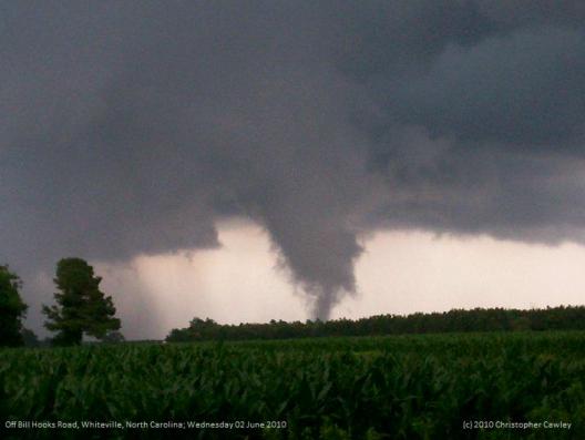
| WHI North Whiteville, NC Christopher Crawley 12/10 34.413744N / 078.751908W | |||
| LYH Lynchburg, VA NWS Lynchburg Regional Airport 37-19-15N 079-12-24W 295M | ILM Wilmington, NC NWS New Hanover International Airport 34-16-06N 077-54-22W 9M | ||
| NEW Newmarket, VA 2W Joyce Winfree STATION CLOSED 5/31/10 joywood@shentel.net | CHS Charleston, SC NWS Charleston Air Force Base 32-53-56N 080-02-26W 13M | ||
| NPN Newport News, VA 7N Gary Leonard - 6/91 GaryMLeonard@aol.com | CAE Columbia, SC NWS Columbia Metropolitan Airport 33-56-31N 081-07-05W 73M | ||
| NOR Norfolk, VA 3NE Jim Fentress 6/1/77 | FLO Florence, SC Florence Regional Airport 34-11-16N 079-43-51W 44M | ||
| ORF Norfolk, VA 5NE 36-54-13N 076-11-31W 14M 1871 | GSP Greenville-Spartanburg, SC NWS Greenville-Spartanburg Airport 34-53-02N 082-13-15W 286M | ||
| POR Portsmouth, VA 36.81° North 76.33° West 3S Bill Trotter - 7/1/76 wxr@cox.net | CRE North Myrtle Beach, SC Grand Strand Airport 33-48-42N 078-43-26W 10M | ||
| MEC Mechanicsville, VA Glen Martin 11/19/91 | OGB Orangeburg, SC Orangeburg Municipal Airport 33-27-50N 080-51-13W 59M | ||
| FHC Norfolk, VA Fred Heutte Center 36° 54'N 76° 16'W 01/01/03 fhcgarden@cox.net | AND Anderson, SC | ||
| RIC Richmond, VA Richmond International Airport 37-30-40N 077-19-24W 50M | TRI Tri-cities, TN (Bristol / Johnson / Kingsport), Tri-City Regional Airport 36-28-47N 082-23-56W 474M | ||
| ROA Roanoke, VA Roanoke Regional Airport 37-19-01N 079-58-27W 362M | DAV Davis, WV Dave Lesher canaanwx@canaantv.tv |