
http://members.cox.net/wxr/acon.htm
SUMMARY OF
CLIMATOLOGICAL DATA
FEBRUARY 2006
...AREA RETURNS TO NORMAL WINTER TEMPERATURES
WITH BELOW NORMAL RAINFALL ~
WINTER SNOWS OVER THEN NORTHERN HALF...
A read through the data and notes will provide all you need to understand a
February that brought a return to more normal winter temperatures but below
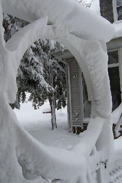
normal precipitation. Snows were abundant over Northern Virginia tapering off
through Southern Virginia into the Northern North Carolina tier.
APPRECIATION TO RUSS TOPPING OF HERNDON (HRN)
Russ Topping has been a member of our local ACON group since we began online many
seasons ago. He sends these notes: "
Please note that we have sold our home and will be moving to a temporary
apartment. We hope to move into our new home in April/May. This will be my
last report, for a while. It was a sad day, as I took the station off the
roof in preparation for the big move. I'm not certain if, or when, the
station will be set up and fully functional again. My email address is also
tied to the county cable provider. As I will be crossing county lines,
I need to change my contact email address to russ.topping@gmail.com.
I hope to be in touch again, with data from my new site. If not, let me
take this opportunity to thank you for the years of gathering and reporting
our monthly data. I'll continue to visit and enjoy the ACON site.
Take care, Russ Topping, Oak Hill, VA" And to you Russ, thanks for all the
continuous and diligent work over the years. Hope you get settled soon and rejoin our group.
FICKLE STORM TESTS TV'S DIVINING SKILL
A winter storm not yet deveplped but soon expected "according to the
models" sends us into a whirl, particularly those in the broadcast business
on whose prognostications many people rely. This month's snow brought the usual
behavior by media meteorologists in the Washington area. Check out how they
did here.
GLOBAL WARMING NOT FEATURED IN NEW HURRICANE STUDY
- Here's a reprint of Virginia State Climatologist Patrick Michaels'
article [ http://www.tcsdaily.com/article.aspx?id=031606F ]
regarding global warming from Science magazine.
[ Many of you have
also seen the media's coverage of Dr. Michaels' views. ]
GROUND BROKEN FOR NEW NOAA CENTER FOR WEATHER & CLIMATE PREDICTION
The U.S. General Services Administration (GSA), in partnership
with the National Oceanic and Atmospheric
Administration (NOAA), has broken ground for
the new Center for Weather and Climate
Prediction. Opus East, L.L.C., of Rockville,
Maryland, will design, construct and own the
building and lease it to the GSA. More here.
UPCOMING NWS STERLING SKYWARN CLASSES
Kevin Shaw of ACON DC/MD/DE informs us that
NWS Sterling, Virginia (LWX) has posted their SKYWARN classes,
dates and times, for 2006 at their website, to which a link is provided below.
It is recommended that those who have taken the classes take them
again as refreshing the memory and learning about changes and new information is vital to
the success of the program.
DROUGHT MONITOR
http://www.drought.unl.edu/dm/monitor.html
REMINDER
All National Weather Service station data listed
herein is preliminary and may be subject to change. The data has
not been certified and cannot be used in legal actions. Only reports
certified by the National Climatic Data Center in Asheville, NC can
be used for these purposes.
ACON VA/NC/SC Member
Station Extremes - FEBRUARY 2006
|
State
|
Maximum Temperature
|
Minimum
Temperature
|
Warmest
Average
Temperature
|
Coldest
Average
Temperature
|
Maximum
Precipitation
|
Minimum
Precipitation
|
|
Virginia
|
72°
Hampton
Newport News
Portsmouth
|
4°
New Market
|
43.5°
Norfolk (FHC)
|
34.7°
Blacksburg
|
4.67"
Ladysmith
|
0.63"
Hampton
|
|
North Carolina
|
75°
New Bern
Wilmington
|
15°
Roxboro
|
46.5°
Wilmington
|
38.9°
Asheville
|
3.35"
Wilmington
|
1.06"
Lumberton
|
|
South Carolina
|
77�
Charleston
|
21°
Anderson
|
54.1°
Charleston
|
44.0°
Anderson
|
3.33"
Columbia
|
1.19"
Greenville-Spartanburg
|
( For an explanation of column headers in the following tables,
please
note the column denotations table below. )
TEMPERATURE / WINDS/ ELEMENTS
VIRGINIA
[Reminder:
All NWS DATA HEREIN IS NOT OFFICIAL]
STN A B C C1 D E F G H I J K K1 L M N N1 N2 O P Q R R1 R2 S CWA
-----------------------------------------------------------------------------------------------------------
ANN 46.18 28.54 37.36 -0.1 67 16 12 19 0 0 21 0 61% 37 WSW 17 1 0 0 0 0 2400 LWX
BCB 45.2 24.2 34.7 +1.2 65 16 7 19 0 4 25 0 51% 36 290� 24 7.0 1 0 0 0 0 40% 2400 RNK
BRI 2400 LWX
CCV 60 25 42.0 +0.4 67 16 12 13,19 0 1 21 0 77% 30 300� 24 3.0 WSW 0 0 0 1 4 40% 2400 BCB
CEN 46.1 27.9 37.0 +3.1 67 16 10 19 0 0 21 0 40 010� 28 3.5 NNW 0 0 0 0 2 2400 LWX
CHO 48.4 27.7 38.1 -0.6 67 16 9 19 0 1 22 0 35 330� 17 5.8 1 0 0 0 2 2400 LWX
40 340� 15
DAN 53.0 28.3 40.6 +0.9 69 17,28 17 19 0 0 23 0 56% 36 220� 4 7.3 1 0 0 0 2 20% 2400 RNK
DCA 46.6 30.6 38.6 +0.5 66 16 14 19 0 1 17 0 57% 47 320� 25 9.6 1 0 0 1 2 60% 2400 LWX
54 330� 15
IAD 45.9 26.1 36.0 +1.2 66 16 10 19 0 1 22 0 58% 40 320� 17 7.7 0 0 0 0 4 60% 2400 LWX
FCH 46.5 30.5 38.5 66 16 10 19 0 0 16 0 42 25 2 0 0 0 0 2400 LWX
HAM 49.0 33.0 41.0 -1.0 72 17 18 19 0 1 13 0 68% 36 W 5 13.0 SSW 0 0 0 0 1 50% 2400 AKQ
HER 44.2 28.1 36.2 +1.4 64 16 10.0 19 0 1 22 0 32 25 0 0 0 0 1+ 2400 LWX
HRN 44.7 27.1 36.0 +1.2 65.8 16 9.2 19 0 1 21 0 55% 37 NW 25 3.4 W 0 0 0 0 1 2400 LWX
LDY 50 27 38 0.0 70 16 12 19 0 0 21 0 52% 1 0 0 0 0 2400 AKQ
LYH 48.9 26.6 37.7 -0.1 67 16 12 13,19 0 1 22 0 55% 32 280� 5 5.7 0 0 0 0 3 30% 2400 RNK
NEW 47.46 22.46 34.96 -2.0 67 16 4 13,19 0 0 23 0 66% 38 W 17 19.21 S 0 0 0 0 0 1800 LWX
NPN 52.3 31.6 42.0 72 17 17 19 0 0 15 0 30 SW 25 0 0 0 0 0 2400 AKQ
NOR 50.7 32.6 41.6 0.0 70 16 20 19 0 0 13 0 0 0 0 0 0 2400 AKQ
ORF 51.0 34.1 42.6 +0.6 71 16,17 22 19 0 1 10 0 59% 43 230� 4 9.0 0 0 0 0 0 30% 2400 AKQ
FHC 51.42 35.58 43.50 70.6 17 19.7 19 0 1 8 0 62% 39 220� 4 4.7 203 0 0 0 0 0 2400 AKQ
POR 52.7 33.7 43.2 +0.5 71.6 17 19.5 19 0 0 14 0 64% 36 203� 25 5.3 270� 0 0 0 0 0 38% 2400 AKQ
CTR 52.4 29.0 40.9 +1.4 71.1 17 15.4 27 0 0 21 0 59% 27 SW 4 1.1 N 0 0 0 0 2 50% 2400 AKQ
MEC 52.6 30.85 41.5 70 16 17 27 0 0 18 0 13 S 24 0 0 0 1 0 1700 AKQ
RIC 51.1 29.5 40.3 +0.8 70 16 14 19 0 1 20 0 56% 39 240� 4 8.8 0 0 0 0 2 60% 2400 AKQ
ROA 48.8 30.3 39.6 +0.5 69 16 13 19 0 0 19 0 50% 43 260� 27 8.5 1 0 0 0 3 40% 2400 RNK
AKQ 52 29 40.5 71 16 15 19 0 0 18 0 2400 AKQ
WAL 47.8 29.9 38.9 +1.2 68 3,16 15 19 0 1 18 0 39 230� 25 9.4 0 0 0 0 2 2400 AKQ
WOO 45.7 28.8 37.2 -0.4 66 17 6 19 0 3 20 0 0 0 0 0 0 2400 LWX
WSH 45.0 26.6 35.8 -0.1 63.9 16 8.7 19 0 0 21 0 57% 27 NE 18 2.0 N 0 0 0 0 0 2400 LWX
|
NORTH CAROLINA
[Reminder:
All NWS DATA HEREIN IS NOT OFFICIAL]
STN A B C C1 D E F G H I J K K1 L M N N1 N2 O P Q R R1 R2 S CWA
-----------------------------------------------------------------------------------------------------------
AVL 50.1 27.8 38.9 -0.1 68 28 18 10,27 0 0 22 0 59% 37 330� 26 7.9 1 0 0 0 1 40% 2400 GSP
MRH 54.4 37.0 45.7 68 4 25 10 0 0 9 0 40 020� 26 9.6 0 0 0 0 4 2400 MHX
CLT 55.0 32.0 43.5 -1.7 71 17,28 19 27 0 0 15 0 57% 33 280� 12 5.7 0 0 0 0 1 60% 2400 GSP
33 010� 26
ECG 52.8 32.5 42.6 -2.1 72 17 20 10,27 0 0 13 0 64% 41 360� 26 9.2 0 0 0 0 0 30% 2400 AKQ
FAY 57.0 33.7 45.3 74 17 21 10 0 0 14 0 59% 43 260� 4 8.0 0 0 0 0 2 2400 RAH
GSO 53.1 31.6 42.3 +1.1 71 17 19 19 0 0 15 0 55% 35 180� 4 7.5 0 0 0 3 2 2400 RAH
HSE 53.1 39.2 46.2 -0.6 67 4 30 19 0 0 4 0 44 180� 4 9.2 0 0 0 0 0 2400 MHX
HKY 53.7 31.5 42.6 +0.3 70 17,28 21 10,19 0 0 18 0 35 210� 4 5.6 0 0 1 0 5 2400 GSP
LBT 56.0 33.7 44.9 -0.1 72 17 21 10 0 0 15 0 37 220� 4 6.4 0 0 0 0 4 2400 ILM
37 020� 26 6.8 0 0 0 0 2
EWN 56.1 33.2 44.7 -1.8 75 17 20 27 0 0 16 0 39 010� 26 6.9 0 0 1 0 0 2400 MHX
RAL 55.2 30.0 42.6 -0.4 74 17 16 10 0 0 18 0 25 4,5 2 0 0 2 0 2400 RAH
RDU 55.0 32.0 43.5 +0.5 74 17 20 19,27 0 0 16 0 56% 37 210� 4 7.0 0 0 0 2 1 2400 RAH
ROX 53.4 31.5 42.5 +3.3 71 16,17 15 19 0 0 17 0 58% 31 SW 25 NW 0 0 0 0 2 47% 2400 RAH
ILM 57.2 35.7 46.5 75 17 23 10 0 0 10 0 64% 43 030� 26 7.6 0 0 0 0 3 48% 2400 ILM
|
SOUTH CAROLINA
[Reminder:
All NWS DATA HEREIN IS NOT OFFICIAL]
STN A B C C1 D E F G H I J K K1 L M N N1 N2 O P Q R R1 R2 S CWA
-----------------------------------------------------------------------------------------------------------
AND 54.1 33.9 44.0 -1.4 70 16,28 21 10 0 0 12 0 36 360� 4 7.0 0 0 0 0 4 2400 GSP
41 300� 14
CAE 57.8 34.8 46.3 -1.6 73 16 23 10,27 0 0 12 0 39 260� 4 6.1 0 0 0 1 1 2400 CAE
CRE 56.1 36.6 46.3 67 17 24 10 0 0 8 0 36 050� 26 6.6 2 0 0 0 2 2400 CHS
CHS 65.5 42.7 54.1 +6.2 77 12 27 26 0 0 7 0 44 230� 2 8.1 3 0 0 0 8 2400 CHS
44 190� 17
44 290� 18
FLO 57.5 35.6 46.5 74 17 22 27 0 0 11 0 36 240� 4 7.4 0 0 0 0 3 2400 ILM
GSP 54.8 33.7 44.3 -0.1 71 28 23 10 0 0 14 0 57% 36 230� 4 7.2 0 0 0 0 2 40% 2400 GSP
OGB 59.0 36.0 47.5 75 17 25 10 0 0 11 0 40 250� 4 6.7 1 0 0 0 3 2400 CAE |
NEARBY STATIONS
[Reminder:
All NWS DATA HEREIN IS NOT OFFICIAL]
STN A B C C1 D E F G H I J K K1 L M N N1 N2 O P Q R R1 R2 S CWA
----------------------------------------------------------------------------------------------------------
TRI 47.4 25.9 36.7 -1.4 68 16 12 19 0 3 22 0 35 250� 4 7.7 0 0 0 0 2 2400 MRX
DAV 30.3 15.9 23.1 56 17 -12 19 0 16 24 2 0700 PBZ |
(Please
note the column denotations table below.)
PRECIPITATION / BAROMETRIC PRESSURE
VIRGINIA
[Reminder:
All NWS DATA HEREIN IS NOT OFFICIAL]
     STN  T      T1     U  U1   V    V1   W X   Y     Z   1  2 3   4    5     6    6A   7    7A    8     S
     -------------------------------------------------------------------------------------------------------
     ANN  2.81        0.80  4 1.14 11-12  6 0  5.83  7.9  12  6 2 13.3 21.5  30.53  19 29.26   4 30.00  2400
     BCB  1.14  -1.88 0.50 11 0.50    11  8 0  3.90  7.0  11  8 3 11.0 19.1                             2400
     BRI                                                                                                1615/1600
     CCV  2.07  +1.03 0.71 11 0.71    11  9 0  5.22  5.5  11    1  8.0 14.5  30.23  17 29.83  11 29.97  2400
     CEN  2.49  -0.44 0.70  4 0.70     4  6 0  4.71  5.8  11  3 3 12.0 19.8  30.53  19 29.28   4 29.91  2400
     CHO  1.79  -1.51 0.57  3 0.67   2-2  6 0  4.39                          30.56  19 29.23   4        2400
     DAN  1.51  -1.90 0.57 11 0.57    11  8 0  3.80  1.6  11  4 1  2.5  1.6  30.52  19 29.30   4        2400
     DCA  2.46  -0.17 0.78 12 0.78    12 1 600 5.71  6.7  12  6 2  8.8 13.6                             2400
     IAD  2.38  -0.39 0.83  4 0.83   3-4  6 0  4.78  4.4  12  5 2  8.1 14.1  30.56  19 29.23   4        2400
     FCH  1.97        0.74  4 1.17   3-4  4 0  5.47  7.0  11- 3 1  8.0 13.75                            2400
                                                          12
     HAM  0.63  -1.67 0.45 11 0.45    11  3 0  3.22  0.2  20  1 0  0.2  1.2  30.58   3 29.62   8 30.04  2400
     HER  2.66  -0.11 0.81  4 1.13 11-12  7 0  5.25  6.0  11  3 3 13.0 19.9                             2400
     HRN  2.46  -0.31 0.73  4 1.01 11-12  6 0  2.46  5.75 12  3 2 11.0 17.0  30.492 19 29.238  4 29.99  2400
     LDY  4.67  +1.77 2.01  4 2.61   3-4  9 1  8.88  4.5  12  4 2  6.0 10.5  30.56  19 29.29   4 30.06  2400
     LYH  2.07  -1.03 0.70 11 0.71 11-12  9 0  5.22  5.5  11  5 2  8.1 12.9  30.53  19 29.26   4        2400
     NEW  2.19   0.00 0.59  4             4 0  4.59  8.0  12  3 2 9.25 16.75                            1700
     NPN  1.07        0.44 11 0.46 11-12  7 0  3.80  0.2  20  1 0  0.2  0.7  30.46  19 29.30   4        2400
     NOR  0.77  -2.73 0.31  4             6 0  3.62  0.1  20  5 0  0.1  1.3                             2400
     ORF  0.65  -2.69 0.27 11 0.27    11  7 0  3.33  0.1  20  5 0  0.1  0.8                             2400
     FHC  0.77        0.28 11 0.28    11  6 0  4.41  0.5  20  5 0  0.5  1.0  30.513 19 29.378  4 30.040 2400
     POR  0.64  -2.57 0.18 4, 0.19 11-12  8 0  3.33  0.5  20  5 0  0.5  1.0  30.53  19 29.38   4 30.049 2400
                           11
     CTR  1.82  -1.47 0.72  4 0.72   4-5  8 0  4.09  1.3  12  4 1  2.1  5.1  30.53  19 29.28   4 30.018 2400
     MEC  1.51        0.56 12 0.79 11-12  9 0  4.95  2.0  12  2 1  2.5  6.25 30.18  19 29.15   4        1700

     RIC  1.47  -1.51 0.60 11 0.69 11-12  9 0  4.36  1.7  12  4 1  3.2  7.6  30.57  19 29.31   4        2400
     ROA  1.56  -1.52 0.61 11 0.61    11  7 0  5.12  5.0  11  5 1  5.9 10.0  30.54  19 29.34   4        2400
     AKQ  1.22        0.52 11             9 0  4.07  0.7  20  3 0  0.7  1.2                             2400
     WAL  0.74  -2.28 0.50 11 0.53 11-12  7 0  3.47  0.2  18  2 0  0.3  3.7  30.50  19 29.30  12        2400
     WOO  1.24  -0.75         0.39   4-5  7 0  4.02  5.8  12  6 1  7.2 16.9  30.52  19 29.62   5        0800
WSH 2.04 -0.60 0.57 4 0.57 4 6 0 5.17 8.5 11 4 3 14.2 22.3 30.47 19 29.30 4 2400 |
NORTH CAROLINA
[Reminder:
All NWS DATA HEREIN IS NOT OFFICIAL]
     STN  T      T1     U  U1   V    V1   W X   Y     Z   1  2 3   4    5     6    6A   7    7A    8     S
     -------------------------------------------------------------------------------------------------------
     AVL  2.55  -1.28 1.86  4 1.86     4  8 1  6.13  1.0  12  7 1 1.T  1.4                              2400
     MRH  2.34        0.56 22 0.56    22 11 0  5.64  0.0          0.0  0.0  30.38  24 29.89  26         2400
     CLT  1.17  -2.38 0.40 11 0.40    11 10 0  4.40   T  9,12 2 0   T    T                              2400
     ECG  1.11  -1.99 0.42  4 0.42     5  7 0  3.38  0.5  20  2 0 0.5  0.5  30.51  19 29.42   4         2400
     FAY  1.68        0.48 22 0.80 22-23  7 0  4.13  0.0          0.0  0.0                              2400
     GSO  1.54  -1.56 0.45 11 0.45    11  7 0  3.92  0.5  18  6 0 1.3  1.3                              2400
     HSE  2.21  -1.73 0.76 23 0.79 22-23 11 0  6.48  0.5  20  1 0 0.5  0.5  30.46  19 29.47   4         2400
     HKY  1.11  -2.76 0.40 11 0.40 10-11  7 0  4.43   T 9,11, 3 0   T    T                              2400
                                                          12
     LBT  1.06  -2.31 0.42 22 0.55 22-23  7 0  2.93  0.0          0.0  0.0  30.50  19 29.42   4         2400
     EWN  1.54        0.47 23 0.78 22-23 10 0  4.00    T  12  1 0   T    T  30.50  19 29.47   4         2400
     RDU  1.65  -1.82 0.46  4 0.62 22-23  6 0  3.72   T 9,12, 4 0   T    T                              1900
                                                       18,20
     RAL  1.78  -1.69         0.60   3-4  7 0  4.21   T       2 0   T    T  30.51  19 29.67   3         2400
     ROX  1.39  -2.11 0.54 11 0.54    11  9 0  4.09  1.0 18,  2 2 2.1  2.2  30.53     29.34   4  30.08  2200
                                                          20
ILM 3.35 -0.31 0.67 25 1.32 25-26 12 0 5.23 0.0 0.0 0.0 30.48 19 29.48 4 2400 |
SOUTH CAROLINA
[Reminder:
All NWS DATA HEREIN IS NOT OFFICIAL]
     STN  T      T1     U  U1   V    V1   W X   Y     Z   1  2 3  4     5     6    6A   7    7A    8     S
     -------------------------------------------------------------------------------------------------------
     AND  2.21  -1.94 0.69  6 0.69     6  9 0  6.15  0.0          0.0    T                              2400
     CAE  3.33  -0.51 0.93 25 1.04 25-26 11 0  6.12   T  6,9  2 0   T    T  30.47  19 29.49   4         2400
     CRE  2.94  -0.56 0.76 25 1.38 25-26  9 0  5.71  0.0          0.0  0.0  30.46  19 29.48   4         2400
     CHS  3.30  +0.22 1.11 25 1.58 25-26 11 2  6.23  0.0          0.0  0.0  30.43  19 29.52   4         2400
     FLO  2.84  -0.18 0.87 22 1.10 22-23 10 0  5.04  0.0          0.0  0.0  30.48  19 29.64  11         2400
     GSP  1.19  -3.05 0.30 11 0.30    11  9 0  5.00    T  11  1 0   T    T                              2400
OGB 2.73 1.15 25 1.50 25-26 9 1 5.97 0.0 0.0 0.0 30.46 19 29.50 4 2400 |
NEARBY STATIONS
[Reminder:
All NWS DATA HEREIN IS NOT OFFICIAL]
     STN  T      T1     U  U1   V      V1   W X   Y     Z   1  2 3  4     5    6   6A   7   7A    8     S
     -------------------------------------------------------------------------------------------------------
     TRI  1.98  -1.42 0.47 22 0.52 22-23 13 0  5.88  2.7 18 10  4  7.7   8.4  30.50  19 29.45   4       2400
DAV 3.30 0.58 28 20 0 9.66 7.9 28 22 11 43.5 137.8 0700 |
Virginia:
Annandale
- Lowell reports:
"
February was only very little below average in precipitation and temperature.
February's mean monthly temperature was - 0.1 �F colder than the average.
February's precipitation total had a - 0.13 inch departure with only 6 days
having measurable precipitation.
The snow on the 11th and 12th was the main event of February. See snow time lapse at -
http://www.annandaleweather.com/photos/snowtimelapse.
[Editor's note: I thought I had seen everything a weather fanatic (in the ultimate good sense)
could do until I saw Lowell's time lapse of this event! And I just bought a
time-lapse recorder (before seeing this movie!) for security purposes. Now I
have another use for it. Document fall rates and total accumulation!]
The storm total was 12.5 inches from 1500 of the 11th until 0735 of the 12th
or a 16.5 hour period. It was the tenth greatest storm total in the last 26
years and the fourth greatest February snow in the last 26 years. It also
ranked eighth in the greatest 24 hour snow total in the last 26 years.
The total snowfall for February was 13.3 inches and was +6.7 inches more
than the 26-year average and only five Februarys have had more snow.
The maximum temperature for the month of 67 �F came only four days after
the snowstorm melting the snowfall quickly. Otherwise it was a typical
February and only broke 6 daily records. The 11th, 12th and 19th were the
dates of the most significant weather.
February had 21 days with the temperature at or below freezing with 19 days being average. The lowest temperature was 12�F on the 19th; this was the lowest February temperature recorded since 1996. The 34�F temperature range of the 25th was the most in February since 2002.
The lowest wind chill (new Scale) for the month was -2.4�F on the 19th which was the lowest wind chill since wind chill records were started here in 2003.
The maximum gust of 37 mph from the WSW on the 17th at 1059 was associated with a cold front bringing in the cold air mass that gave the month's lowest temperature on the 19th.
The minimum barometer reading of 29.26 inches on the 4th was the lowest minimum pressure recorded in February since 2003 when 29.09 inches was recorded.
WINTER RECORDS-- DECEMBER, JANUARY, FEBRUARY---
This was the 14th driest winter in the past 26 years.
9.32 inches Total seasonal precip.
Average is 9.55 inches (26-Years of Data).
Departure of -0.23 inches.
Maximum is 15.74 inches.
Minimum is 3.63 inches.
This was the 9th warmest winter in the past 26 years.
38.18 �F seasonal mean temperature.
Average is 36.41 �(26-Years of Data).
Departure of + 1.77� F.
Maximum is 41.77 �F.
Minimum is 31.71 �F.
FEBRUARY DAILY Records Tied or Broken (26-Years of records):
2 HIGH minimum temperature: 3, 4;
1 HIGH range temperature: 25;
2 LOW range temperature: 11, 22;
1 HIGH snowfall: 12.
[ - - ]
Arlington
- Report from Guyer at NWS LWX:
"
TEMPERATURES AND PRECIPITATION FOR FEBRUARY TURNED OUT TO BE VERY
CLOSE TO NORMAL FOR THE WASHINGTON DC AREA. A SNOW STORM ON THE 11TH
AND 12TH DROPPED NEARLY 9 INCHES OF SNOW...WHICH WAS THE ONLY
OCCURRENCE OF MEASURABLE SNOW FOR THE MONTH. THERE WERE 4 OTHER DAYS
WHEN TRACE AMOUNTS OF SNOW FELL IN THE FORM OF FLURRIES AND LIGHT
SNOW SHOWERS.
THE WARMEST TEMPERATURE FOR THE MONTH WAS 66 DEGREES ON THE 16TH.
THIS WAS 1 DEGREE BELOW THE AVERAGE OF RECORD HIGH TEMPERATURES
FOR THE MONTH. THE COLDEST WAS 14 DEGREES ONLY 3 DAYS LATER ON THE
19TH. THIS WAS ALSO 1 DEGREE BELOW THE AVERAGE OF RECORD LOW
TEMPERATURES FOR THE MONTH.
" [ + - ]
Bridgewater
- "
- [ M M ] - report from Clayton
Campbell County
- "
Campbell county had slightly drier month then in the previous months with
precipitation normals dropping off to over an inch deficit.
"
- [ + - ] - notes from Roger
Centreville
- "
With the tropical breezes of January still fresh in our minds, the early
days of February in sunny Centreville attempted to mimic those of festive
Jacksonville by an average temperature difference of less than 10� during
the first two weeks of the month. A high of 67� on the 16th was in sharp
contrast to a high of 30� and the low for the month of 10� three days later
on February 19th. The average for the last full month of winter was an even
37�, just 3.1� above the 33.9� normal. While the average high of 46.1� was
just 1.7� over the stated monthly high of 44.4�, the average low was
relatively well behaved compared to the January readings. Our low average
temperature of 27.9� was only 4.6� above the 23/3� normal February average
low of 23.3�. Based on a few years of past data, 4.6� doesn't justify an
entry in bold typeface this time around.
In the precipitation department, snow finally recaptured quite a bit of our
attention this month. An overnight east coast storm dropped 10.8" on
February 11th and 12th, and except for the piles in some local parking lots,
three days later was nearly all but forgotten. George Washington's birthday
was off to a snowy beginning on the 22nd when light snow began to fall
around daybreak. It didn't turn out to be anything to really sink your
teeth into because after all had been declared done, only 1.2" had fallen.
While January recorded just a trace of snow, the foot accumulated in
February chopped away at our seasonal snow deficit to bring us to within
0.4" of our 20.2" normal. Have no fear! Spring will be here soon again.
" - [ + - ] - summary from Paul
Dulles
- "
TEMPERATURES...PRECIPITATION...AND SNOWFALL FOR FEBRUARY TURNED OUT
TO BE VERY CLOSE TO NORMAL. A SNOW STORM ON THE 11TH AND 12TH
DROPPED JUST OVER 8 INCHES OF SNOW...WHICH WAS THE ONLY OCCURRENCE
OF MEASURABLE SNOW FOR THE MONTH. THERE WERE 3 OTHER DAYS WHEN TRACE
AMOUNTS OF SNOW FELL IN THE FORM OF FLURRIES AND LIGHT SNOW SHOWERS.
THE WARMEST TEMPERATURE FOR THE MONTH WAS 66 DEGREES ON THE 16TH.
THIS TIES THE AVERAGE OF RECORD HIGH TEMPERATURES FOR THE MONTH. THE
COLDEST WAS 10 DEGREES ONLY 3 DAYS LATER ON THE 19TH. THIS WAS 3
DEGREES ABOVE THE AVERAGE OF RECORD LOW TEMPERATURES FOR THE MONTH.
" - [ + - ] - report from NWS LWX
Falls Church
- "
This Feb was colder than average. Jan was 5.4 degrees warmer than February.
Snowfall was slightly above average for the month. In Jan I had a trace of
snow this month I had 8". I also had my share of windy days this month..
my peak gust of 42 MPH was on 2/25.
" - [ - M ] - report from NWS LWX
Hampton
- This report from Dave:"
February temperatures were slightly below normal; however this
was the driest February on record at my station since records began in 1977.
The coldest day this winter season was the 19th with a high of 31 and a
low of 18 - the first time this winter max temps were below freezing.
" - [ - - ]
Herndon
- Bob notes:"
My average MAX temperature was 1.3 degrees below
the Dulles "normal" and the average MIN was 4 degrees
ABOVE "normal". Snowfall was 7 inches ABOVE the Dulles average.
The groundwater observation well at Reston showed a net rise of about
1.4 feet for the month.
" - [ - - ]
Herndon
- Russ sends these notes and changes in location:
"
February 2006 saw a return to more typical winter weather
patterns, after record breaking warmth in January. Temperatures
averaged 1.2 degrees above normal. Snow lovers were also
rewarded for their patience on the 11th (4.5"), 12th (5.75"),
and 22nd (0.75"). The monthly snow total was 4.8" above average.
Monthly precipitation was 0.31" below average.
" - [ + - ]
Ladysmith
- Danny sends these notes:
"
Marked by a return to cooler temperatures and the occasional hint
of winter, February was over 5 degrees cooler than January and finished
almost exactly normal. Six inches of snowfall for the month is the most I
have recorded in a single month since being in the area in 2003.
Precipitation was above normal for the third straight month, and
precipitation for the year now stands over 2.5" above average.
" - [ +/- + ]
Portsmouth
- "
In February, the temperature average was temperature was 0.5� above normal.
Rainfall for the month was well below normal, by some 2.57" or 20% of the
normal February precipitation.
This was the driest February in the database here dating to 1976.
The 0.64" surpasses the previous least amount of 1.20" in 1991.
One-half inch of snow fell bringing the yearly
total to only 1.0", well below normal.
STATION RECORDS:
RECORDS: 3rd - TEMPERATURE - MAXIMUM MINIMUM 52� [PREVIOUSLY 47� 1990];
4th - TEMPERATURE - MAXIMUM MINIMUM 50� [PREVIOUSLY 46� 1998];
20th - SNOWFALL - 0.5" [PREVIOUSLY 0"].
For the year, temperature averages for the year were 4.3� ABOVE normal. Rainfall
at the end of February was 3.72" below normal or 47% of the norm.
" [ + - ]
North
Carolina:
Raleigh
-
"
The average daily temperature was -0.4 degrees below normal which was over
4 degrees cooler than the warm month of January 2006. Precipitation was
light with only 1.78" inches. A trace of snow was observed on the 12th and
18th of the month. There was no measurable snow for the period from December
2005 -February 2006. The snow drought continues for the second consecutive
year. No severe weather was observed including any thunderstorms.
- [ - - ] - notes from Bob.
Raleigh
- NWS Raleigh (RAH) reports:
"
February 2006 was highlighted by a return to more seasonable temperatures. After several locations across North Carolina recorded one of their warmest January's on record, February brought the typical cold frontal passages and associated cool downs. As a result, the average monthly temperatures for February 2006 were
around 5 degrees colder than those observed in January. Typically, January is the coldest month of the year for North Carolina.
One thing that did not change was the continuation of the dry weather during February. Just as in January, there were several fast moving, moisture starved weather systems that affected the state in February. The total monthly precipitation generally averaged between 1 and 2 inches across the interior of the state (35 to 50 percent of normal), and 2 to 3 inches across the southern Mountains and along the Coast (65 to 90 percent of normal).
With the lack of significant precipitation in February, soil moisture levels and stream flow slipped to well below normal levels by month's end. Local reservoir levels, aided by the extensive wet period between November 15 and December 31, 2005, remained nearly steady.
The full FEBRUARY 2006 Weather Review is available at:
http://www.erh.noaa.gov/rah/ncsummaries/MonthlySummary.Feb.2006.doc.
" - [ - - ]
Elsewhere:
Tri-Cities:
-
"
The monthly average temperature at Tri-Cities was 36.7 degrees, which was
1.3 degrees below normal. It tied with 1960 as the 17th coldest February on
record at Tri-Cities. No daily records were broken. The coldest February at
Tri-Cities was back in 1958, when the average temperature was only 28.1
degrees.
Tri-Cities received 1.98 inches of precipitation in February, which was
1.42 inches below normal. It ranked as the 10th driest February on record
at Tri-Cities. Measurable precipitation occurred on 13 days, but only three
of those days had more than one-quarter of an inch of rain. The heaviest
rain fell on the 22nd, when 0.47 inches was reported. The driest February
at Tri-Cities was back in 1968, when only 0.75 inches was recorded. Total
snowfall for the month was 7.7 inches, which was 3.6 inches above normal.
" - [- - ] - report from NWS MRX, Morristown, TN
COLUMN
DENOTATIONS:
| A maximum mean temperature |
T total precipitation (inches)
T1 departure from normal |
| B minimum mean temperature |
U maximum calendar day precipitation
(inches) |
C monthly mean temperature
C1 departure from normal |
U1 date of maximum calendar day precipitation |
| D maximum temperature |
V date(s) of maximum daily precipitation |
| E date(s) of maximum temperature |
V1 maximum 24-hour precip. &
date(s) |
| F minimum temperature |
W number of days with precip. >=
.01" |
| G date(s) of minimum temperature |
X number of days with precip. >=
1.0" |
| H days with maximum temperature
>=90 |
Y year-to-date precipitation (inches) |
| I days with maximum temperature
<=32 |
Z maximum calendar day snowfall (inches) |
| J days with minimum temperature
<=32 |
VRB Variable |
| K days with minimum temperature
<= 0 |
1 date of maximum calendar day snowfall (inches)
|
| K1 average relative humidity |
2 number of days with snowfall |
| L peak wind gust (miles per
hour) |
3 number of days with snowfall >=
1.0" |
| M direction of peak wind gust |
4 total snowfall for month
(inches) |
| N date(s) of peak wind gust |
5 total snowfall for 2005-2006 season
(inches) |
| N1 average wind speed (miles per hour) |
6 maximum barometric pressure (inches) |
| N2 dominant wind direction |
6A date of maximum barometric pressure |
| O number of days with thunder |
7 minimum barometric pressure (inches) |
| P number of days with hail |
7A date of minimum barometric pressure |
| Q number of days with glaze |
8 average sea-level pressure |
| R number of days with ice pellets |
STN Station |
| R2 sky cover percentage |
NR not recorded |
| R1 number of days with dense fog
[1/4 mile and less visibility] |
(i) incomplete data |
| S local observation time for
temps/precipitation |
(M) missing, if listed in data table |
| ~ "about" |
E estimated |
| + additional indeterminate
number of days |
CWA - NWS Office County Warning Area |

For ACON
VA/NC/SC Recent Weather News, Search CNN
http://www.cnn.com/WEATHER
National
Weather Service Web Sites & Current Email Addresses
Within or
Nearby the ACON VA/NC/SC Area Can Be Found At:
NWS Washington/Baltimore,
VA/MD
NWS Wakefield, VA
NWS Blacksburg, VA
NWS Raleigh, NC
NWS Newport/Morehead City, NC
NWS Wilmington, NC
NWS Greenville-Spartanburg, SC
NWS Columbia, SC
NWS Charleston, SC
NWS Morristown, TN
National Weather Service
Homepages
$$$ National Climatic Data
Center, Asheville, NC $$$
STATION
/ LOCATION (MILES & DIRECTION FROM MAIN POST OFFICE)/OBSERVER / YEAR
RECORDS BEGAN / EMAIL ADDRESS:
| |
ROK Roanoke, VA 6SW Wendell
Prillaman 4/76 wlprillaman@cox.net |
| ANN Annandale,
VA 1 3/4 ENE - Lowell Koontz 8/31/79 wwkoontz@verizon.net |
AKQ Wakefield,
VA NWS Wakefield Municipal Airport 36-58-53N 077-00-04W 33M |
| DCA Arlington,
VA Washington, DC, Reagan Washington National Airport 38-50-54N 077-02-03W
18M |
WSH Washington, VA
David Yowell runamok@runamok.com |
| BCB Blacksburg,
VA NWS Virginia Tech Airport 37-13N 080-25W |
WEE Weems, VA 3WNW Francis
J. Socey |
| BRI Bridgewater,
VA Clayton Towers Ctowers@rica.net |
WOO Woodstock, VA 5NW Lauck
Walton - 12/1/85 jwalton@shentel.net |
|
CEN Centreville, VA Paul Bassett 1985, 38� 50.9788' N LAT. 77� 25.6374' W LON. | Elevation 324' | m.psb@verizon.net
|
LDY Ladysmith, VA Danny Jessee 2003 danny@dannyjessee.com
|
|
CCV Campbell County, VA - 37� 24' N 79� 04' W -
Roger Penny September 2005 bulletnva@yahoo.com
|
WAL Wallops Island, VA
37� 56'26" N
75� 27'47" W Wallops Flight Facility Airport
|
CHO Charlottesville,
VA Charlottesville-Albemarle Airport ASOS (Rappahannock County)
38-08-18N 078-27-21W 192M |
AVL Asheville,
NC Asheville Regional Airport 35-25-55N 082-32-15W 670M |
| |
MRH Beaufort,
NC Michael J. Field Airport 34-44-01N 076-39-38W 3M |
| DAN Danville, VA, Danville
Regional Airport, 36-34-22N 079-20-10W 175M |
BRE Brevard, NC
1SE Bob Keehn 1/1/90 rkeehn@brinet.com |
| IAD Dulles - Washington-Dulles
International Airport 38-56-05N 077-26-51W 93M |
CLT Charlotte,
NC NWS Charlotte/Douglas International Airpot 35-12-48N 080-56-55W 220M |
| FCH Falls Church,
VA Erica Page - 3/7/94 Windie1970@aol.com |
HKY Hickory, NC |
| HAM Hampton, VA
5NE Dave Kessel 1989 david82@verizon.net |
ECG Elizabeth City, NC,
Coast Guard Air Station 36-15-47N 076-10-58W 11M |
| CTR Winterpock in Chesterfield County, VA Albert Arnold 06/03 |
FAY Fayetteville, NC Fayetteville
Regional Airport, 34-59-22N 078-52-48W 55M |
| HER Herndon, VA
R.M. Beall P- 10/76 T- 1/91 beall47@earthlink.net |
GSO Greensboro, NC NWS
Piedmont Triad International Airport 36-05-51N 079-56-37W 275M |
| HRN Herndon, VA 4SW Russ
Topping - 1985-2005 russ.topping@gmail.com |
HSE Cape Hatteras,
NC Mitchell Field 35-13-56N 075-27-21W 3M |
| |
LBT Lumberton,
NC Lumberton Municipal Airport 34-36-26N 079-03-36W 37M |
| |
EWN New Bern,
NC Craven County Regional Airport 36-04-03N 077-02-50W 3M |
| LXI Lexington,
VA Scott M. Lancey, - 06/96 weather@midatlanticwx.com |
RAL Raleigh, NC
7NNW Bob Woodson - 6/1/93 kf4mmm@qsl.net |
| LKU Louisa,
VA 1N Joseph Bowers 1944 - NWS ID 44-5050-02jmbiii@earthlink.net |
RDU Raleigh-Durham, NC
Raleigh-Durham International Airport 35-52-14N 078-47-11W 130M |
| LOU Louisa,
VA 6S John Bullock (about 1970) INACTIVE 1/1/02 - MEMBER DECEASED FALL 2004 |
ROX Roxboro, NC
2SE Merriell A. Jay 1/93 |
| LYH Lynchburg,
VA NWS Lynchburg Regional Airport 37-19-15N 079-12-24W 295M |
ILM Wilmington,
NC NWS New Hanover International Airport 34-16-06N 077-54-22W 9M |
| NEW Newmarket,
VA 2W Joyce Winfree joywood@shentel.net |
CHS Charleston, SC NWS
Charleston Air Force Base 32-53-56N 080-02-26W 13M |
| NPN Newport
News, VA 7N Gary Leonard - 6/91 GaryMLeonard@aol.com |
CAE Columbia, SC
NWS Columbia Metropolitan Airport 33-56-31N 081-07-05W 73M |
| NOR Norfolk,
VA 3NE Jim Fentress 6/1/77 |
FLO Florence, SC
Florence Regional Airport 34-11-16N 079-43-51W 44M |
| ORF Norfolk,
VA 5NE 36-54-13N 076-11-31W 14M 1871 |
GSP Greenville-Spartanburg,
SC NWS Greenville-Spartanburg Airport 34-53-02N 082-13-15W 286M |
| POR Portsmouth,
VA 36.81° North 76.33° West 3S Bill Trotter - 7/1/76 wxr@cox.net |
CRE North Myrtle
Beach, SC Grand Strand Airport 33-48-42N 078-43-26W 10M |
| MEC Mechanicsville,
VA Glen Martin 11/19/91 |
OGB Orangeburg, SC
Orangeburg Municipal Airport 33-27-50N 080-51-13W 59M |
| FHC Norfolk, VA Fred
Heutte Center 36° 54'N 76° 16'W 01/01/03 fhcgarden@cox.net |
AND Anderson, SC |
| RIC Richmond,
VA Richmond International Airport 37-30-40N 077-19-24W 50M |
TRI Tri-cities,
TN (Bristol / Johnson / Kingsport), Tri-City Regional Airport 36-28-47N
082-23-56W 474M |
| ROA Roanoke, VA
Roanoke Regional Airport 37-19-01N 079-58-27W 362M |
DAV Davis, WV Dave Lesher canaanwx@canaantv.tv |
|