 ACON - VA/NC/SC
The Atlantic Coast Observer Network: Virginia, North Carolina, South Carolina
ACON - VA/NC/SC
An uncharacteristic zonal flow helped establish new records for warmth during the first-half of the 2nd month of winter. However, by month's end, the region had suffered some of the coldest, wintry weather seen in years! Temperatures averaging as much as 15-20o above the norm in the first half of the month dropped to extremely cold averages of the same magnitude in the latter half.
Much of the area had several snowfalls between mid-month and the 23rd, with notable measurements during the period in Western and Central North Carolina, particularly in the Greensboro/Raleigh vicinities. Another storm brought snow and ice and month's end.
The big event of the month was the surprisingly strong low pressure that rolled across the Carolinas and bombed off the SE US coast on the morning of the 25th. The National Weather Service gave very little lead time on preparing for this storm. Earlier than 24 hours before the storm pounded the region, the NWS had absolutely no idea- based on model outputs - of the pending severity of the storm. While the Service knew 24-hours in advance that there would be snows of 6-12" somewhere in central Virginia and North Carolina, they could not pinpoint just where they would be recorded and grossly underforecast precipitation amounts. Record snowfalls were recorded in the Carolinas. Raleigh-Durham Airport reported a record storm snowfall of 20.3" on January 24th-25th.No need to debate the poor performance of the Service or the computer models in advance of this storm as most of the media and naysayers have pounded them with criticism. Quite honestly, such events keep all weather interests- professional and amateur - aware of the incredibly unpredictable nature of meteorology, despite our greatest efforts. And we must admit that we all enjoy the occasional sudden surprise in variance with all that modern technology affords us.
Our members' reports below will best characterize January 2000's weather and the amazing coastal storm, so far "the storm of the century!"
SNOW REPORTS & MAPS
I could spend hours reprinting the snowfall maps of
January's snow and ice storms, but that would be expensive to mail.
For our NON-INTERNET MEMBERS, consider visiting
the local library or a friend to access our Internet home page so you can
visit the links below to review the maps, graphics, and articles
on the late January 2000 winter storms. Again, we are located at:
http://www.pilot.infi.net/~bsmoot/acon.htm
For our INTERNET members, just click on one of the links below to review this winter lambaste!
From NWS ILM: From NWS GSP:
Record
Snow Blankets the Region - January 25, 2000
January 24-25
Major Snowstorm in Western Carolinas http://nwsilm.wilmington.net/archive/snowstorm.html
http://www.nws.noaa.gov/er/gsp/jan2400snow.htm
Snow
Cover Image - January 25, 2000
http://nwsilm.wilmington.net/archive/snowcover.gif
From NWS DCA: From NWS BCB:
January
25, 2000 Snowfall Map
January 25, 2000 Snowfall
Map
http://www.nws.noaa.gov/er/lwx/Jan25-00.gif
http://www.bev.net/weather/J25sno.jpg
January
30, 2000 Snowfall Map
January 30, 2000 Snowfall
Map
http://www.nws.noaa.gov/er/lwx/Jan30-00.gif
http://www.bev.net/weather/J30sno.jpg
From NWS AKQ: From NWS CHS:
Snowfall
Totals from Jan 25,2000 Storm
Charleston Snow Pics
http://www.nws.noaa.gov/er/akq/snowtot.htm
http://wchs.csc.noaa.gov
STAMPS & DATA RETRIEVAL MODE
Everyone has made the decision whether to have our monthly summaries mailed or to retrieve them from the Internet. Most every stamp balance has been reconciled. Thanks for taking care of this promptly. For those of you using the Internet, here's the address for summary retrieval one more time: http://www.pilot.infi.net/~bsmoot/acon.htm
TEAM WEATHERNET
Erica sends this clarification on retrieving Team Weathernet's
reports from WRC-TV's WeatherNet4, http://www.nbc4.com
.
"On Weathernet4....go to Community and Education...we
now have Team Weathernet added so it's easier to get to."
GET WELL WISHES
Recent notes tell us that some members have been "down and out!" Get well wishes go to John Bullock who writes that he has been feeling poorly for 3 weeks. Also, Joyce Winfree has had pneumonia and is hooked up to oxygen for a while.
NOTES FROM "AROUND THE LEAGUE"
Virginia:
Annandale - January was wet and slightly on the warm side but had a split personality on temp with 1st half warm and 2nd half cold. The 64 mph wind recorded on the 13th at 1356 was a new max wind gust record at this station (records for 20 years). The greatest snowfall total for January since 1996. It was also the greatest number od days with snow and the greatest amount of snow on the ground. The January 25th snow of 10.8" was most i any one storm since the 7th in 1996. The barometer reading of 30.73" on the 15th was the highest barometer reading in any month since February 1, 1999. There was a 60o change in temp from 69o on the 4th to a reading of 9o on the 22nd. this was the greatest monthly range for January since 1997. This January averaged the windiest on record with an average daytime max wind speed of 21 MPH. The 9o minimum on January 22nd was the coldest in 3 years since the 6o on January 19, 1997.
Lowell has placed his outstanding
1999 Weather Records with Annual Summary at: http://www.erols.com/llkoontz/1999rec.htm
In addition, he's begun one
for 2000 at http://www.erols.com/llkoontz/2000rec.htm
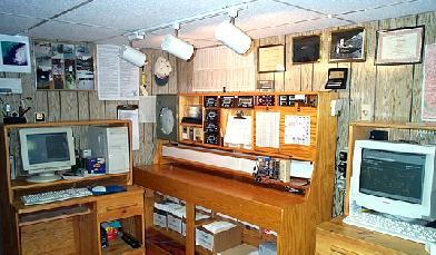
He also sends along this picture of his weather station and office:
Arlington - NWS reports that Washington's mean temp was +1.2o while precip was +0.29". ON JANUARY 3RD...RECORD HIGH TEMPERATURE OF 68 DEGREES. PREVIOUS RECORD WAS 66 DEGREES SET IN 1997. ON JANUARY 25TH...RECORD SNOWFALL FOR THAT DAY OF 9.3 INCHES. PREVIOUS RECORD WAS 6.0 INCHES SET IN 1891.
THE FIRST HALF OF THIS MONTH HAD FIVE DAYS OF SIXTY OR ABOVE...EVEN A DAY IN THE 70S. HOWEVER...THE SECOND HALF OF THE MONTH FEATURED SEVERAL DAYS THAT DID NOT BREAK OUT OF THE 20S AND THREE SNOW STORMS. THE MONTH ENDED UP JUST OVER A DEGREE ABOVE NORMAL.
THE STRONGEST SNOW STORM WAS A COASTAL STORM THAT RAPIDLY DEVELOPED ON THE CAROLINA COAST AND MOVED STEADILY NORTHWARD ON THE 25TH. EAST OF THE CITY RECEIVED 10 TO 20 INCHES...WHILE THE WESTERN SUBURBS RECEIVED 6 TO 12 INCHES.
THAT STORM WAS FOLLOWED FIVE DAYS LATER BY A SUPER BOWL SUNDAY STORM THAT LEFT A MIX OF SNOW...SLEET...AND FREEZING RAIN OVER THE CITY.
Blacksburg - The monthly mean temp of 30.3o was normal while precip was just 0.02" below normal. (from NWS Blacksburg) (See Roanoke's notes for the area summary.)
Bridgewater - On the morning of the 25th, it was announced on the radio that schools were closed. People around here were wondering what was going on. Then it was announced that the eastern part of the county was having snow. One place already had nearly five inches. Bridgewater got nothing out of this storm, and Harrisonburg got only a trace. Five inches fell just a few miles east of Harrisonburg. I don't ever recall a snowstorm in which the snow-no snow area was so close. On the 13th, the winds were very strong from the northwest. My weather computer clocked a gust at 55 mph. Quite a few trees went down. The strong winds continued for most of the day. The last time I remembered a wind storm of this nature was back in the mid 70's. We had a beautiful snowfall on Sunday, the 30th. Five inches fell in and around Bridgewater. All the trees and bushes were decorated with the white stuff. The wind was quiet and the temperature not too cold. A lot of people went by our house walking in the snow, and enjoying the winter scene. We were happy that the snow didn't turn to sleet and freezing rain, which was a possibility.
Charlottesville - Longtime member Jack Stewart, from whom we've heard little this past year, informs us that he's still traveling around among NH, SC, VA, etc.! He hasn't lost interest in the weather and still keeps a record when in CHO land. He'll discontinue his monthly mailings but, hopefully, will check in once and a while and check us out on the Web when he has the chance.
Centerville - "Once the 'storm of the century' (can't miss on that one!) - which caught most of us by surprise - got organized, it behaved well for a nor'easter. The average daily temp was about 5o warmer than average with nights 6.5o above average. At 1335 on the 13th there was a rogue wind gust that set my socks out straight! I'd say it was 35-40 MPH but I'm not counting it for the records. Rainfall was 0.16" above normal." - Paul's notes
Dulles - NWS reports the mean temp for January '00 was +1.9o above normal while precip was -0.84".
Falls Church - Erica writes: "January 2000 started off quite mild; then towards the end of the month we were socked with 2 big snowstorms. The one on the 20th brought 4 inches and the 25th brought 10 inches to Falls Church. The month did, however, still average above normal rainfall. The snowfall was also above average."
Fredericksburg - Ken writes: "The monthly temps average not far from normal, but it was a month of contrasts. The 1st 13 days averaged 45o . The last 18 days averaged 26.1o with over 10" of snow and ice. A low pressure system which was forecast to pass east of virginia on the 25th dropped over 6" of snow here and up to 3 times that amount in locations to the south and east."
Hampton - Dave reports: "After starting very
mild, a prolonged period of below normal temps occurred from mid-month
with stormy weather. Snow occurred on the 18th with temps near 20o
creating traffic woes! (travel time between Williamsburg to Hampton was
4 hours!) Another system on the 20th produced three
inches of snow which quickly melted. A significant storm on the 25th
produced high tides, wind damage , and near blizzard conditions on the
Peninsula. Moderate tidal flooding occurred in parts of the city
as well as wind damage at least to 3 houses in the Buckroe Beach area.
Snow drifts of 1-1.5 feet occurred with the wind. Snow still was
hanging around as of early February. January 2000 station records:
2nd - record high minimum 49o
; 3rd - record high minimum 57o
, record high maximum 73o
; 4th - record high max 75o
; 25th - record high wind gust 60 MPH ; record snowfall 7.0" ; month -
record snowfall of 11.5"
Herndon - Russ sends these notes: "The big news of the month was the nor'easter that took forecasters by surprise on the 25th. We had quite a bit on the ground after our 3rd storm, on the 30th, brought snow and ice. The temperatures stayed cold enough that there was little in the way of melting, which is unusual for this region. January was also a very windy month. We had 7 days with peak gusts over 30 mph and a high wind warning on the 13th. Finally some noteworthy winter weather!"
Lynchburg - NWS BCB noted a mean temp here 0.5o below normal while precip here was 0.47" above normal. (See Roanoke's notes for the area summary.)
Norfolk - NWS AKQ noted that the monthly average temp was 1.1o above normal while precip was 1.29" above the norm. The average wind speed was 10.1 MPH with a 51 MPH gust from the NNE on the 25th.
Portsmouth - Where do I begin with all the station records for January at this station? Well, here we go:New daily rainfall records: 1.19" on the 30th; New daily snowfall records: 0.6" on the 23rd (old record TRACE); 4.0" on the 25th (no previous record) ; New wind records: 49 MPH on the 13th (old record 33 MPH in 1983) and 60 MPH on the 25th (old record 33 MPH in 1998) ; New maximum temperature records: 73º on the 3rd (old record 69º/1997) ; 76º on the 4th (old record 71º/1997) ; 68º on the 11th (old record 66º in 1980) ; New minimum temperature record: 12º on the 28th (tie of previous station record set in 1986) ; New maximum minimum temperature records: 57º on the 3rd (old record 52º/1992) ; 53º on the 4th (old record 50º in 1992) ; 51º on the 10th (old record 50º in 1992) ; New minimum maximum temperature records: 31º on the 22nd (tied previous record in 1984) ; 36º on the 24th (old record 38º in 1986) ; 35º on the 25th (old record 37º in 1987) ; 30º on the 26th (old record 37º in 1987) 28º on the 27th (tied previous record in 1982)
The monthly mean temperature was 0.3o below normal while precip was 116% of normal (+0.67"). The first substantial winter snowfalls since 1996 were recorded. While only 4" of snow fell at the station on the 25th, 6-8" were recorded on average at sites in every direction around the station. The first half of the month was uncharacteristically warm balanced with a very cold second half.
A rare four snowfall events in the latter half of the month- Ironically, the lightest amount (0.1" / 18th) of ice and snow caused over 400 auto accidents at rush hour throughout the Hampton Roads cities!
Mechanicsville - Snow - heavy at times - with blowing snow from a nor'easter on the 25th. Sleet and freezing rain fell on the 30th with power outage from the 30th at 1930 until the 2st of February at 1200! - notes from Glenn
Richmond - NWS AKQ noted that the monthly average temp was 0.6o above normal while precip was 0.72" above the norm. The average wind speed was 9.3 mph.
Roanoke - Wendell notes the month was 1.1o above normal while rainfall was 0.55" below normal. Winter returned during the month with snowfall 3.8" above normal!
Roanoke - NWS BCB reports the monthly mean temp was 0.8o above the norm while precip was 0.54" below normal.
In the Roanoke/Blacksgurg/Lynchburg corridor: FOR THE MOST PART...JANUARY BEGAN PRETTY UNEVENTFUL AND FINISHED UP WITH A BIG BANG. VIRGINIA STARTED OFF ENJOYING A MILD YEAR WITH TEMPERATURES WELL ABOVE NORMAL FOR MOST LOCATIONS AND VERY LITTLE PRECIPITATION. BY THE 11TH-13TH OF JANUARY...THE FIRST STRONG COLD FRONT PASSED THROUGH THE REGION CREATING WIDESPREAD WIND GUSTS IN EXCESS OF 50 MPH...AND ISOLATED WIND GUSTS EXCEEDING 60 MPH. NUMEROUS REPORTS OF WIND DAMAGE WERE REPORTED. TEMPERATURES PLUNGED FROM THIS FRONT AS WELL AS CAUSING LOTS OF DAMAGE. TEMPERATURES THAT RANGED FROM THE MID 50S TO THE MID 60S FELL TO A VERY NOTICEABLE 30 DEGREES COOLER THAN THE PREVIOUS DAY. WINTER SEEMED TO FINALLY ARRIVE. FOR MOST OF THE REGION...OUR FIRST SNOW COVER OF THE SEASON OCCURRED ON THE 18TH SHORTLY AFTER MIDNIGHT...REPORTS CAME IN OF AMOUNTS RANGING FROM 1-7 INCHES...MAINLY OVER SOUTHWEST VIRGINIA AND THE NORTHERN MOUNTAINS OF NORTH CAROLINA. BY THE 20TH...STRONG WINDS BEHIND ANOTHER LOW PRESSURE CENTER GAVE US VERY COLD TEMPERATURES ONCE AGAIN...THE COLDEST OVERNIGHT TEMPERATURES OF THE SEASON WERE RECORDED ON THE 21ST...LOWS RANGING IN THE UPPER TEENS IN THE PIEDMONT TO SINGLE DIGITS ACROSS THE HIGHLANDS. FINALLY...A SNOWSTORM THAT SURPRISED OUR NO SURPRISE WEATHER SERVICE. OUCH...LEAVING NORTH CAROLINA DEEPLY COVERED WITH ICE AND SNOW FOR QUITE SOME TIME...ONLY TO HAVE A SHORT LIVED BREAK FROM THE SNOW...FOR OUR FINAL SNOW STORM OF THE MONTH...29TH AND 30TH. SNOW TOTALS RANGED FROM ONE INCH TO A FOOT...WITH MOSTLY ICE AND SLEET OVER THE PIEDMONT OF NORTH CAROLINA AND VIRGINIA.
Woodstock - A little colder than average but quite dry here, third driest in 14 years! (Editor's note: Sounds like Lauck really missed out on all the winter fun!)
Vienna - Robert writes: "January temperatures were a little above the average as was the precip. Snowfall was about twice my 15-year average but way behind my record of 30.9 inches set in 1996."
North Carolina:
Asheville - From NWS GSP: AVL's mean temp was 0.3o degrees in excess of the norm while precip was 0.15" below norm. The average wind speed was 10.1 mph.
Brevard - "Notes: Away from station 1-3rd,11-12th,21-31st. Rain + snow-melt recorded for all 31 days, 3.77" compares with 7.78" for the past 10 Januarys. Snowfall data obtained from newspaper, Transylvania Times. With only 15 days observed, comparison with past data, except for rainfall, not attempted. The snow fell the day after I left for Texas."
Charlotte - CLT's mean temp was 0.5o degree above normal while precip was 0.36" above the norm.
Raleigh - Bob writes of January: "What began a very mild January turned-out to be the snowiest in recorded history. There were 4 winter events in 7 days including the 24-hour record snowfall on the 24th and 25th. RDU measured 20.3" and my station measured 18". According to the hourly obs at RDU, 12" accumulated between 1 and 6 AM on the 25th. The biggest surprise about the storm was that it was a surprise!! For the Triangle areas, the NWS was forecasting 1-3" as late as the evening of the 24th. A "winter weather advisory" was in effect. Wake County Schools were dismissed one hour early on the 24th and did not reopen until February 3rd. Due to the snow cover, record lows were recorded on the 26th, 27th, and 28th at RDU. "
Raleigh - NWS RDU reported average temps 0.5obelow normal while precip was 2.55" in excess of the norm. The month was the snowiest ever recorded at RDU. In fact, (excerpts from RDU's monthly summary): SEVERAL SNOWFALL RECORDS WERE SET IN THE MONTH OF JANUARY. THE SNOWFALL OF 17.9 INCHES ON JANUARY 25TH BROKE THE RECORD FOR MOST SNOWFALL IN A DAY AND MOST SNOWFALL IN A 24 HOUR PERIOD. THE PREVIOUS RECORD WAS 17.8 INCHES ON MAR 2ND 1927. THE MONTHLY SNOWFALL OF 25.8 INCHES BROKE THE RECORD OF 20.0 INCHES SET IN JANUARY OF 1893. THE 20.3 INCHES OF SNOW THAT FELL ON THE 24TH AND 25TH BROKE THE RECORD FOR MOST SNOWFALL IN A SINGLE STORM. THE OLD RECORD WAS 17.9 INCHES FROM FEBRUARY 15TH TO 17TH IN 1902.
FOUR DAILY SNOWFALL RECORDS WERE ALSO SET. THE SNOWFALL
OF 3.0 INCHES ON THE 18TH BROKE THE DAILY RECORD OF A TRACE SET IN
1981/94. THE SNOWFALL OF 2.4 INCHES ON THE 20TH BROKE THE DAILY RECORD
OF 1.7 INCHES SET IN 1985. THE SNOWFALL OF 2.4 INCHES ON THE 24TH
BROKE THE DAILY RECORD OF 1.8 INCHES SET IN 1977. THE SNOWFALL OF
17.9 INCHES
ON THE 25TH BROKE THE DAILY RECORD OF 2.0 INCHES SET
IN 1966.
NUMEROUS TEMPERATURE RECORDS WERE ALSO SET IN THE MONTH OF JANUARY. THE HIGH TEMPERATURE OF 74 DEGREES ON THE 3RD BROKE THE DAILY RECORD HIGH OF 71 DEGREES SET IN 1997. THE MINIMUM TEMPERATURE ON THE 3RD WAS 55 DEGREES WHICH BROKE THE RECORD HIGH MINIMUM TEMPERATURE FOR THE DAY. THE OLD RECORD WAS 54 DEGREES SET IN 1950.
THREE RECORD LOW TEMPERATURES IN A ROW WERE SET FROM
JANUARY 26TH THROUGH JANUARY 28TH. THE LOW TEMPERATURE ON THE 26TH
WAS 13 DEGREES WHICH BROKE THE RECORD OF 14 DEGREES SET IN 1968.
THE LOW TEMPERATURE ON THE 27TH WAS 10 DEGREES WHICH BROKE THE RECORD
OF 13 DEGREES SET IN 1986/82. THE LOW TEMPERATURE ON THE 28TH WAS
1 DEGREE
WHICH BROKE THE RECORD OF 8 DEGREES SET IN 1986. THE
LOW TEMPERATURE OF 7 DEGREES ON THE 29TH TIED THE RECORD FIRST SET IN 1977.
Roxboro - Notes from Merriell: A nice first half of the month but the second half was everything winter could be. Record snowfall and very cold. However, temps averaged warmer than normal and precip was almost and inch above.
Wilmington - The mean temp (according to NWS ILM) was deficient by 0.1o Rainfall was 0.79" above the norm. ILM received 60% of its possible sunshine. From ILM's monthly summary: NOT ONE BUT TWO DAYS SAW SNOW FALL ON WILMINGTON IN THE MONTH OF JANUARY. THE FIRST TASTE OF THE WHITE STUFF OCCURRED ON THE MORNING OF THE 18TH WHEN 1.1 INCHES FELL. THIS BROKE THE RECORD OF 0.1 INCH SET ON THE DATE IN 1901. ANOTHER QUICK SHOT OF WINTER WEATHER PASSED ON THE 22ND WHEN A TRACE AMOUNT OF SLEET WAS REPORTED. BUT THESE TWO DAYS WERE BUT AN APPETIZER FOR WHAT WAS TO COME. ON THE 25TH... 5.0 INCHES OF SNOW FELL ON THE PORT CITY. THIS BLEW AWAY THE PREVIOUS RECORD FOR THE DATE (A TRACE IN 1968). DESPITE SOME WARMER WEATHER IN THE LAST COUPLE OF DAYS OF THE MONTH... THERE WAS STILL A SMALL AMOUNT OF SNOW LEFT ON THE GROUND ON AS FEBRUARY BEGAN. NO RAINFALL RECORDS WERE SET OR TIED.
South Carolina:
Charleston - Eleanor sends these notes in her article for the Storm Courier newsletter:
A Tale of Two Snows
by: Eleanor Vallier-Talbot, Senior Meteorologist NWS
CHS/K-12 Education and Outreach
On average, a trace of snow
falls across the Lowcountry and Coastal Empire during a typical winter.
It is not totally unusual to have a measurable snowstorm across coastal
South Carolina and southeastern Georgia. The last heavy snow event
occurred on December 22 to 24, 1989, when 2 to 5 inches of snow fell over
coastal Georgia, and 4 to 14 inches along south coastal South Carolina
(5" in Savannah, 8" in Charleston, 14" in Myrtle Beach and 15" in Wilmington,
NC). Other larger snowstorms have fallen across the region.
Two hundred years ago, on January 9th to 11th, 1800, Savannah received
over 18 inches of snowfall, as reported in the Columbian Museum and Savannah
Advertiser. Another 10 inch snow was reported in Savannah on
March 3rd and 4th of 1837. Charleston's all time snowiest month of
14 inches occurred during the winter of 1799-1800. The Big Southern
Snowstorm on February 12, 1899,
dropped 3.9 inches of snow in Charleston.
So, what occurred on January 25th and 26th of 2000 was definitely rare,
but not unheard of.
The first snow, during the
overnight hours of the 24th and 25th, was caused by low pressure off the
southeast coast. The low tracked across the northern Gulf of Mexico
early on the 24th, moved quickly across northeastern Florida, then developed
rapidly off the Georgia and northern Florida coast, near Jacksonville,
late on the 24th. This caused cold air aloft to be dragged to the
surface on the moderate to heavy rainfall, along with colder air wrapping
around the storm from the north. After sunset on the 24th, the driving
rain mixed for several hours with sleet, then changed over to snow early
on the 25th. The snow "piled" up to an inch at Charleston International
Airport, even with a low of 33 degrees. The temperature across many
other areas of south coastal South Carolina dropped to below freezing.
Reports of up to 2" of snow were recorded north and west of Charleston,
generally in northern Colleton, Dorchester and Berkeley counties, though
snow was reported as far south as Beaufort. This snow melted quickly
during the 25th with a high of 51 degrees.
The second event occurred
the next morning, early on the 26th. This was a more isolated event,
with snowfall only occurring across Dorchester, Berkeley and Charleston
counties. A small piece of upper level energy moved quickly southeast
across the region late on the 25th. This feature looked very much
like an "Alberta Clipper" system that normally affects the northern part
of the United States, originating from near Alberta province, Canada.
Inland locations across South Carolina tracked this energy on radar, but
all precipitation remained aloft...that is, until it reached Dorchester
and Berkeley counties. As the area approached the coast, it merged
with a piece of a fast upper level jet stream. This allowed more
upward motion to occur. That, along with an inflow of low level Atlantic
moisture, allowed the precipitation to work down to the surface.
Temperatures that morning were mostly in the mid 20s, so the snow fell
fast. It also stuck around for several hours after sunrise on the
26th as temperatures were slow to rebound. This made a
normally difficult morning commute a nightmare, as
all of the area bridges were closed due to icing conditions. The
Cooper River Bridges, which are a few hundred feet above Charleston Harbor,
were the last to open, around mid morning. A total of 2 inches of
snow fell in the Charleston area, with reports of up to 3 inches in Berkeley
county.
For pictures of the snow,
check out the front page of the NWS Charleston web site at:
http://wchs.csc.noaa.gov .
"Weather Record Book, United States and Canada The Outstanding Events 1871-1970," by David M. Ludlum through Weatherwise magazine. 1971, Weatherwise, Inc.
The monthly average temperature was 4/10ths deg. below the norm while rainfall was 0.59" in excess of the norm. Snowfall was 3" above normal. The average wind speed was 8.3 MPH.
Columbia - NWS CAE reports a monthly mean temp departure of -0.7o while total precip was a whopping 4.46" in excess of the norm.
Florence - FAA Florence noted a +0.9 mean temp departure while rainfall was 1.05" above the norm. The month saw a record cool high of 33o on the 29th (old record was 35o in 1966) and a tied record high of 76o on the 3rd (1952).
Greenville-Spartanburg - The mean temp was 1.5o in excess of the norm while precip was 0.38" below the norm. The average wind speed was 7.2 mph. - from NWS GSP
North Myrtle Beach - NWS ILM reports the month's precip was 1.58" above normal while the mean temp was 3.2o below normal . The station noted record lows on the 15th (20o ), the 27th (23o ), and on the 28th (20o ).
Ruby - Franklin says January was a very cold, rough month in his area. Much snow and ice remains on the ground on the date he writes, February 5th!
Nearby Cities:
The Tri-cities/Bristol area noted a mean temp
0.1o below the norm
while precip was in excess of the norm by 0.39"
|
|
|
|
|
|
|
|
|
|
|
|
|
|
|
|
|
|
|
|
|
|
|
|
|
|
|
|
|
|
|
|
|
|
|
|
|
|
|
|
|
|
|
|
|
|
|
|
|
|
|
|
|
|
|
|
|
|
|
|
|
|
|
|
|
|
|
|
|
|
|
|
|
|
|
|
|
|
|
24 |
NNW |
13 |
|
|
|
|
|
|
|
|
|
|
|
|
|
|
|
|
|
|
|
|
|
|
|
|
|
|
|
|
|
|
|
|
|
|
|
|
|
|
|
|
|
|
|
|
|
|
|
|
|
|
|
|
|
|
|
|
|
|
|
|
|
|
|
|
|
|
|
|
|
|
|
1600 |
|
|
|
|
|
|
|
|
|
|
|
|
|
|
|
|
|
|
|
|
|
|
|
|
|
|
|
|
|
|
|
|
|
|
|
|
|
|
|
|
|
|
|
|
|
|
|
|
|
|
|
|
|
|
|
|
|
|
|
|
|
|
|
|
|
|
|
|
|
|
|
|
|
|
|
|
|
|
|
|
|
|
|
|
|
|
|
|
|
|
|
|
|
|
|
|
|
|
|
|
|
|
|
|
|
|
|
|
|
|
|
|
|
|
|
|
|
|
|
|
|
|
|
|
|
|
|
|
|
|
|
|
|
|
|
|
|
|
|
|
|
|
|
|
|
|
|
|
|
|
|
|
|
|
|
|
|
|
|
|
|
|
|
|
|
|
|
|
|
|
|
|
|
|
|
|
|
|
|
|
|
|
|
|
|
|
|
|
|
|
|
|
|
|
|
|
|
|
|
|
|
|
|
|
|
|
|
|
|
|
|
|
|
|
|
|
|
|
|
|
|
|
|
|
|
|
|
|
|
|
|
|
|
|
|
|
|
|
|
|
|
|
|
|
|
|
|
|
|
|
|
|
|
|
|
|
|
|
|
|
|
|
|
|
|
|
|
|
|
|
|
|
|
|
|
|
|
|
|
|
|
|
|
|
|
|
|
|
|
|
|
|
|
|
|
|
|
|
|
|
|
|
|
|
|
|
|
|
|
|
|
|
|
|
|
|
|
|
|
|
|
|
|
|
|
|
|
|
|
|
|
|
|
|
|
|
|
|
|
|
|
|
|
|
|
|
|
|
|
|
|
|
|
|
|
|
|
|
|
|
|
|
|
|
|
|
|
|
|
|
|
|
|
|
|
|
|
|
|
|
|
|
|
|
|
|
|
|
|
|
|
|
|
|
|
|
|
|
|
|
|
|
|
|
|
|
|
|
|
|
|
|
|
|
|
|
|
|
|
|
|
|
|
|
|
|
|
|
|
|
|
|
|
|
|
|
|
|
|
|
|
|
|
|
|
|
|
|
|
|
|
|
|
|
|
|
|
|
|
|
|
|
|
|
|
|
|
|
|
|
|
|
|
|
|
|
|
|
|
|
|
|
|
|
|
|
|
|
|
|
|
|
|
|
|
|
|
|
|
|
|
|
|
|
|
|
|
|
|
|
|
|
|
|
|
|
|
|
|
|
|
|
|
|
|
|
|
|
|
|
|
|
|
|
|
|
|
|
|
|
|
|
|
|
|
|
|
|
|
|
|
|
|
|
|
|
|
|
|
|
|
|
|
|
|
|
|
|
|
|
|
|
|
|
|
|
|
|
|
|
|
|
|
|
|
|
|
|
|
|
|
|
|
|
|
|
|
|
|
|
|
|
|
|
|
|
|
|
|
|
|
|
|
|
|
|
|
|
|
|
|
|
|
|
|
|
|
|
|
|
|
|
|
|
|
|
|
|
|
|
|
|
|
|
|
|
|
|
|
|
|
|
|
|
|
|
|
|
|
|
|
|
|
|
|
|
|
|
|
|
|
|
|
|
|
|
|
|
|
|
|
|
|
|
|
|
|
|
|
|
|
|
|
|
|
|
|
|
|
|
|
|
|
|
|
|
|
|
|
|
|
|
|
|
|
|
|
|
|
|
|
|
|
|
|
|
|
|
|
|
|
|
|
|
|
|
|
|
|
|
|
|
|
|
|
|
|
|
|
|
|
|
|
|
|
|
|
|
|
|
|
|
|
|
|
|
|
|
|
|
|
|
|
|
|
|
|
|
|
|
|
|
|
|
|
|
|
|
|
|
|
|
(Please
note the column denotations table below.)
PRECIPITATION / BAROMETRIC PRESSURE
|
|
|
|
U1 |
|
|
|
|
|
|
|
|
|
|
|
|
|
|
7A | S |
|
|
|
|
|
|
|
|
|
|
|
|
|
|
|
|
|
|
|
|
|
|
|
|
|
|
|
|
|
|
|
|
|
|
|
|
|
|
|
|
|
|
|
|
|
|
|
|
|
|
|
|
|
|
|
|
|
|
|
|
|
|
|
|
|
|
|
|
|
|
|
|
|
|
|
|
|
|
|
|
|
|
|
|
|
|
|
|
|
|
|
|
|
|
|
|
|
|
|
|
|
|
|
|
|
|
|
|
|
|
|
|
|
|
|
|
|
|
|
|
|
|
|
|
|
1600 |
|
|
|
|
|
|
|
|
|
|
|
|
|
|
|
|
|
|
|
|
|
|
|
|
|
|
|
|
|
|
|
|
|
|
|
|
|
|
|
|
|
|
|
|
|
|
|
|
|
|
|
|
|
|
|
|
|
|
|
|
|
|
|
|
|
|
|
|
|
|
|
|
|
|
|
|
|
|
|
|
|
|
|
|
|
|
|
|
|
|
|
|
|
|
|
|
|
|
|
|
|
|
|
|
|
|
|
|
|
|
|
|
|
|
|
|
|
|
|
|
|
|
|
|
|
|
|
|
|
|
|
|
|
|
|
|
|
|
|
|
|
|
|
|
|
|
|
|
|
|
|
|
|
|
|
|
|
|
|
|
|
|
|
|
|
|
|
|
|
|
|
|
|
|
|
|
|
|
|
|
|
|
|
|
|
|
|
|
|
|
|
|
|
|
|
|
|
|
|
|
|
|
|
|
|
|
|
|
|
|
|
|
|
|
|
|
|
|
|
|
|
|
|
|
|
|
|
|
|
|
|
|
|
|
|
|
|
|
|
|
|
|
|
|
|
|
|
|
|
|
|
|
|
|
|
|
|
|
|
|
|
|
|
|
|
|
|
|
|
|
|
|
|
|
|
|
|
|
|
|
|
|
|
|
|
|
|
|
|
|
|
|
|
|
|
|
|
|
|
|
|
|
|
|
|
|
|
|
|
|
|
|
|
|
|
|
|
|
|
|
|
|
|
|
|
|
|
|
|
|
|
|
|
|
|
|
|
|
|
|
|
|
|
|
|
|
|
|
|
|
|
|
|
|
|
|
|
|
|
|
|
|
|
|
|
|
|
|
|
|
|
|
|
|
|
|
|
|
|
|
|
|
|
|
|
|
|
|
|
|
|
|
|
|
|
|
|
|
|
|
|
|
|
|
|
|
|
|
|
|
|
|
|
|
|
|
|
|
|
|
|
|
|
|
|
|
|
|
|
|
|
|
|
|
|
|
|
|
|
|
|
|
|
|
|
|
|
|
|
|
|
|
|
|
|
|
|
|
|
|
|
|
|
|
|
|
|
|
|
|
|
|
|
|
|
|
|
|
|
|
|
|
|
|
|
|
|
|
|
|
|
|
|
|
|
|
|
|
|
|
|
|
|
|
|
|
|
|
|
|
|
|
|
|
|
|
|
|
|
|
|
|
|
|
|
|
|
|
|
|
|
|
|
|
|
|
|
|
|
|
|
|
|
|
|
|
|
|
|
|
|
|
|
|
|
|
|
|
|
|
|
|
|
|
|
|
|
|
|
|
|
|
|
|
|
|
|
|
|
|
|
|
|
|
|
|
|
|
|
|
|
|
|
|
|
|
|
|
|
|
|
|
|
|
|
|
|
|
|
|
|
|
|
|
|
|
|
|
|
|
|
|
|
|
|
|
|
|
|
|
|
|
|
|
|
|
|
|
|
|
|
|
|
|
|
|
|
|
|
|
|
|
|
|
|
|
|
|
|
|
|
|
|
|
|
|
|
|
|
|
|
|
|
|
|
|
|
|
|
|
|
|
|
|
|
|
|
|
|
|
|
|
|
|
|
|
|
|
|
|
|
|
|
|
|
|
|
|
|
|
|
|
|
|
|
|
|
|
|
|
|
|
|
|
|
|
|
|
|
|
|
|
|
|
|
|
|
|
|
|
|
|
|
|
|
|
|
|
|
|
|
|
|
|
|
|
COLUMN DENOTATIONS:
| A maximum mean temperature | T total precipitation (inches) |
| B minimum mean temperature | U maximum calendar day precipitation (inches) |
| C monthly mean temperature | U1 date of maximum calendar day precipitation |
| D maximum temperature | V date(s) of maximum daily precipitation |
| E date(s) of maximum temperature | V1 maximum 24-hour precip. & date(s) |
| F minimum temperature | W number of days with precip. >= .01" |
| G date(s) of minimum temperature | X number of days with precip. >= 1.0" |
| H days with maximum temperature >=90 | Y year-to-date precipitation (inches) |
| I days with maximum temperature <=32 | Z maximum calendar day snowfall (inches) |
| J days with minimum temperature <=32 | 1 date of maximum calendar day snowfall (inches) |
| K days with minimum temperature <= 0 | 2 number of days with snowfall |
| L peak wind gust (miles per hour) | 3 number of days with snowfall >= 1.0" |
| M direction of peak wind gust | 4 total snowfall for month (inches) |
| N date(s) of peak wind gust | 5 total snowfall for 1999-2000 season (inches) |
| O number of days with thunder | 6 maximum barometric pressure (inches) |
| P number of days with hail | 6A date of maximum barometric pressure |
| Q number of days with glaze | 7 minimum barometric pressure (inches) |
| R number of days with ice pellets | 7A date of minimum barometric pressure |
| R1 number of days with dense fog | (i) incomplete data |
| S local observation time for temps/precipitation | (M) Missing, if listed in data table |
| ~ "about" | E estimated |
| + additional indeterminate number of days | NR not recorded |
STATION / LOCATION (MILES & DIRECTION FROM MAIN POST OFFICE) / OBSERVER / YEAR RECORDS BEGAN / EMAIL ADDRESS:
| ANN Annandale, VA 1 3/4 ENE - Lowell Koontz 12/90 llkoontz@erols.com | ROA Roanoke, VA Webmaster (Blacksburg): William.Perry@noaa.gov |
| DCA Arlington, VA NWS Webmaster (Sterling): james.decarufel@noaa.gov | ROK Roanoke, VA 6SW Wendell Prillaman 4/76 |
| BCB Blacksburg, VA NWS Webmaster: William.Perry@noaa.gov | VNA Vienna, VA Robert Boott, 1.5SW boottr@vrinet.com |
| BRI Bridgewater, VA Clayton Towers Ctowers@rica.net | AKQ Wakefield, VA NWS Webmaster: Hugh.Cobb@noaa.gov |
| CEN Centreville, VA Paul Bassett 1985 pbassett@digizen.net | WSH Washington, VA David Yowell runamok@runamok.com |
| CHO Charlottesville, VA 3N John Stewart (Rappahannock County) - 1/91 - Inactive | WEE Weems, VA 3WNW Francis J. Socey |
| IAD Dulles International Airport Webmaster (Sterling): james.decarufel@noaa.gov | WOO Woodstock, VA 5NW Lauck Walton - 12/1/85 jwalton@shentel.net |
| FCH Falls Church, VA Erica Page - 3/7/94 ERICA96661@aol.com | AVL Asheville, NC NWS NWS GSP: bryan.mcavoy@noaa.gov |
| FRB Fredericksburg, VA 7SW Ken McKneely mckneelys@email.msn.com | BRE Brevard, NC 1SE Bob Keehn 1/1/90 Bob_Keehn@citcom.net |
| HAM Hampton, VA 5NE Dave Kessel 1989 tccdkessel@yahoo.com | CLT Charlotte, NC NWS NWS GSP: bryan.mcavoy@noaa.gov |
| HER Herndon, VA R.M. Beall P- 10/76 T- 1/91 | GSO Greensboro, NC NWS Webmaster (Raleigh/RAH): Richard.Jones@noaa.gov |
| HRN Herndon, VA 4SW Russ Topping - 1985 rtopping@erols.com | RAL Raleigh, NC 7NNW Bob Woodson - 6/1/93 woods@pipeline.com |
| LKU Louisa, VA 1N Joseph Bowers 1944 - NWS ID 44-5050-02 jmbiii@mnsinc.com | RDU Raleigh-Durham, NC NWS Webmaster: Richard.Jones@noaa.gov |
| LOU Louisa, VA 6S John Bullock (about 1970) | |
| LYH Lynchburg, VA NWS Webmaster (Blacksburg): William.Perry@noaa.gov | ROX Roxboro, NC 2SE Merriell A. Jay 1/93 |
| NEW Newmarket, VA 2W Joyce Winfree joywood@shentel.net | ILM Wilmington, NC NWS nwsilm@wilmington.net |
| NPN Newport News, VA 7N Gary Leonard - 6/91 GaryMLeonard@aol.com | CHS Charleston,
SC NWS, courtesy of Eleanor Vallier-Talbot
Eleanor.Vallier-Talbot@noaa.gov evaltal@wpmedia.com Webmaster Contents CHS: Theodore.Rodgers@noaa.gov |
| NOR Norfolk, VA 3NE Jim Fentress 6/1/77 | CAE Columbia, SC NWS |
| ORF Norfolk, VA 5NE NWS 1871 Webmaster (Wakefield): Hugh.Cobb@noaa.gov | GSP Greenville-Spartanburg, SC NWS bryan.mcavoy@noaa.gov |
| POR Portsmouth, VA 3S Bill Trotter - 7/1/76 pwrs@pilot.infi.net | RUB Ruby, SC 3 NW Franklin Hancock |
| MEC Mechanicsville, VA Glen Martin 11/19/91 | FLO Florence, SC nwsilm@wilmington.net |
| RMD Richmond, VA Roy Britt 8/22/83 rbritt@erols.com | CRE North Myrtle Beach, SC nwsilm@wilmington.net |
| RIC Richmond, VA NWS Webmaster (Wakefield): Hugh.Cobb@noaa.gov | TRI Tri-cities/Bristol, TN NWS Webmaster (Morristown):W-Mrx.Webmaster@noaa.gov |
| CHW Canaan Heights, WV Dave Lesher wxdave@boo.net |