NEW
MEMBER, NEW STATION:
HARRISONBURG
(HRG)
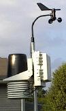
Terry Slagle in
Harrisonburg has joined us this month! He sends some information
about himself and his station: "I am 36 years old and have lived in Harrisonburg
for the past 4.5 years. I became interested in weather while living in
Florida during my high school and college years. The threat of a tropical
storm or hurricane gets everyone's attention. For the 8 years I lived in
Florida I never experienced a hurricane. That came once I moved to North
Carolina and went through Hugo in 1989.
I have had a
wireless Davis Monitor II weather station since May 2000 and have been
using it to archive the weather and post information hourly to my website.
I use Virtual Weather Station software to keep the website current. The
website can be
viewed at http://harrisonburgweather.com.
(Altitude at Harrisonburg is 1306')."
Welcome Terry!!
...Quiet
First half for May 2001...
...A Far
More Active Second Half...
While there
was no severe weather of note in April, the change of seasons in May brought
about considerable shower and thunderstorm activity in the latter half
of the month.
Early in the
month, a high pressure ridge built over the Mid-Atlantic. The period
was dry but punctuated by scattered afternoon showers and thundershowers
over western areas of VA and NC into NW SC resulting from weak low pressure
in the vicinity triggering activity in conjunction with daily heating of
the atmosphere. Temps reached 90° for the first time this year
in western areas of the tri-state area; but temps closer to the coast only
rose to the upper 80s in most locations. Nighttime lows ranged from
the 30s and 40s in western areas of VA to the lower 60s by the 4th and
5th over SE VA.
On May 5th high
pressure moving from south-central and SE Canada across the Great Lakes
and New England south along the coast sent a cold front to the VA border
and NE NC by evening. The front activated considerable scattered
shower and thunderstorm activity prompting warnings across western and
central VA and as far east as the Isle of Wight County. The coasts
of VA and NC escaped the activity that produced downpours for the warnings
areas. On May 6th: As of 9 AM cold front had only made it to
southern NC. (no active weather along it at that time.) As
high pressure built in from the north on the 7th, strong onshore winds
at coastal areas of North Carolina created watches for overwash at the
Outer Banks and for rip currents.
Some areas
of showers formed along SC/GA border late at night into early Monday the
7th. NWS WBC reported a 20th consecutive day without rain at Washington-Reagan
National Airport in Arlington, VA as of the 8th, far from the record 33
days set August 7 - September 7 in 1995.
First severe
weather outbreaks were noted from NWS local storm Reports on May 12th as
wind damage was reported in Kingsboro and Edgecombe, NC. And thus
began a period of severe outbreaks lasting the entire month over VA, NC,
and SC with local storm reports indicating wind damage, hail, and severe
thunderstorms, much to be expected as the seasons change.
On the 17th,
flash flood watches were issued for the Appalachians as a front hung in
the mountainous areas. Several inches of rain fell from cells and
thunderstorms over western and southwestern VA into northwest NC as warm,
Gulf air was pulled well to the north along the chain. Willis, Pulaski,
Bland and Radford in Virginia reported 2 day rainfall totals of just over
3.5" of rain. Staffordsville in Giles County reported nearly 4.5"
in the same time period. The heavy rains would continue into the
following week with continued flash flood watches and warnings. Monthly
rainfall totals for flood watch areas included: Blacksburg (7.89") and
Roanoke (6.68" at ROK).
By the 18th
and 19th, shower and thunderstorm activity moved east to the coast.
The activity continued in the western areas with ongoing flash flood watches
and warnings with new rounds of convection aided now by the development
of southerly winds from high pressure off the SE US coast.
For North and
South Carolina, a noticeable increase in severe weather around the 19th
and 20th with wind damage reported. Flash flooding still reported
in SW and western VA and thunderstorms produced hail in south central VA
into north central NC.
On the 21st,
a line of thunderstorms and sightings of funnel clouds in Suffolk, VA prompted
NWS Wakefield to inform the public of possible tornadic development although
no touchdowns were noted and weak rotation noted on radar dissipated.
On the 22nd,
severe reports of wind damage (large trees down) from Palmyra, Fluvanna,
Green Springs, Louisa, Caroline and Fort Hill, VA with a possible
tornado at Caroline. Some hail also reported near Carmel Church.
Gust winds reported across all of northern VA extending eastward into MD.
Meanwhile, flash flooding still persistent in Alleghany County, Collierstown,
and Rockbridge in western VA as reported by NWS Blacksburg
The Roanoke
Airport reported a 63 mph wind gust and wind damage reports came in from
residents in the area. Wind damage on this date was also reported from
Hendersonville, NC.
On Friday the
25th, a rather noteworthy tornado touched down in Waldorf, MD at 4:30 PM.
Funnel clouds were reported in nearby locales.
Of special note
were the dry conditions along the SC coast with an unually low 1.36" at
Charelston. Rather dry as well over central and eastern NC, compared
to the other reporting stations throughout the region.
Here's Patrick
Maloit's (NWS AKQ) MAY
2001 Hydrological Report Narrative Summary: After a dry start...the
month of May ended on a wet note...as a series of cold fronts moved across
the Mid-Atlantic states in the last half of the month. The late month rain
was not enough however...to prevent below normal precipitation across most
of central and southeast Virginia...and northeast North Carolina. |

ACON
- VA/NC/SC
The Atlantic
Coast Observer Network:
Virginia,
North Carolina, South Carolina
http://www.pilot.infi.net/~bsmoot/acon.htm
SUMMARY OF CLIMATOLOGICAL
DATA
MAY 2001
Only the
Northern Neck...south central Virginia...and portions of the lower Maryland
Eastern Shore had near normal...to above normal rainfall in May.May 2001
precipitation totals ranged from 1.30 inches at the American Water Company
in Hopewell...to 6.87 inches at Gwynn's Island in Mathews County. An area
of high pressure slowly moved southwest from off the Mid-Atlantic coast...into
South Carolina from the 1st through 4th. This kept the region dry...except
for some light showers in the Virginia Piedmont on the 4th...triggered
by a trough of low pressure in the lee of the Appalachian Mountains.
A relatively weak cold front moved across the region the night of the 4th...moving
offshore on the 5th. While the passage of the front brought generally light
showers to the Mid-Atlantic states...it did bring about the 24-hour rainfall
maxima for the month at Petersburg...where 1.60 inches fell from the 4th
to the 5th...and at Emporia of 1.20 on the 5th. Behind the front...high
pressure built down from Canada from the 5th to the 8th. A weak cold front
moved through the area late on the 8th...causing light showers across the
Piedmont region. High pressure built in from the southern plains behind
the front...slowly moving off the southeast coast on the morning of the
12th. A cold front moved through the area from the midwest on the 12th...moving
offshore by the morning of the 13th. The showers and thunderstorms with
this front...produced a 24-hour maxima for May at the Elizabeth City Coast
Guard Station of 1.05 inches on the 12th. On the 13th...high pressure built
in from the Great Lakes...moving to the Atlantic coastal plain on the 15th.
A warm front stalled out across western Virginia and central North Carolina
on the 16th. Rain on the east side of the front produced 24- hour maxima
for may of 0.67 inches at Jackson, North Carolina from the 15th to the
16th. The weather pattern remained nearly stationary through the 18th...when
the high moved offshore...and the stationary front moved slowly north as
a warm front...stretching across southern Virginia the morning of the 19th.
Rainfall ahead of this warm front caused some 24-hour rainfall maxima for
the month across the region...including 0.90 inches from the 18th to the
19th at Snow Hill on the lower Maryland Eastern Shore...1.13 inches at
the Salisbury Airport on the 19th. This front then sagged south and stalled
out across central North Carolina on the 20th...then moved north to southern
Virginia as a warm front (again) on the 21st...and continued north to the
Mason-Dixon line by the morning of the 22nd. The second visit of the front
to the region produced more rainfall maxima for May including...2.30 inches
at Clarksville in Mecklenburg County (19-20th)...1.07 inches at the Norfolk
International Airport (20th-21st)...0.74 inches at Assateague Island (21st)...and
1.42 inches at Louisa (21st-22nd). A cold front pushed through the region
late on the 22nd...moving offshore by the morning of the 23rd. This produced
1.42 inches of rain in less than a 24 hour period on the 22nd at the co-op
observer location in Salisbury. Weak high pressure built in from the central
plains from late on the 22nd through the 24th. A warm front lifted north
from Georgia...to central Virginia by the morning of the 25th...and then
north to southeast Pennsylvania by the morning of the 26th. The passage
of the warm front created more 24-hour maxima for rainfall in May...with
2.5 inches at Vienna in Dorchester County (24-25th)...and 2.20 inches at
Corbin in Caroline County on the 25th. A cold front passed through the
Mid-Atlantic states during the 26th...producing several 24 hour rainfall
maxima for the month...including 2 inches at the Crisfield Coast Guard
Station in Somerset County on the 26th. Weak high pressure built in from
the plains from the 26th into the 27th. A cold front slowly moved across
the region on the 28th...before stalling out as a stationary front from
the Eastern Shore to central North Carolina on the 29th. Another cold front
pushed its way across the region from late on the 29th into the 30th. The
net result of the passage of these two fronts was the setting of a number
of 24- hour rainfall maxima across the area including 2.02 inches at Princess
Anne in Somerset County from the 28th-29th. An area of high pressure built
in from the Great Lakes from the 30th to the 31st to close the month on
a dry note. Spring of 2001 had below normal precipitation across most of
central and southeast Virginia...and northeast North Carolina...and near
to above normal across most of south central Virginia...the Northern Neck...and
the lower Maryland and Virginia Eastern Shore. Spring 2001 rainfall ranged
from 6.47 inches at Edenton in northeast North Carolina...to 13.53 inches
at the Salisbury co-op observer site in Maryland.
HAM RADIO &
ARPS - Bob Woodson
(RAL) has linked his Davis Weather Station with a 2 meter HT radio
to transmit weather information via APRS . The NWS at RDU can see
current weather information from area hams that who weather stations without
using the Internet. Information regarding APRS can be found
at http://www.centralcarolinaskywarn.net.
MEMBER INTERNET
HOMEPAGES -
Remember...some
of our members display their weather data - current and archived - on the
Internet. You can click through to them while online by visiting
the ACON - VA/NC/SC main home page. Many offer much more that data!!
http://www.pilot.infi.net/~bsmoot/acon.htm
|
ACON VA/NC/SC Member
Station Extremes - May 2001
|
State
|
Maximum Temperature
|
Minimum
Temperature
|
Warmest
Average
Temperature
|
Coldest
Average
Temperature
|
Maximum
Precipitation
|
Minimum
Precipitation
|
|
Virginia
|
92°
Centreville & Newport News
|
32°
Blacksburg & Louisa (LKU)
|
68.8° Norfolk (NOR)
|
59.8°
Harrisonburg
|
7.89"
Blacksburg
|
1.42"
Richmond (RMD)
|
|
North Carolina
|
95°
Wilmington
|
37°
Brevard
|
70.1°
Wilmington
|
63.6°
Brevard
|
4.21"
Brevard
|
2.30"
Concord
|
|
South Carolina
|
96°
Orangeburg
|
47°
Greenville-Spartanburg
|
72.7°
Columbia
|
68.4°
North Myrtle Beach
|
4.53"
Columbia
|
1.36"
Charleston
|
Virginia:
Annandale - Lowell reports:
"May was a month of extreme split personality as the 1st half was
extremely dry and the 2nd half was very wet. The average
minimum temperature dep. was 0.75°f and the max. was -
0.22°; thus the mean was surprisingly a little above ave. +0.27°;
May 8th was the 20th day without measurable rain - rainfall on the 9th
was 0.05 inches. The record for the last 21 yrs. is 22 days.
The most unusal reccord was the high barometer reading of May 6th, the
highest barometer ever recorded in <ay at this station.
On the 22nd we set a new rainfall record for the date 1.51 inches. That
was also the most rain in a may day since 1997. The temp.
range for the 26th was only 2°, the smallest daily temperature
ever recorded for the date and ties the 21 year record for the lowest temperature
range ever recorded any date of the year! From April 18 until May
18th we have had only 0.08 inches of rain in the last 30 days. The
89°f maximum on the 4th was a new 21 year record high maximum
for the date by 8 degrees."
Arlington - NWS WBC reports:
"Early May continued with the dryness of April. After less than two inches
of rain during April...the first eight days of May were rain free. That
produced a 20 day stretch without rain...extending back into late April.
Talk soon turned to drought as water levels dipped and crops were stunted.
This intensified as the next nine days produced only a few hundredths of
rain...stretching the dry spell to nearly a month. Things changed around
mid May however as a large and deep stationary low developed over the upper
midwest states. This whirlpool in the atmosphere drew moist air from the
Gulf of Mexico...while small areas of low pressure spun around the larger
low to our west. The result was a rainy last half of May...with three and
three quarters of an inch of rain falling during the final two weeks...and
that was a low figure regionally. Generally between three and six inches
of rain fell during the last half of May around the region. While the first
half of May was warm and dry with temperatures generally in the 70s and
80s...the second half was cooler and damp with high temperatures generally
in the 60s and 70s. There were also a few severe weather outbreaks during
the second half of May. The district received damaging winds on the 22nd...and
a tornado was confirmed in the northern suburbs during an outbreak of severe
thunderstorms on the 27th. Mean temps were 0.5° below normal
while rainfall was 0.05" above normal. "
Blacksburg - Temps were 0.2°
above normal while precip was 4.01" above normal. - NWS Blacksburg
Bridgewater - Clayton reports:
"The first half of May was dry and hot while the last half was cool and
wet. The first fifteen days produce only .05 inches of precipitation while
3.59 inches ocurred during the last sixteen days. There were eight consecutive
days with measurable precipitation. During this rainy spell, eleven out
twelve days had measurable rain. Precipitation for the year now is 12.3
inches which is 2.55 inches below normal."
Centreville - Paul notes: "May
began where April left off; hot and dry, but all in all we just about broke
even for averages. Naturally the average nightly lows were above
normal. By two degrees above the 50.2° normal in fact, and the
overall average temperature for the month was 63.2°; less than a degree
above what wed normally expect for May. The maximum of 92° on
the 4th and the minimum of 36° on the 7th; a spread of 56°, occurred
over a period of 64 hours; a little less than three days. The heck
with this phenomena weather, Im heading to Florida. At least there
its hot and dry (drought) there all the time.
The first half of May continued to
be dry. How dry was it you ask. Four weeks with just 0.02
of measurable precip until the 16th. For May, thats dry. Then
it really poured, and by the end of the 17th we had actually doubled the
amount of the past 28 days with an additional 0.04. The next two
weeks made up for lost time though with 3.87 more rain giving us a surplus
for May of 0.29. The greatest daily amount occurred on the 22nd
with 1.26 being partially to blame for delays with arrivals at Dullas
airport. The rest of the blame along the East coast goes to severe
thunderstorms in and around Orlando, FL which is exactly where I was trying
to leave from. My luggage? It wasnt on the same plane as me
but then, I may have been expecting too much with only six hours for the
airlines to get it all figured out. Cheers. "
Charlottesville - Rainfall
for the month was 1.64" below normal. - NWS WBC
Dulles - NWS WBC reports
the mean temp was 0.8° in excess of the norm. Rainfall was 1.77"
above normal.
Falls Church - "May 2001 was
slightly cooler than normal but above average in rainfall.
There were 6 days of stormy weather with about half of those days having
severe weather." - notes from Erica
Hampton - Dave reports two
station record ties during the month. The max of 89° was tied
on the 11th and the max of 90° was tied on the 12th.
Harrisonburg - Terry sends
these observations: " 0.10" of rain on May 16 ended a streak of 23 days
with only .28" of rain during that time. The 2.54" total for May was the
second highest month so far this year."
Herndon - Russ sends these
notes: "May rainfall was 1.77 inches above normal. We had measurable rain
for much of the latter half of the month, after a month went by with less
than one tenth of an inch. Temperatures averaged 0.8°
degrees above normal, with no records
set."
Lynchburg - The mean temp was
2.1° below normal while precip was 0.40" above the norm. - NWS Blacksburg
Louisa - Joe noted that finally
some decent rains have arrived. With over 4" in May and another 4"
in June (through the 19th), he's spending quite a bit of time on his lawnmower.
New Market - Joyce notes via
email: "Temperature is 6° below normal for mean for month. We did have
normal rain fall finally after the middle of the month. Still are below
normal for yearly rainfall. The ground is still dry but workable. We were
much warmer the first part of the month than the last part. In fact one
of the coldest nights was the 31st."
Newport News - Gary sends these
notes: "First 12 days of the month were dry and warm (5 record highs and
1 tie!!) Rest of the month was cooler and wetter."
Norfolk - From NWS AKQ:
The monthly precip was 0.92" below normal while the monthly mean temp was
0.4° above normal. The average wind speed was 9.0 mph.
For the year, rainfall is deficient by 5.11".
Portsmouth - The average temp
here was about normal, +0.2°, while precip was only 86% of the normal
(-0.56"). The average wind speed was 4.09 mph from a dominant southerly
direction. May station records included: 4th - maximum temperature
TIE - 87° (previously in 1996);
5th - maximum temperature - 88° (previously
87° in 1980); 21st - Daily precipitation 1.03"
(previously 0.68" in 1982); 22nd - Maximum minimum temperature 70°
(previously 68° in 1984); 26th - Daily precipitation
1.21"
(previously 0.98" in 1994). For the year, rainfall is 70% of the
norm, or 5.79" in deficiency.
Mechanicsville - "Thunderstorms
occurred on the 12th, 18th, 19th, 22nd, 25th, & the 28th which is a
lot of t-storms! None were severe." - notes from Glenn
Richmond - According to NWS
AKQ: Richmond's rainfall was 1.81" below normal. The average
wind speed was 6.6 MPH. Temps averaged 0.8° below normal.
Rainfall for the year is running 4.26" below normal.
Roanoke (ROA) - "Temperature
averages were 0.9° above normal. Rainfall was above normal (+1.63")
- notes NWS Blacksburg
Roanoke (ROK) - "A big turn-around
in May from a hot and dry first half to a cool and rainy second half resulting
from heavy rainfall. The average temp was 0.3° above average
and the rainfall was 2.34" above average."
Woodstock - "Temperatures
were very near my 16 year average. Precipitation was lacking
in the first fortnight of the month, but after that we had soaking rains
and thunderstorms to bring us well above average for the month...4th highest
in 16 years. This brings precip for the first five months
of the year slightly above the 1950-1970 average as shown in the Virginia
Climatological Survey, but it's still 3 inches below my 1986-2001 year
average for the same period." - notes via email from Lauck
North Carolina:
Asheville - From NWS GSP:
The monthly mean temp was 1.0o above normal while rainfall
was 1.96" below normal. The average wind speed was 5.2 mph.
Brevard - Bob sends this
summary: "May, 2001 was a temperate month, the mean, 76.0° F, high
was 1° below expected (the 1990-1999 average) while the mean low, 51.1°
F, was 0.4° below normal. Heating 30 day degree days was 84%
of normal while cooling was 49% of the normal for May. The month yielded
slightly more rain than expected, 4.21" compared with 3.63", but we are
still almost ten inches below the expected YTD total, 19.5" compared with
29.35". Cloud cover averaged 71% for the month."
Charlotte - NWS GSP reports
the mean temp here was 0.8° above normal while precip was 1.17" below
normal. Yearly rainfall totals at the end of April were 4.91" below
normal.
Concord - Tom eamils his report:
"May continued the trend of being drier than normal with rainfall only
66% of what it should have been for the month. Temperatures were almost
normal or only +0.1° above normal for the month. Yearly rainfall is
now -6.43" below average or 67% of what it should be through May. Severe
drought conditions continue across the Western NC Area with water restrictions
still in place locally."
Greensboro - NWS RAH reports
a record low max temp of 60° on the 17th. The monthly mean temp
at Piedmont Triad Airport was 0.4° in excess of the norm whle rainfall
was 1.33" below normal.
Lumberton - The average wind
speed was 5.9 MPH. - from NWS ILM
Raleigh (RAL) - Bob writes:
"Weather for May can be described as near normal temperatures, but below
normal rainfall. Even though rainfall was below normal, precipitation was
observed on thirteen (13) days. No severe weather at this station, however
severe wether wtaches were issued at least three(3) times in May.
Have linked my Davis Weather Station
with my 2 meter HT radio to transmit weather information via APRS
. The NWS at RDU can see current weather information from area hams that
have weather stations without
using the Internet. Information regarding
APRS
can be found at http://www.centralcarolinaskywarn.net.
Raleigh (RDU) - NWS RDU reports
a record low max temp set on consecutive days... 63° on the 16th &
60° on the 17th. Temps averaged 1° above normal while rainfall
was deficient by 0.39"
Roxboro - From Merriell,
"May was dry with no rainfall the first two weeks. The month total
rainfall was about 1" below normal. Temperatures averaged near normal
although there were cool and warm periods."
Wilmington - Excerpts
from the NWS ILM narrative summary: A sunny and drier than normal may for
the port city... No temperature records were broken or tied for the
month. Total rainfall for the month was 1.35 inches below normal.
May was sunnier than normal. with 77% of possible sunshine and the normal
was 67%. Cooling degree days totaled 178 units in May. This
amount was 10 units above normal. The seasonal total is 295 units... 75
units above normal. Heating degree days totaled 14 units in May. This amount
was 4 units above normal. The seasonal heating degree total grew to 2718
units... 248 units above normal. The average wind speed for may was
7.2 mph.
South Carolina:
Columbia
- NWS CAE reports the average relative humidity was 65% while the average
temperature was 1.8° above normal. Rainfall was 0.85" above normal.
For the year rainfall is running 6.08" below the normal.
Charleston
- NWS CHS reports that the mean temp was 0.5° below normal while precip
for the month was 2.65" in deficiency. Average wind speed was 7.8
mph.
Florence
- NWS ILM reports the mean temp there was 1.3° above normal while rainfall
was 1.79" below normal. The average wind speed was 6.9 mph.
Greenville-Spartanburg
- The monthly temps averaged 0.9° above normal while total rainfall
was 2.28" below normal. The average wind speed was 6.1 mph.
- NWS GSP
North Myrtle
Beach - From NWS ILM: Rainfall was 0.81" below normal.
Temps averaged 1.3o below normal. The average wind speed
was 8.0 MPH. Records: High temp set on the 19th (90°) beating
old record 89° in 1996.
Orangeburg
- The average relative humidity was 66%. (from NWS CAE)
Nearby Cities:
Tri-cities/Bristol area noted
temps averaging 1.8° above the norm with total rainfall below
normal (-0.09"). For the year, rainfall is 0.79" below normal
- from NWS Morristown, TN
(Please
note the column denotations table below.)
TEMPERATURES / WIND / ELEMENTS
VIRGINIA
STN  A      B    C    D      E F     G    H I  J K L  M     N  O P Q R R1 S
------------------------------------------------------------------------------
ANN 75.06 54.87 64.97 89     4 40    7   0  0  0 0 29 NNW  30  5 0 0 0  0 2400
                                                   33 W    30
BCB             60.2  84     3 32   14             38 W    22             2400
BRI 74.0  51.0  62.5  88     2 36   14   0  0  0 0             3 0 0 0  1 0530/1600
CEN 74.2  52.2  63.2  92     4 36    7   3  0  0 0 21 327ø 12  5 0 0 0  0 1200/2400
CHO 73.8  50.8  62.3  89     4 38    8   0  0  0 0 24 200° 25  7 0 0 0  6 2400
DCA 75.0  56.7  65.9  88    11 46    7   0  0  0 0 37 300° 30  4 0 0 0  2 2400
IAD 74.5  50.7  62.6  90     4 33    7   1  0  0 0 38 260° 22             2400
FCH 74.7  56.3  65.5  88    11 46    7   0  0  0 0             6 0 0 0  1 2400
HAM 77.3  59.9  68.6  90    12 51   14   1  0  0 0 42 N    18  1 0 0 0  0 2400
HRG 70.5  49.0  59.8  82.9   4 34.9 14   0  0  0 0 23 W     5  1 0 0 0  3 2400
HER 73.7  52.7  67.2  88.0   4 37.9  7   0  0  0 0 24      30  4 0 0 0 NR 2400
HRN 72.6  52.3  62.6  87.8   4 36.8  7   0  0  0 0 41 NW   22  1 0 0 0  1 2400
LKU 73.65 47.61 60.6  88     8 32    7   0  0  0 0 19 WNW  25  0 0 0 0  0 2400
LOU 72.2  50.3  61.3  86     5 40   14   0  0  0 0             6 0 0 0  0 0800
LYH             62.4  86     4 37   14             33 W    22             2400
NEW 74.39 49.10 61.75 89     2 37  8,31  0  0  0 0 35 W    13  2 0 0 0  8 1700
NPN 78.0  56.5  67.3  92    12 46  8,14  5  0  0 0 37 NE   12  6 0 0 0  2 2300
                                                   30 NW   18
NOR 79.1  58.5  68.8  90 11,12 47    9   2  0  0 0             5 0 0 0  1 2400
ORF 75.3  57.7  66.5  90    12 46    1   0  0  0 0 36 310° 12  6 0 0 0  3 2400
POR 77.4  58.0  67.7  89    12 50 9,14,  0  0  0 0 35 W    22  4 0 0 0  1 2400
                                  15,16
MEC 78    56    67.12 87   4,5 43    7   0  0  0 0             7 0 0 0  0 1800
                         11,12
RIC 76.5  53.9  65.2  89    11 42    7   0  0  0 0 36 180° 25  6 0 0 0  2 2400
RMD 78.0  56.8  67.4  89     5 42    8   0  0  0 0             2 0 0 0  0 2300
ROA             64.8  89     4 42   14             51 W    22             2400
ROK 76.2  52.9  64.5  90     4 38   14   1  0  0 0 28 NW   22  8 1 0 0  1 2200
AKQ 78.39 52.84 65.61 89  5,12 39    7                                    2400
WEE 75.3  54.3  64.8  88  4,11 40    7   0  0  0 0 30 N  6,13  5 1 0 0  1 1600
WOO 71.0  53.6  62.3  85     4 44  7,31  4  0  0 0             4 0 0 1  3 0800
WSH 73.8  52.2  63.03 91.1   4 37.8  7   0  0  0 0 14 ENE   5  4 1 0 0  0 2400
                                                       SE  25
                                                      ENE  30
NORTH CAROLINA
STN  A      B    C    D      E F    G     H I  J K L  M     N  O P Q R R1 S
------------------------------------------------------------------------------
AVL 76.2  51.8  64.0  87 16,18 40   14   0  0  0 0 41 090°                2400
BRE 76.0  51.1  63.6  86    16 37   37   0  0  0 0 22      20  0 0 0 0  8 1600
                            11
CLT 80.4  55.9  68.2  90    19 46   23   1  0  0 0 29 170°                2400
CND 79.2  54.9  67.5  90.1  19 40.8 14   1  0  0 0 19 W    24  6 1 0 0  6 2400
GSO 76.9  55.7  66.3  88    19 47    7                                    2400
LBT 82.8  56.5  69.6  93    19 47 1,14   3  0  0 0 46 270° 28  8 0 0 0  3 2400
RAL 79.4  54.1  66.8  91    18 41   14   1  0  0 0 29      22  4 0 0 0  1 2400
RDU 79.9  56.1  68.0  91    19 44   14   0
ROX 77.2  55.2  66.2  89    19 42   14   0  0  0 0 28 S    25  6 0 0 0  0 2100
ILM 81.5  58.6  70.1  95    19 49  1,3   1  0  0 0 33 310° 28  5 1 0 0  5 2400
SOUTH CAROLINA
STN  A      B    C    D      E F    G    H  I  J K L  M     N  O P Q R R1 S
------------------------------------------------------------------------------
CAE 85.5  59.9  72.7  95    18 50  1,3                                    2400
CHS 84.6  59.9  72.3  94    18 50 1,28   3  0  0 0 37 W    12  0 0 0 0  2 2400
CRE 78.2  58.5  68.4  90    19 48    1   1  0  0 0 33 210° 22  3 0 0 0  6 2400
FLO 86.0  58.5  72.3  95    19 49    1   8  0  0 0 31 260° 27  5 0 0 0  2 2400
GSP 80.4  57.2  68.8  91 16,18 47   23   2  0  0 0 33 210°                2400
OGB 85.2  58.7  71.9  96    18 48    1                                    2400
NEARBY LOCATIONS
STN  A      B    C    D      E F    G     H I  J K L  M     N  O P Q R R1 S
------------------------------------------------------------------------------
TRI 77.9  52.5  65.2  86  5,16 36   14   0  0  0 0                        2400
                            17
CHW 63.0  46.9  54.9  75.5   3 32.0 31   0  0  1 0                        2400
(Please
note the column denotations table below.)
PRECIPITATION
/ BAROMETRIC PRESSURE
VIRGINIA
STN  T     U       V      V1   W X   Y      Z  1  2 3    4    5      6       7        S
-----------------------------------------------------------------------------------------
ANN  4.82  1.51 22 1.52 21-22 10 3 16.12  0.0          0.0 12.8  30.58   6 29.72  22 2400
BCB  7.89                                                                            2400
BRI  3.74  0.97 21 1.52 21-22 13 0 12.30  0.0          0.0  8.6  30.33     29.80     0530/1600
CEN  3.91  1.26 22 1.63 21-22 10 1 14.63  0.0          0.0 14.2  30.55   5 29.70  22 2400
CHO  2.94  0.88 21 1.03 21-22 14 0        0.0          0.0                           2400
DCA  3.71  1.07 26 1.59 25-26 10 1 14.35  0.0          0.0  7.4  30.54   7 29.65  22 2400
IAD  5.69  2.07 22 2.67 21-22 12 2 15.99  0.0          0.0  9.8  30.55   7 29.69  22 2400
FCH  4.22  1.37 22 1.37    22  8 1 13.51  0.0          0.0 10.0                      2400
HAM  3.25  1.05 21 1.50 25-26  7 2        0.0          0.0  1.5                      2400
                26
HRG  2.54  0.69 22 0.82 21-22 13 0 10.26  0.0          0.0 10.4  30.48   7 29.71  22 2400
HER  5.37  2.32 22 2.32    22 11 1 16.96  0.0          0.0 15.4  30.58   7 29.58  22 2400
HRN  5.43  2.18 22 2.18    22 12 1 16.87  0.0          0.0 13.0  30.523  7 29.710 22 2400
LKU  4.11  1.86 22 1.86    22 13 2 13.94                    3.0  30.57     29.76     2400
LOU  3.80  1.35         22-25  5 2 16.20  0.0          0.0  3.0  30.20     29.98     0800
LYH  4.31                                                                            2400
NEW  3.85  1.93 19            13 0 12.67  0.0          0.0 12.3                      1700
NPN  3.44  1.77 26 2.22 25-26 10 1 13.32  0.0          0.0  2.6  30.45   7 29.34  12 2300
NOR  3.78  1.87 26 1.87    26  9 2 14.46  0.0          0.0  1.3                      2400
ORF  2.89  1.07 21            10 2 12.71  0.0          0.0  1.6                      2400
POR  3.46  1.21 26 1.21    26 10 2 13.21  0.0          0.0  1.6  30.450  7 29.720 22 2400
MEC  2.45  0.63 26 0.69 25-26 10 0 14.77  0.0          0.0  5.4  30.00   7 29.28  22 1800
RIC  2.03  0.57 26 0.86 25-26 11 0 12.55  0.0          0.0  3.3                      2400
RMD  1.42  0.78 26             5 0 13.78  0.0          0.0  3.0                      2300
ROA  5.61                                                                            2400
ROK  6.68  1.52 15 2.33 15-16 15 2 16.90  0.0          0.0  7.4  30.48   6 29.60  22 2400
AKQ  4.10  1.70 26            13 2 13.33  0.0          0.0  8.0                   13 2400
WEE  3.97  0.61 19 2.00 25-26  9 0        0.0          0.0       30.39   8 29.62  28 1600
WOO  4.85          1.28 18-19 14 2 12.92  0.0          0.0 17.8  30.68   8 30.18  22 0800
WSH  4.11  1.10 19 1.37 18,19 13 0 13.68  0.0          0.0  9.5  30.58   7 29.76  22 2400
NORTH CAROLINA
STN  T     U       V      V1   W X   Y     Z   1  2 3  4     5       6       7        S
-----------------------------------------------------------------------------------------
AVL  2.47          1.04 24-25  8 0 14.15  0.0          0.0 15.5  30.38   7 29.75  22 2400
BRE  4.21  1.05 25            13 1 19.53  0.0          0.0  8.5  30.50   7 29.90   1 1600
                                                                        17 29.63  25
CLT  2.65  0.58 28 0.88 24-25 10 0 13.57  0.0          0.0  2.7  30.43     29.73     2400
CND  2.30  0.48 28 0.83 28-29  9 0 13.03  0.0          0.0  4.0  30.45   7 29.75  22 2400
GSO  2.69  0.71 16                                                                   2400
LBT  4.02  1.68 16 1.83 16-17 10 1 12.22  0.0          0.0  0.0  30.42   7 29.74  22 2400
RAL  2.51          0.47    16 13 0 15.66  0.0          0.0  3.0  30.48   7 29.74  22 1900
RDU  3.53          0.92 15-16
ROX  2.83  1.10 26 1.10    26 11 1 16.91  0.0          0.0  0.5  30.51   7 29.75  22 2100
                                                                                  23
ILM  3.08          1.39 27-28  8 1 15.20  0.0          0.0  0.2  30.38   7 29.79  23 2400
SOUTH CAROLINA
STN  T     U       V      V1   W X   Y     Z   1  2 3  4     5       6       7        S
-----------------------------------------------------------------------------------------
CAE  4.53                          14.24  0.0          0.0    T                      2400
CHS  1.36  0.44 12 0.53 22-23  6 0 11.98  0.0          0.0    T  30.34   7 29.80  22 2400
CRE  2.29  1.41 29 1.68 28-29  8 1 14.19  0.0          0.0  0.0  30.38   7 29.79  29 2400
FLO  1.76  1.14 29 1.18 29-30  7 1  9.86  0.0          0.0  0.0  30.40   7 29.75  22 2400
GSP  2.14  0.58 22             9 0 15.25  0.0          0.0  6.3  30.38   7 29.71  16 2400
OGB  2.59                          13.91  0.0          0.0                           2400
NEARBY LOCATIONS
STN  T     U       V      V1   W X   Y     Z   1  2 3  4     5       6       7        S
-----------------------------------------------------------------------------------------
TRI  4.07  0.93 22            13 0 16.72                                             2400
COLUMN
DENOTATIONS:
| A maximum mean temperature |
T total precipitation (inches) |
| B minimum mean temperature |
U maximum calendar day precipitation
(inches) |
| C monthly mean temperature |
U1 date of maximum calendar day precipitation |
| D maximum temperature |
V date(s) of maximum daily
precipitation |
| E date(s) of maximum
temperature |
V1 maximum 24-hour precip.
& date(s) |
| F minimum temperature |
W number of days with precip.
>= .01" |
| G date(s) of minimum
temperature |
X number of days with precip.
>= 1.0" |
| H days with maximum
temperature >=90 |
Y year-to-date precipitation
(inches) |
| I days with maximum
temperature <=32 |
Z maximum calendar day snowfall
(inches) |
| J days with minimum
temperature <=32 |
1 date of maximum calendar
day snowfall (inches) |
| K days with minimum
temperature <= 0 |
2 number of days with snowfall |
| L peak wind gust (miles
per hour) |
3 number of days with snowfall
>= 1.0" |
| M direction of peak
wind gust |
4 total snowfall for
month (inches) |
| N date(s) of peak
wind gust |
5 total snowfall for 2000-2001
season (inches) |
| O number of days with
thunder |
6 maximum barometric pressure
(inches) |
| P number of days with
hail |
6A date of maximum barometric pressure |
| Q number of days with
glaze |
7 minimum barometric pressure
(inches) |
| R number of days with
ice pellets |
7A date of minimum barometric pressure |
| R1 number of days with dense
fog |
(i) incomplete data |
| S local observation
time for temps/precipitation |
(M) Missing, if listed in
data table |
| ~ "about" |
E estimated |
| + additional
indeterminate number of days |
NR not recorded |
STATION
/ LOCATION (MILES & DIRECTION FROM MAIN POST OFFICE) /
OBSERVER
/ YEAR RECORDS BEGAN / EMAIL ADDRESS:
| ANN Annandale,
VA 1 3/4 ENE - Lowell Koontz 12/90 wwkoontz@bellatlantic.net |
ROK Roanoke,
VA 6SW Wendell Prillaman 4/76 |
| DCA Arlington,
VA NWS Webmaster (Sterling): james.decarufel@noaa.gov |
VNA Vienna,
VA Robert Boott, 1.5SW Robert.Boott@tma.osd.mil |
| BCB Blacksburg,
VA NWS Webmaster: William.Perry@noaa.gov |
AKQ Wakefield,
VA NWS Webmaster: Neil.Stuart@noaa.gov |
| BRI
Bridgewater, VA Clayton Towers Ctowers@rica.net |
WSH Washington,
VA David Yowell runamok@runamok.com |
| CEN Centreville,
VA Paul Bassett 1985 pbassett@sitestar.net |
WEE Weems, VA
3WNW Francis J. Socey |
| CHO Charlottesville,
VA Airport ASOS (Rappahannock County) |
WOO Woodstock, VA
5NW Lauck Walton - 12/1/85 jwalton@shentel.net |
| IAD
Dulles International Airport Webmaster (Sterling): james.decarufel@noaa.gov |
AVL Asheville,
NC NWS NWS GSP: bryan.mcavoy@noaa.gov |
| FCH Falls
Church, VA Erica Page - 3/7/94 Windie1970@aol.com |
BRE Brevard,
NC 1SE Bob Keehn 1/1/90 Bob_Keehn@citcom.net |
| FRB Fredericksburg,
VA 7SW Ken McKneely mckneelys@email.msn.com |
CLT Charlotte,
NC NWS NWS GSP: bryan.mcavoy@noaa.gov |
| HAM Hampton,
VA 5NE Dave Kessel 1989 dckessel@home.com |
CND Concord, NC 3
W, Highway 73, 2 miles E of I85. stormwatch@vnet.net |
| HRG Harrisonburg,
VA Terry Slagle 5/2000 Altitude: 1306' tslagle@rica.net |
GSO Greensboro,
NC NWS Webmaster (Raleigh/RAH): Richard.Jones@noaa.gov |
| HER Herndon,
VA R.M. Beall P- 10/76 T- 1/91 beall47@earthlink.net |
RAL Raleigh,
NC 7NNW Bob Woodson - 6/1/93
kf4mmm@qsl.net |
| HRN Herndon,
VA 4SW Russ Topping - 1985 weatherman@cox.rr.com |
RDU Raleigh-Durham,
NC NWS Webmaster: Richard.Jones@noaa.gov |
| LKU
Louisa, VA 1N Joseph Bowers 1944 - NWS
ID 44-5050-02 jmbiii@earthlink.net |
LBT Lumberton, NC FAA Lumberton 34o
37'N 79o 04'W |
| LOU
Louisa, VA 6S John Bullock (about 1970) |
ROX Roxboro,
NC 2SE Merriell A. Jay 1/93 |
| LYH
Lynchburg, VA NWS Webmaster (Blacksburg): William.Perry@noaa.gov |
ILM
Wilmington, NC NWS nwsilm@wilmington.net |
| NEW Newmarket,
VA 2W Joyce Winfree joywood@shentel.net |
CHS Charleston,
SC NWS, courtesy of Eleanor Vallier-Talbot
Eleanor.Vallier-Talbot@noaa.gov
evaltal@wpmedia.com
Webmaster Contents CHS: Theodore.Rodgers@noaa.gov |
| NPN
Newport News, VA 7N Gary Leonard - 6/91 GaryMLeonard@aol.com |
CAE Columbia,
SC NWS caewx@noaa.gov |
| NOR
Norfolk, VA 3NE Jim Fentress 6/1/77 |
OGB Orangeburg, SC NWS
caewx@noaa.gov |
| ORF
Norfolk, VA 5NE NWS 1871 Webmaster (Wakefield): Hugh.Cobb@noaa.gov |
GSP Greenville-Spartanburg,
SC NWS bryan.mcavoy@noaa.gov |
| POR
Portsmouth, VA 3S Bill Trotter - 7/1/76 pwrs@pilot.infi.net |
RUB Ruby,
SC 3 NW Franklin Hancock |
| MEC
Mechanicsville, VA Glen Martin 11/19/91 |
FLO Florence,
SC nwsilm@wilmington.net |
| RMD Richmond,
VA Roy Britt 8/22/83 roybritt@earthlink.net |
CRE North
Myrtle Beach, SC nwsilm@wilmington.net |
| RIC
Richmond, VA NWS |
TRI
Tri-cities/Bristol, TN NWS Webmaster (Morristown):W-Mrx.Webmaster@noaa.gov |
| ROA Roanoke,
VA Webmaster (Blacksburg): William.Perry@noaa.gov |
CHW Canaan Heights,
WV Dave Lesher wxdave@boo.net |