
ACON - VA/NC/SC The Atlantic Coast Observer Network: Virginia, North Carolina, South Carolina http://www.pilot.infi.net/~bsmoot/acon.htm |
|
ACON - VA/NC/SC The Atlantic Coast Observer Network: Virginia, North Carolina, South Carolina http://www.pilot.infi.net/~bsmoot/acon.htm |
SUMMARY
OF CLIMATOLOGICAL DATA
NOVEMBER
2000
...CONTINUED COLD, AND DRIER THAN USUAL...
Not as dry this month, but for most of our stations totals were still below normal. The troughiness over the East continued; therefore, continued cold temps. However, no major snowfalls through month's end. However, some light snows - 2 - 2.5 inches - across most all of North Carolina and northern South Carolina. The snowfall on the 19th was mostly due to column evaporative cooling in the atmosphere where heaviest precipitation fell in association with an upper low moving across the Southeast.
In his November narrative hydrologic report for the Wakefield forecast area, Patrick Maloit noted: "November was drier than normal across most of central and eastern Virginia...northeast North Carolina...and the lower Maryland Eastern Shore. A general northwest to west flow aloft prevented any Gulf or Atlantic moisture from reaching the area for most of the month. The flow aloft also helped keep the region cooler than normal as well for the month...enabling for most of the area to receive a dusting of snow towards the end of the month. November began with canadian high pressure in control. The high slid offshore on the night of the 3rd as a cold front moved through the region spreading scattered showers across the Mid-Atlantic states. Another area of high pressure built in on the 4th from Canada. This high finally began to move offshore on the 9th...as a low pressure system developed in the lower Ohio Valley. The low pressure system and its cold front moved through the eastern United States on the 10th...producing scattered showers with it. Another Canadian high built in behind it...keeping the region dry for the next few days. Another cold front moved through the Mid-Atlantic states on the 14th...this time southwest flow aloft helped bring some gulf moisture in ahead of it. As a result...its passage produced a general quarter to half inch rainfall across eastern Virginia... northeast North Carolina...and southeast Maryland. Behind this front...the regions 4th Canadian high pressure system of the month moved in late on the 14th...and dominated the region's weather through the morning of the 16th. Another cold front moved through the area from late on the 16th into the 17th...producing light precipitation. The quick moving weather pattern...that typified the weather of mid-November 2000...continued with high pressure building in on the 17th and another cold front passing on the 19th. This cold front had a coastal low develop along it...helping to bring in some Atlantic moisture to the region. This resulted in a general quarter to half an inch of precipitation across the Mid-Atlantic states. There was enough cold air immediately behind the front...to give most locations anywhere from a trace to up to 1 inch of snow late on the 19th most of the measurable snow was across southeast Virginia and northeast North Carolina. High pressure built in behind the front on the 20th followed by another cold front early on the 21st producing scattered snow showers with its passage. Canadian high pressure built in behind the front...keeping the region cold through Thanksgiving. The low moved northeast to along the Eastern Seaboard on the 25th...as an area of low pressure developed over the gulf coast states. This complex low pressure system impacted the Mid-Atlantic states from the 25th through the morning of the 26th...when it moved to New England. This storm produced all the 24 hour rainfall maxima for the month across central and eastern Virginia...northeast North Carolina...and the lower Maryland Eastern Shore. At several reporting stations...over half the precipitation for the month occurred from the 25th to the 26th. 24 hour precipitation totals ranged from 0.52 inches at Ocean city...to 1.78 inches at Hopewell...with most locations reporting an inch or more of rainfall. High pressure built on the 26th as the nor'easter exited the region...and dominated the weather in the Mid-Atlantic states through the 29th...when a cold front moved through the region late in the day. The area's 8th high pressure system of the month moved in from Canada on the 30th to close the month. November 2000 precipitation totals ranged from 0.75 inches at Ocean City...to 3 inches at Ahoskie. The lowest amounts for the months tended to be on the Eastern Shore...with the highest amounts across northeast North Carolina and southeast and south-central Virginia. The fall of 2000 was also drier than normal across most of central and eastern Virginia...northeast North Carolina...and the lower Maryland Eastern Shore. Even though September was wetter than normal in most locations...it was not to overcome the record to near record dryness of October...and a drier than a normal November. Precipitation totals for fall 2000 range from 3.90 inches at Ocean City...to 9.57 inches in extreme southeast James City County, Virginia.
The full Regional Monthly Precipitation Summary and Discussions for Virginia can be located on the AKQ homepage at: http://tgsv5.nws.noaa.gov/er/akq/climate.htm Patrick Maloit continues the hard work on these monthly products. Please check out the other home pages for the NWS offices for their regional reports. A great jump start page for these is: http://www.wrh.noaa.gov/wrhq/nwspage.html a graphical page for National Weather Service home pages across the nation.
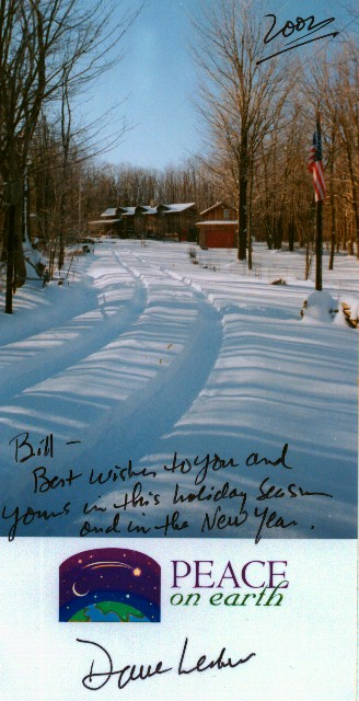
PEACE
on
Earth
2000
Member Dave
Lesher sends his holiday greetings from Canaan Heights, WV.
"The Spotter's Page"
Volume 5, Issue 1, Fall/Winter 2000 arrived in the mail a couple of weeks ago from NWS Wakefield. If you didn't receive one from AKQ, you can download it from their web subpage at http://www.nws.noaa.gov/er/akq/flwntr00.PDF . Topics of focus include waterspouts, new NOAA Weather Radio transmitters, the cooperative weather program, and WARNGEN. Diane Innes has put together a worthwhile update for us!
Reminders
Visit the NWS Charleston Education Center which member Eleanor Vallier-Talbot manages at http://wchs.csc.noaa.gov/education_center.htm
We are now into a new snowfall measurement season and some of us have had some impressive totals!! BE SURE TO REVIEW METHODS FOR MEASURING SNOWFALL FOUND IN A DOCUMENT PREPARED BY MEMBER LOWELL KOONTZ ! You can find this article on the Web at: http://www.pilot.infi.net/~bsmoot/koontz.htm .
Special note from Paul Bassett
"As time
permits I will be putting some notes in better shape that I have used to
search for weather related items on eBay. If you think our ACON members
would be interested, they could email me their request at pbassett@sitestar.net
. I'll be happy to pass them along."
|
|
|
Temperature |
Average Temperature |
Average Temperature |
Precipitation |
Precipitation |
|
|
|
|
|
|
|
New Market |
|
|
|
|
|
|
|
Roxboro |
|
|
Greenville-Spartanburg & Charleston |
|
|
Greenville-Spartanburg |
Greenville-Spartanburg |
|
NOTES FROM "AROUND THE LEAGUE"
Virginia:
Annandale - Lowell sends these notes: "NOVEMBER WAS VERY DRY AND A LITTLE ON THE COOL SIDE -- IT WAS THE FOURTH DRIEST NOV. IN THE LAST TWENTY-ONE YRS. LAST NOV. WAS WARM WITH 16 DAYS OF => 60° MAX. TEMPS. ; THIS YR NOV. HAD ONLY 7. THE 22° MIN. ON THE 24TH WAS THE LOWEST IN NOV SINCE 1996 THE MEAN TEMP. WAS -1.9° BELOW THE AVERAGE AND THE LOWEST SINCE 1997 AND NOV. NOV. 20TH WE HAD A SHORT PERIOD OF MIXED RAIN & SNOW- SNOW IN NOV. HAS ONLY OCCURRED 7 TIMES IN THE LAST 22 YRS THE FIRST REALLY KILLING FROST HERE OCCURRED ON NOV. 16TH. THE 20TH HAD AN EXTREMELY HEAVY FROST. THIS WAS IN PART FROM A MORNING FOG THAT ADDED TO THE FROST ONE NEAR LIGHTNING STRIKE AT ABOUT 1800 ON THE 29TH BUT STILL LITTLE RAIN WITH THE EVENT- THE DRY FALL CONTINUES. SKY WAS JUST A LITTLE CLEARER THAN AVE. FOR THE MONTH."
Arlington - NWS WBC's Dewey Walston notes DCA's mean temp was 2.8obelow normal while the rainfall departure was 1.52" below the norm. No records were set. November was a dry and cold month in the area. The average wind speed was 8.5 MPH.
Blacksburg/Roanoke/Lynchburg Area - "OVERALL...NOVEMBER WAS BOTH COOLER AND DRIER THAN NORMAL. THE MONTH BEGAN MUCH AS OCTOBER ENDED...WITH TEMPERATURES WELL ABOVE NORMAL AND LITTLE OR NO PRECIPITATION FOR MOST OF THE FIRST WEEK. A STRONG...SLOW MOVING FRONTAL SYSTEM ON THE 9TH BROUGHT SIGNIFICANT RAIN TO THE AREA. MANY LOCATIONS HAD OVER AN INCH OF RAIN THAT DAY. THEREAFTER... THE BASIC WEATHER PATTERN CHANGED AND MOST OF THE REST OF NOVEMBER WAS COOLER THAN NORMAL. A SUCCESSION OF COLD FRONTS FROM THE WEST BROUGHT LITTLE IN THE WAY OF PRECIPITATION...BUT CONTINUED TO REINFORCE THE COLD AIR OVER THE REGION. THE FIRST WINTERLIKE WEATHER OF THE SEASON OCCURRED ON THE 25TH IN THE FORM OF SLEET AND FREEZING RAIN."
In Blacksburg proper...DAILY HIGH TEMPERATURES WERE SPLIT NEARLY EVENLY...WITH HIGHS FOR MOST OF THE FIRST HALF OF THE MONTH ABOVE NORMAL...AND FOR THE SECOND HALF BELOW NORMAL. OVER AN INCH OF RAIN FELL ON THE 9TH...THEN VERY LITTLE PRECIPITATION OCCURRED AGAIN UNTIL THE 25TH. TEMPERATURES...HOWEVER...WERE WARM ENOUGH THAT THE SLEET AND FREEZING RAIN CAUSED LITTLE OR NO PROBLEMS. The monthly mean temp was 2.5° below normal while precip totals ran 1.16" below the norm.
Bridgewater - Clayton sends these notes: "Precipitation for the year now is 31.0 inches. This is 4.78 inches below normal. Several months ago, the precipitation for the year was just about normal. The very dry months of October and November have dropped the normal precipitation. During this period, we have had only 1.19 inches. The first snowflakes of the fall season occurred on the 20th in a heavy snow squall. The ground was a little bit white in places. The first moderate frost occurred on the morning of the 8th. The average temperature was 3 degrees above normal. The precipitation was 2.97 inches below normal. My records for precipitation are for 36 years."
Centreville - Paul offers these notes: "Our dry spell that began September 27th finally ended a month-and-a-half later on November 9th with 0.06 followed by 0.33 in 17 minutes a day later. It was good to see our precipitation return to a somewhat normal state of affairs, but we still experienced only 57% of our 2.99 expected for the month. Temperatures were true to form with the average highs just slightly above normal. With the daily average only 0.4o above normal, the average nightly low was 2.6o above normal."
Dulles - The monthly precipitation total, according to NWS WBC, was 1.73" below normal while the average temperature was deficient by 3.4o
Falls Church - Erica sends these notes: "November was both below normal in temperature and in rainfall. On the 29th, a thunderstorm came through the Falls Church area around 6 PM, lasting about 20 minutes. The storm produced quite a lightning display. But only 0.04" or rain fell with this storm so it didn't help the monthly total that much."
Fredericksburg - Ken reports, "Thanksgiving week turned cold with a low pressure system bring most of the month's rain at the end of the week."
Hampton - Dave reports: "A COLD AND CONTINUED DRY MONTH- THE FIRST SIGNIFICANT RAINFALL SINCE LATE SEPTEMBER. ALSO, A TRACE OF SNOW ON THE 19TH."
Herndon - Russ notes: "Another dry month. We were 1.5" below our normal rainfall. It was also a very cold November; 3.4 degrees below our average. A rare November thunderstorm rumbled through on the 29th."
Herndon - From Robert Beall: "First heavy frost on the 16th. Looks and feels like fall."
Lynchburg - From NWS BCB: PRECIPITATION WAS THE FURTHEST BELOW NORMAL. WHILE MANY LOCATIONS HAD OVER AN INCH OF RAIN ON THE 9TH...LYNCHBURG HAD A HALF INCH. THE MONTHLY AVERAGE TEMPERATURE WAS ALSO THE FURTHEST BELOW NORMAL. ALTHOUGH THE AVERAGE DAILY HIGH WAS HIGHER THAN IN ROANOKE...THE AVERAGE OVERNIGHT LOW WAS LOWER. . The mean temperature was 4.7o below normal while rainfall was 1.91" below normal.
New Market - Joyce reports: "With records back to 1982--- we were about 4 degrees cooler for mean high & low. About 1.5" below normal rainfall this month. We are about normal for rainfall for year."
Newport News - Gary reports:
"THE 4TH BROUGHT AN END TO 38 DAYS OF NO MEASUREABLE RAINFALL.
A RECORD
FOR THIS STATION.
ON THE 19TH A DUSTING OF SNOW FELL; WHILE UNUSUAL, NOT A RECORD.
OVERALL, A COOL MONTH WITH 4 RECORD LOWS AND 1 TIE."
Norfolk - From Pat Maloit at NWS AKQ: The monthly precip was 1.22" below norm while the average monthly temp was 3.2o below normal. Rainfall for the year through month's end was 7.02" above normal. The fall was cooler and drier than normal. The average wind speed for the month was 7.1 MPH.
Portsmouth - Not too many snowfalls here in the month of November (last in 1987) but this year brought a trace on the 19th as rain mixed with wet snow then changed to all-snow before ending in the evening. For the month, temps averaged a whopping 4.5o below normal while precip was only 61% of the norm (-1.27") November records include: 18th - Minimum maximum 48º (previously 51º in 1990); 19th - Minimum maximum 44º (previously 46º in 1980); 22nd - Minimum temperature 25º (previously 28º in 1981); 22nd - Minimum maximum temperature 40º (previously 42º in 1987); 23rd - Minimum maximum temperature 41º (previously 44º in 1981); 25th - Daily precipitation 0.88" (previously 0.63" in 1983) The average wind speed was 3.7 MPH from a dominant northerly direction. the mean temp for the year was 61.8º which was normal for the 11 month period. Rainfall for the year was running in excess by 2.19".
Richmond - According to NWS AKQ's Patrick Maloit: Richmond's rainfall was 1.45" below normal while temps averaged 3.5o below normal. Yearly rainfall was running 0.96" above the norm. The fall was cooler and drier than normal. The average wind speed was 6.9 MPH.
Mechanicsville - Glenn noted: "Rain mixed with snow briefly around 1910 hours on the 19th."
Roanoke - Wendell writes - "November was colder and drier than normal. The average temperature was 2.9o below normal. Rainfall measured 1.53" below normal. We had flurries on the 18th and 19th and a trace of sleet on the 25th."
Roanoke - NWS BCB notes: "SIGNIFICANT PRECIPITATION DURING THE MONTH ALSO OCCURRED ON THE 9TH IN THE WARM HALF OF THE MONTH...AND ON THE 25TH IN THE COLD LATTER HALF. THE WINTRY PRECIPITATION ON THE 25TH WAS TOO LITTLE TO CAUSE ANY PROBLEMS SINCE IT WAS MOSTLY RAIN. LOW TEMPERATURES BELOW FREEZING OCCURRED ON 14 DAYS IN ROANOKE...MOSTLY DURING THE LAST TWO WEEKS." The monthly mean temp was 3.5o below normal while precip was 1.12" below normal.
Vienna - Bob reports: "November was cooler and drier than average. However, the month seemed wet compared to my record dry October when only 0.04 of rain fell. Other precipitation was a trace of snow observed on the 20th. The first half of the month saw above average temps but the second half of the month, particularly around Thanksgiving, averaged below normal. The first freezing temp of the season (30F) occurred on the 6th. A record low November temp of 16F occurred on the 24th based on 15 years of records. Only one daily high reached 70F or greater (3rd). By contrast, freezing temps (lows) were noted on 14 days. Frost was observed on six days and dense fog conditions were noted only once."
Woodstock - Lauck reported: " November precipitation was very low (3rd in 15 years), lowest 2 month precipitation in 15 years. Temps were a little below average (5th in 15 years)."
North Carolina:
Asheville - From NWS GSP: The monthly mean temp was 2.9o below normal while rainfall was 0.7" above normal.
Brevard - Bob sends these notes: "The keyword for October 2000 is DRY! I recorded 0.08" for the month, and at the nearby Asheville Airport no rain was recorded for the entire month. My ten-year (1990-1999) average for October is 5.32" and my ten-year lows were 0.48" in 1991 and 0.82" in 1998. Having an annual average rainfall of 70", a cumulative deficit of 18.86" would seem of little concern, but being mountainous, our rainfall flows down hill quickly. Many wells are becoming dangerously low on water. Another remarkable feature of the month was the number of consecutive days without measurable wind, from the 13th through the 26th of October due to a persistent high covering the region. The month's average temperature, 56.0 deg. F, compares with 56.6 deg. F over the past ten years."
Charlotte - NWS GSP reports the mean temp here was 3.3o below normal while precip was 0.68" below normal.
Greensboro - NWS RAH reports that the mean temp here was 2.9o below normal while rainfall was 1.02" below normal. A new daily record high minimum temperature of 62 was set on the 9th. A daily record low max temp of 37 on the 21st tied the record set in 1939. A new record low of 17 was set on the 22nd. The old record of 18 was set in 1937. The 1.7" of snow that fell on the 19th ws the 5th earliest measurable snow ever at the Piedmont Triad International Airport.
Lumberton - The average wind speed was 4.5 MPH. - from NWS ILM
Raleigh - "Surprise snow of 2" on November 19th. Evaporative cooling changed rain to snow during afternoon of the 19th. Wake Co. Schools were delayed 2 hours the following day (Monday). Overall temperatures were well below normal while the monthly precipitation was 0.11" below normal." -Bob Woodson Raleigh, NC (RAL)
Raleigh - NWS RDU reports November 2000 brought a new daily high minimum temp of 64 on the 9th. The daily record low max temperatures were tied on the 20th and 21st when the mercury only reached 42 and 41 degrees. A new daily precip record was set on the 14th. The 2.2" of snow that fell on November 19th was the 4th earliest measurable snow ever in the Raleigh-Durham area.
Roxboro - Merriell noted: "November was mostly cloudy, cooler and drier than normal. There were times when it seemed like mid-winter with measurable snowfall included!"
Wilmington - From NWS ILM: "THE AVERAGE TEMPERATURE FOR THE MONTH OF NOVEMBER IN WILMINGTON WAS 4.5 DEGREES BELOW NORMAL. NO TEMPERATURE RECORDS WERE BROKEN IN NOVEMBER. THE TOTAL RAINFALL FOR NOVEMBER WAS 1.56 INCHES ABOVE NORMAL. 69 PERCENT OF POSSIBLE SUNSHINE WAS RECEIVED IN NOVEMBER (NORMAL IS 63 %). THE AVERAGE WIND SPEED FOR THE MONTH WAS 6.0 MPH. "
South Carolina:
Columbia - NWS CAE reports the monthly mean temp was 1.5o below the norm. Rainfall was 0.36" below the norm. The year-to-date rainfall was 10.90" below the normal.
Charleston - NWS CHS notes: "Monthly precipitation was 0.23" above normal and the mean temp was 3.1o below normal."
Florence - NWS ILM reports the mean temp was 2.5o below normal while rainfall was 0.23" above normal. The low temperature on the 22nd broke the old record of 24 degrees set on this date in 1951.
Greenville-Spartanburg - The monthly temps averaged 1o below normal while total rainfall was 0.4" above normal. 54% of possible sunshine was recorded. - NWS GSP
North Myrtle Beach - From NWS ILM: Rainfall was 0.64" above normal. Temps averaged 2.8o below normal. The average wind speed was 5.2 MPH. The high temp of 77 on the 8th tied the previous record high set or this date set in 1996. The low temperature of 22 on the 22nd broke the old record of 54 set on this date in 1954.
Nearby Cities:
Tri-cities/Bristol area noted temps averaging 2.9o below the norm with total rainfall 0.50" below the norm. For the year, rainfall is running 3.39" below normal. - from NWS Morristown, TN
Canaan Heights, WV - Dave reports: "During the first 13 days of the month, daily max temperatures were above 50 on 11 occasions. Then arctic air invaded the East, bringing on a cold spell that culminated in a period of 7 days and two hours from the 17th to the 24th when temperatures never rose above freezing."
(Please
note the column denotations table below.)
TEMPERATURES / WIND / ELEMENTS
VIRGINIA
        STN  A      B    C    D      E F    G    H I  J K L  M     N  O P Q R R1 S
        -----------------------------------------------------------------------------
        ANN 53.27 36.30 44.78 70     3 22   24   0 0 11 0 33 WNW  14  1 0 0 0  1 2400
                                                          33 W    30
        BCB             39.7  74     2 16   20                                   2400
        CEN 54.1  36.2  45.2  72     3 21   24   0 0 13 0 19 NW   30  1 0 0 0  0 1200/2400
        DCA 55.1  38.2  46.6  71     3 25 22,24  0 0  8 0 41 W    20             2400
        IAD 54.0  30.9  42.5  74     3 14   24   0 0 20 0 25 NW   11             2400
        BRI 54.1  32.0  43.1  74     3 15   22   0 0 14 0             0 0 0 0  0 0530/1630
        FCH 54.0  37.2  45.6  69   2,3 24 22,25  0 0 11 0             1 0 0 0  0 2400
        FRB 57.3  35.1  46.2  73     3 20   23   0 0 12 0             0 0 0 0  0 0800
        HAM 56.1  40.4  48.0  74     9 23    2   0 0  8 0 45      25             2100
        HER 52.3  34.1  43.2  69.4   3 18.3 24   0 0 13 0 28      11  1 0 0 0    2400
        HRN 52.2  34.0  42.6  72.4   3 16.3 24   0 0 12 0 31 NW   11  1 0 0 0  1 2400
        LKU 54.83 27.21 43.76 71     3 13 23,24  0 0 21 0 26 NW   21  0 0 0 0  0 2400
        LOU 51.57 33.57 42.57 67     3 16   23   0 0 12 0             1 0 0 0  0 0800
        LYH             43.0  74     3 17   22
        NEW 52.9  29.53 41.21 77     3 11   22   0 0 16 0 40 W    29  0 0 0 0  1 1700
        NPN 57.2  35.7  46.5  72 3,8,9 22 23,24  0 0 12 0 37 SE   26  0 0 0 0  1 2300
        NOR 57.0  38.7  47.8  73     9 26 22,23, 0 0  5 0             0 0 0 0  0 2400
                                            24
        ORF 57.1  41.4  49.3  74     9 26   22   0 0  5 0 43 S    25  0 0 0 0  0 2400
        POR 56.6  39.9  48.2  73     9 25   22   0 0  5 0 27 WSW  26  0 0 0 1  0 2400
                                                          27 N    30
        MEC 59    36    46    71     3 19   22   0 0  9 0             0 0 0 0  0 1800
        RMD 58.8  38.2  48.5  73   3,8 22   22   0 0  6 0             0 0        2300
        RIC 57.0  35.1  46.1  75     3 17   22   0 0 11 0 32 NW   29  0 0 0 0  2 2400
        ROA             44.2  74   2,3 21   22
        ROK 55.1  33.9  44.5  75     3 20   20   0 0 15 0 30 SW    9  0 0 0 1  0 2200
                                                          30 NW   30
        AKQ 58.7  31.77 45.23 76     3 19 22,23  0 0 16 0                        2400
        WEE 50.2  33.7  42.0  74     3 18 25,26  0 0 11 0 35+NW   11  0 0 0 0  2 0800/2000
        WOO 54.5  36.6  45.6  74     4 16   22   0 0 12 0             1 0 0 0  2 0800
        WSH 52.0  35.1  43.6  71     3 17.3 22   0 0 12 0 22 E    10  1 0 0 0  0 2400
        VNA 53.6  33.6  43.6  71     3 16   24   0 0 14 0             0 0 0 0  1 2200
        STN  A      B    C    D      E F    G    H I  J K L  M     N  O P Q R R1 S
        -----------------------------------------------------------------------------
        AVL 55.1  34.0  44.6  77     2 19   22   0 0 16 0                        2400
        BRE 64.3  33.4  48.9  74   7,9 21  4,17  0 0 10+0 33      16  0 0 0 0  5 2100
        CLT 59.9  37.6  48.8  80     3 18   22   0 0  7 0                        2400
        GSO 57.0  36.2  46.6  77     3 17   22
        LBT 62.9  38.3  50.6  81   8,9 19   22   0 0  7 0 32 WNW  21  0 0 0 0  3 2400
        RAL 59.9  34.2  47.1  77     9 19   22   0 0 14 0 26      10  0 0 0 1  1 2400
        RDU 59.7  36.3  48.0  79   8,9 24 22,23
        ROX 57.1  35.9  46.5  77     3 19   22   0 0  9 0 28 NW   10  0 0 0 0  0 2100
        ILM 63.9  41.0  52.5  81     9 25   22            30 SW   10  1 0 0 0  2 2400
        STN  A      B    C    D      E F    G    H I  J K L  M     N  O P Q R R1 S
        -----------------------------------------------------------------------------
        CAE 64.5  40.1  52.3  82     3 21   22                                   2400
        CHS 66.9  43.7  55.3  83     8 24   22   0 0  2 0 24 E    25  1        2 2400
        CRE 62.9  40.5  51.7  77   8,9 22   22   0 0  5 0 28 E    25  1 0 0 0  2 2400
        FLO 65.2  40.8  53.0  82   8,9 20   22   0 0  4 0 29 SSW   9  1 0 0 0  4 2400
        GSP 60.7  40.4  50.6  83     3 20   22   0 0  3 0                        2400
        OGB 65.0  41.4  53.2  82     8 22   22                                   2400
        STN  A      B    C    D      E F    G    H I  J K L  M     N  O P Q R R1 S
        -----------------------------------------------------------------------------
        TRI 55.0  33.2  44.1  77   2,8 12   22   0 1 18 0                        2400
        CHW 42.1  28.6  35.4  63.0   3 5.7  23   0 7 19 0                        2400
VIRGINIA
    STN  T     U       V      V1   W X   Y      Z  1  2 3    4    5      6       7        S
    -----------------------------------------------------------------------------------------
    ANN  1.69  0.49 25 0.97 25-26  8 0 43.62    T 20  1 0    T    T  30.46  24 29.49  10 2400
    BCB  1.32                                   T            T    T
    CEN  1.70  0.78 25 0.98 25-26  7 0 37.11    T 20  1 0    T    T  30.34  30 29.51  10 2400
    DCA  1.60  0.49 25 0.72 25-26  7 0        0.0          0.0  0.0                      2400
    IAD  1.57  0.52 25 0.73 25-26  8 1        0.0          0.0  0.0                      2400
    BRI  1.17  0.73  9 0.73     9  4 0 31.00    T     1      T    T  30.21     29.25     0530/1630
    FCH  1.47  0.52 25 0.75 25-26  6 0 31.57    T 20  1 0    T    T                      2400
    FRB  1.45          0.92 25-26  4 1 40.95  0.0          0.0  0.0                      0800
    HAM  1.85  1.40 25 1.46    25  7 1 51.09    T 19  1 0    T    T                      2100
    HER  1.85  0.55 10 0.79 25-26  9 0 36.74  0.0          0.0  0.0  30.46  24 29.40  10 2400
    HRN  1.73  0.61 25 0.77 25-26  9 0 35.66  0.0          0.0  0.0  30.430 24 29.521 10 2400
    LKU  1.48  0.73 25 0.73 25     9 0 35.69  0.0          0.0  0.0  30.91     29.47     2400
    LOU  1.50  0.90 26             3 0 33.05  0.0          0.0  0.0  30.60  25 29.88   9 0800
    LYH  2.30
    NEW  1.02  0.38 26 0.38    26  5 0 35.02    T 20  1 0    T    T                      1700
    NPN  1.99  0.94 25 1.25 25-26  7 0 48.24    T 19  1 0    T    T  30.42  24 29.53  10 2300
    NOR  1.63  0.67 25 0.73 25-26  7 0 48.43    T 19  1 0    T    T                      2400
    ORF  1.41  0.67  2 0.67     2  5 0          T 30  1 0    T    T  30.22  16 29.67  30 2400
    POR  1.98  0.88 25 0.93 25-26  8 0 47.30    T 19         T    T  30.452 24 29.540 10 2400
    MEC  2.20  1.06 26 1.42 25-26  7 1 45.92    T 19  1 0    T    T  29.92  24 29.28  10 1800
    RMD  1.71  1.13 25             4 1        0.0          0.0  0.0                      2300
    RIC  1.72  1.07 25 1.17 25-26  6 1 40.86    T 19  1 0    T    T                      2400
    ROA  2.10                                                                            2400
    ROK  2.64  1.27  9 1.29 25-26  7 2 41.46  0.0          0.0  0.0  30.37  24 29.54   9 2400
    AKQ  2.14  1.15 25             9 1 45.28  1.0 19  1 1  1.0  1.0                      2400
    WEE  2.06          1.25 25-26  5 1                       T    T  30.39  24 29.66  10 1630
    WOO  1.35          0.80  9-10  7 0 34.92  0.3 20  1 0  0.3  0.3  30.65     29.98     0800
    WSH  1.89  0.85 25 1.20 24-25  6 0 35.66  0.0          0.0  0.0  30.44  24 29.53  10 2400
    VNA  1.77  0.54 25 0.54    25  8 0 35.67    T 20  1 0    T    T                      2200
    STN  T     U       V      V1   W X   Y     Z   1  2 3  4     5       6       7        S
    -----------------------------------------------------------------------------------------
    AVL  4.25          2.29   8-9  9 0 36.17  2.5 19  1 1  2.0  2.0  30.36  22 29.55   9 2400
    BRE  4.73                        1 62.68  0.0          0.0  0.0  30.62  30 28.89   2 2100
    CLT  2.75  0.68  9 0.68     9  9 0 36.17  2.5 19  1 1  2.5  2.5  30.39  22 29.61   9 2400
    GSO  1.95          0.58 25-26             1.7 19  1 1  1.7  1.7                      2400
    LBT  3.23  1.18 25 1.18 24-25  8 1        0.0          0.0  0.0  30.43  22 29.67  19 2400
    RAL  2.87          1.02 24-25 11 1        2.0 19  1 1  2.0  2.0  30.40  24 29.64  10 1900
    RDU  2.56  1.12 25                 37.59  2.2 19  1 1  2.2  2.2
    ROX  1.81  0.77 25 0.77    25  8 0 42.24  2.5 19  0 1  2.5  2.5  30.42  24 29.59  10 2100
    ILM  4.67          2.60 25-26 11 1 52.21  0.0          0.0  0.0  30.41  22 29.68  10 2400
    STN  T     U       V      V1   W X   Y     Z   1  2 3  4     5       6       7        S
    -----------------------------------------------------------------------------------------
    CAE  3.26                          35.42  0.0          0.0  0.0                      2400
    CHS  2.72  1.44 19 1.49 18-19  9 1 43.29  0.0          0.0  0.0                      2400
    CRE  3.54  1.56 25 1.56    25  7 2 51.45  0.0          0.0  0.0  30.43  22 29.70  10 2400
    FLO  2.75  0.94 19 0.96 18-19  6 0 35.16  0.0          0.0  0.0  30.42  22 29.67  10 2400
    GSP  4.06          1.47   8-9 12 1 33.09  2.5 19  1 1  2.5  2.5  30.38  22 29.59   9 2400
    OGB  3.37                          38.32                                             2400
    STN  T     U       V      V1   W X   Y     Z   1  2 3  4     5       6       7        S
    -----------------------------------------------------------------------------------------
    TRI  2.44  1.51  9 1.51  9-10 11 1 33.99                         30.43 22 29.46    9 2400
| A maximum mean temperature | T total precipitation (inches) |
| B minimum mean temperature | U maximum calendar day precipitation (inches) |
| C monthly mean temperature | U1 date of maximum calendar day precipitation |
| D maximum temperature | V date(s) of maximum daily precipitation |
| E date(s) of maximum temperature | V1 maximum 24-hour precip. & date(s) |
| F minimum temperature | W number of days with precip. >= .01" |
| G date(s) of minimum temperature | X number of days with precip. >= 1.0" |
| H days with maximum temperature >=90 | Y year-to-date precipitation (inches) |
| I days with maximum temperature <=32 | Z maximum calendar day snowfall (inches) |
| J days with minimum temperature <=32 | 1 date of maximum calendar day snowfall (inches) |
| K days with minimum temperature <= 0 | 2 number of days with snowfall |
| L peak wind gust (miles per hour) | 3 number of days with snowfall >= 1.0" |
| M direction of peak wind gust | 4 total snowfall for month (inches) |
| N date(s) of peak wind gust | 5 total snowfall for 2000-2001 season (inches) |
| O number of days with thunder | 6 maximum barometric pressure (inches) |
| P number of days with hail | 6A date of maximum barometric pressure |
| Q number of days with glaze | 7 minimum barometric pressure (inches) |
| R number of days with ice pellets | 7A date of minimum barometric pressure |
| R1 number of days with dense fog | (i) incomplete data |
| S local observation time for temps/precipitation | (M) Missing, if listed in data table |
| ~ "about" | E estimated |
| + additional indeterminate number of days | NR not recorded |
STATION
/ LOCATION (MILES & DIRECTION FROM MAIN POST OFFICE) /
OBSERVER
/ YEAR RECORDS BEGAN / EMAIL ADDRESS:
| ANN Annandale, VA 1 3/4 ENE - Lowell Koontz 12/90 wwkoontz@bellatlantic.net | ROA Roanoke, VA Webmaster (Blacksburg): William.Perry@noaa.gov |
| DCA Arlington, VA NWS Webmaster (Sterling): james.decarufel@noaa.gov | ROK Roanoke, VA 6SW Wendell Prillaman 4/76 |
| BCB Blacksburg, VA NWS Webmaster: William.Perry@noaa.gov | VNA Vienna, VA Robert Boott, 1.5SW Robert.Boott@tma.osd.mil |
| BRI Bridgewater, VA Clayton Towers Ctowers@rica.net | AKQ Wakefield, VA NWS Webmaster: Neil.Stuart@noaa.gov |
| CEN Centreville, VA Paul Bassett 1985 pbassett@sitestar.net | WSH Washington, VA David Yowell runamok@runamok.com |
| CHO Charlottesville, VA 3N John Stewart (Rappahannock County) - 1/91 - Inactive | WEE Weems, VA 3WNW Francis J. Socey |
| IAD Dulles International Airport Webmaster (Sterling): james.decarufel@noaa.gov | WOO Woodstock, VA 5NW Lauck Walton - 12/1/85 jwalton@shentel.net |
| FCH Falls Church, VA Erica Page - 3/7/94 ERICA96661@aol.com | AVL Asheville, NC NWS NWS GSP: bryan.mcavoy@noaa.gov |
| FRB Fredericksburg, VA 7SW Ken McKneely mckneelys@email.msn.com | BRE Brevard, NC 1SE Bob Keehn 1/1/90 Bob_Keehn@citcom.net |
| HAM Hampton, VA 5NE Dave Kessel 1989 david64@visi.net | CLT Charlotte, NC NWS NWS GSP: bryan.mcavoy@noaa.gov |
| HER Herndon, VA R.M. Beall P- 10/76 T- 1/91 beall47@earthlink.net | GSO Greensboro, NC NWS Webmaster (Raleigh/RAH): Richard.Jones@noaa.gov |
| HRN Herndon, VA 4SW Russ Topping - 1985 rtopping@erols.com | RAL Raleigh, NC 7NNW Bob Woodson - 6/1/93 kf4mmm@qsl.net |
| LKU Louisa, VA 1N Joseph Bowers 1944 - NWS ID 44-5050-02 jmbiii@earthlink.net | RDU Raleigh-Durham, NC NWS Webmaster: Richard.Jones@noaa.gov |
| LOU Louisa, VA 6S John Bullock (about 1970) | LBT Lumberton, NC FAA Lumberton 34o 37'N 79o 04'W |
| LYH Lynchburg, VA NWS Webmaster (Blacksburg): William.Perry@noaa.gov | ROX Roxboro, NC 2SE Merriell A. Jay 1/93 |
| NEW Newmarket, VA 2W Joyce Winfree joywood@shentel.net | ILM Wilmington, NC NWS nwsilm@wilmington.net |
| NPN Newport News, VA 7N Gary Leonard - 6/91 GaryMLeonard@aol.com | CHS Charleston,
SC NWS, courtesy of Eleanor Vallier-Talbot
Eleanor.Vallier-Talbot@noaa.gov evaltal@wpmedia.com Webmaster Contents CHS: Theodore.Rodgers@noaa.gov |
| NOR Norfolk, VA 3NE Jim Fentress 6/1/77 | CAE Columbia, SC NWS caewx@noaa.gov |
| OGB Orangeburg, SC NWS caewx@noaa.gov | |
| ORF Norfolk, VA 5NE NWS 1871 Webmaster (Wakefield): Hugh.Cobb@noaa.gov | GSP Greenville-Spartanburg, SC NWS bryan.mcavoy@noaa.gov |
| POR Portsmouth, VA 3S Bill Trotter - 7/1/76 pwrs@pilot.infi.net | RUB Ruby, SC 3 NW Franklin Hancock |
| MEC Mechanicsville, VA Glen Martin 11/19/91 | FLO Florence, SC nwsilm@wilmington.net |
| RMD Richmond, VA Roy Britt 8/22/83 roybritt@earthlink.net | CRE North Myrtle Beach, SC nwsilm@wilmington.net |
| RIC Richmond, VA NWS | TRI Tri-cities/Bristol, TN NWS Webmaster (Morristown):W-Mrx.Webmaster@noaa.gov |
| CHW Canaan Heights, WV Dave Lesher wxdave@boo.net |