Holiday Greetings from Snowy, Davis, WV - Pic from Member Dave Lesher

ACON - VA/NC/SC
The Atlantic Coast Observer Network: 
Virginia, North Carolina, South Carolina
http://members.cox.net/wxr/acon.htm

SUMMARY OF CLIMATOLOGICAL DATA 
NOVEMBER 2002

...A Colder, Wetter Than Normal November...


Hello folks! The holidays are upon us and I hope each of you has taken the time to enjoy them, for one reason or another. Looking back at your reports and those of the NWS, we can qualify the month- with few exceptions - as a colder and wetter than normal November. But one can hardly find reason to complain as many worries over water shortages were diminished. The only site reporting warmer than normal temperatures was Bridgewater. Looking at readings relative to normal in North Carolina, the state seems to have been the coldest in our region. Rainfall was above normal in most areas. Columbia, SC and Wilmington, NC were just below their normal rainfall averages. Here is Portsmouth, we had our 2nd wettest November in the database going back to July 1976. Great Joy comes from Joyce (New Market, VA) who says, at last, her pond is again full. Snowfall made few appearances through the region; but just over the NW Virginia border in Davis, WV... well, look at the pic to the left and see if Dave Lesher, at the summit of Canaan Mountain, is complaining about the lack of snow (over 22" for the new season at the time of the picture)! A look back at the weather maps shows a series of lows moving out of the SW across Dixie with high pressure moving repeatedly out of south central Canada, with both reinforcing a seemingly constant trough over the eastern half of the US. Thus, the chilly, damp weather. Despite the excess rain, more sunshine than not was noted throughout the region as the sun continued to sink lower in the autumn sky.

Hope your holiday season has been a blessed one. Happy New Year !!


  • Is A Heavy Dew Added to Rainfall Totals? Member Lauck Walton (Woodstock, VA) asked this question. While I've heard a little about this subject over the years, here's a response I received from Bill Sammler, Warning Coordination Meteorologist at NWS AKQ, about Lauck's question: "I believe the procedure is, if there is no observation of falling precipitation, then whatever might show up in the gage (it happens with ASOS from time to time) is thrown out. Dew type condensation is not considered precipitation, and therefore, should not be included in the observations. Trace precipitation is anything less than .01".
  • Member Clayton Towers' December 1989 Retrospective Longtime Member Clayton Towers sent this report recently and I think it's worth reflecting upon. We remember those special events from the past as evidenced as we gather around holiday fires to reminisce. Read now Clayton's taking us back to December 1989 for a truly special winter weather event in Bridgewater, Virginia. "Some say this December (1989) was the coldest December in the past century. Below are some facts about this unusual December:
    1. It was the coldest in at least the last 43 years. The average temperature was 4° colder than December, 1963.
    2. The average temperature of 22.6° was 13.4° below average. The average low temperature was an unbelievable 11.3°!
    3. The -14° was a record low for the month of December. The -12 reading was the second lowest.
    4. There were 9 below zero readings, which was a record. The previous record was 2.
    5. There were 5 consecutive mornings with below zero readings. This was a record, not only for December, but also for any month.
    6. There were 11 consecutive days when the temperature didn't rise above 32°.
    7. There were 11 mornings that had record-breaking low temperatures for the date. Nine days had mean temperatures which were record-breakers for the date. There were five days in which the minimum high temperatures broke records.
    8. The 15.5" of snow was the most snow for December since 1966.
    9. There was snow on the ground from the 8th to the end of the month.
    10. This December produced a white Christmas. This was the first white Christmas since 1969. Other Christmases might had a skiff of snow which I didn't consider as being a true white Christmas.
    11. The cold, snowy weather caused all kinds of problems. The local school system cancelled school for a number of days. The road people used up most of their money for snow-removal. Many country roads were very slippery for a long period of time from icy conditions from packed snow. Frigid temperatures prevented melting. At Christmas, many parties, banquets, and school programs had to be cancelled.
    12. This was certainly a December to be remembered. This was the coldest December in my 43 years of record-keeping on temperatures. I don't ever remember a December like this one."
  • NEW MEMBER: The Fred Heutte Center, Ghent Square, Norfolk, VA The Friends of Fred Heutte Foundation has just received a grant from The Norfolk Foundation to purchase and install a new EZ-mount Davis Cabled Vantage Pro Weather Station to be installed the weekend of December 28th-29th, 2002 with data beginning online by New Year's Day 2003. Check out their website at http://www.fredheutte.org and click on the weather icons and links for their developing weather subpage. The horticulture based foundation and center is located right in the middle of Ghent. This site is on the opposite side of Norfolk from ORF and from our member, Jim Fentress (NOR). The Center is just north of the downtown area and about 3/4 mile from the Elizabeth River at Downtown Norfolk. For a map of its location, click here!
  • Interesting Reading: Brazil Lightning Bolts Set Shocking World Record   ACON DC/MD/DE member Kevin Shaw shares and article about lightning in the world's most dense tropical country. Read the text version here !
  • AND ONE LAST TIME! Instrumentation Calibration It's that time of year to check those weather instruments for accuracy. With today's surge of electronic instruments come greater chances for wiring and transmission/broadcast problems. Check for power problems and replace batteries. 'Tis the season to get those spliced wires cleaned, resoldered, and retaped. Wind cups need to be cleaned of dirt and cobwebs (indeed, spiders love to lay webs on my anemometer cups every fall and they're located 30' above ground!) Also, be sure to clean out your standard and electronic rain gauges from dirt, debris, algae, and mold. And recalibrate those barometers! A couple of you have some "out-of-this world" monthly readings!! And be sure to ask a loved one to splurge this holiday season on a weather instrument, especially if you need an upgraded model! (Have you seen the fantastic weather instruments at Ebay Online Auctions?)
  • Susan Funk's, NWS AKQ November 2002 Hydrological Report  http://www.erh.noaa.gov/er/akq/HYM/NovPre2002.txt
  • Drought Monitor Update:  http://www.drought.unl.edu/dm/

  • Drought Seasonal Outlook from Climate Prediction Center:  http://www.cpc.ncep.noaa.gov/products/expert_assessment/seasonal_drought.html
  • Wind Chill Chart (updated including new formula) Check this out at the NWS Wakefield website, http://205.156.54.206/er/akq/windchill_sheet.pdf.
  • Reminder National Weather Service station data listed herein is preliminary and may be subject to change.  The data has not been certified and cannot be used in legal actions.  Only reports certified by the National Climatic Data Center in Asheville, NC may be used for these purposes.

ACON VA/NC/SC Member Station Extremes - November 2002
State
Maximum Temperature
Minimum
Temperature
Warmest
Average
Temperature
Coldest
Average
Temperature
Maximum
Precipitation
Minimum
Precipitation
Virginia
80°
Norfolk (ORF)
15°
Louisa
51.1°
Norfolk
41.9°
Blacksburg
5.99"
Portsmouth
2.98"
Ashburn
North Carolina
82°
Wilmington
20°
Charlotte, Roxboro
56.0°
Cape Hatteras
44.8°
Asheville
8.18"
Cape Hatteras
3.06"
Wilmington
South Carolina
83°
Charleston
23°
Florence
56.1°
Charleston
49.5°
Greenville-Spartanburg
5.66"
Charleston
2.77"
Columbia , Florence

VIRGINIA
[Reminder: All NWS DATA HEREIN IS NOT OFFICIAL]
STN  A      B    C      C1    D      E F     G    H I  J K L  M     N  O P Q R R1 S
------------------------------------------------------------------------------
AHB 64.2  31.2  44.1        70.8  10 21.9 28   0  0 13 0 25 WNW   7  1 0 0 0  1 2400
ANN 52.73 37.70 45.22 -1.54 84   3,5 37 30,31  0  0  0 0 23 WSW  13  0 0 0 0  0 2400
BCB             41.9  -0.90 67    11 19   28                                    2400
BRI 54.6  37.4  46.0  +1.6  70 10,11 19   28   0  0  9 0             0 0 0 0  0 0515/1600
CEN 52.5  35.2  43.9        70    10 23   28   0  0 12 0 47 318° 23  0 0 0 0  2 1200/2400
CHO 54.5  35.4  45.0  -4.0  69    11 21   28   0  0 11 0 38 300° 30  3 0 0 0  3 2400
DAN 58.2  36.1  47.2        72    10 20   28   0  0 12 0                        2400
DCA 54.7  39.5  47.1  -1.60 73    10 27 28,29  0  0  3 0 40 300° 30  1 0 0 0  4 2400
IAD 53.5  34.7  44.1  -1.10 72    10 21   28   0  0 13 0 43 280° 30  1 0 0 1  2 2400
FCH 53.6  37.0  45.3        73    10 25 28,29  0  0  6 0 35       6  1 0 0 0  0 2400
HAM 58.0  40.6  49.3        79    10 26    2   0  0  2 0 38 360° 30             2400
HRG 52.7  33.7  43.2  -0.80 69.4  10 18.6 28   0  0 14 0 18 N     6  1 0 0 0  2 2400
HER 52.3  36.7  44.5        70.5  10 23.4 28   0  0  8 0 26      23  1 0 0 0 NR 2400
HRN 52.5  35.7  44.1  -1.10 69.6  10 20.6 29   0  0 10 0 36 NNW  22  1 0 0 0  3 2400 
LKU 55.7  33.6  44.7        71    10 15   28   0  0 18 0 31 ssw  30  0 0 0 0  0 2400
LYH 55.4  34.5  45.0        69  9,10 21   28   0  0 17 0                        2400
                                  11
LXI 52.4  32.4  42.1  -5.6  69.6  10 18.1 28   0  0 16 0 37 NNW  30  1 0 0 0  4 2400
NEW 53.40 33.23 43.62       72    10 17   28   0  0 13 0 45 NW   30  0 0 0 0  4 1700
NPN 58.3  37.8  48.0        78    10 21   29   0  0 10 0             0 0 0 0  1 2300 
NOR 59.3  41.1  50.2        79    11 26   29   0  0  2 0             0 0 0 0  0 2400
ORF 59.7  42.5  51.1  -1.20 80    11 26   29   0  0  2 0 35 240° 29  2 0 0 0  0 2400
POR 59.3  42.7  51.0  -1.70 78    11 27   29   0  0  2 0 32 295° 30  0 0 0 0  0 2400
MEC 57    36    48          72    10 21   29   0  0  5 0 26 NW   29  0 0 0 0  0 1800
RIC 57.5  37.9  47.7  -1.30 74 10,11 21   29   0  0  6 0 33 290° 30  1 0 0 0  4 2400  
ROA 54.7  37.8  46.3  -1.10 72    10 24   28   0  0  6 0                        2400
ROK 55.8  36.2  46.0  -1.40 73    10 23   28   0  0 12 0 29 W    28  0 0 0 0  0 2400
AKQ 59.6  36.6  48.1        79    10 20   29   0  0 12 0                        2400
WEE 56.3  32.9  44.7        74    11 20   29   0  0  7 0 45      11  3 0 0 0  2 0800/2000
WOO 52.0  38.0  45.0        69    11 234  29   0  0  5 0             1 0 0 2  5 0800
WSH 51.7  36.3  44.0        67.7  11 23.7 28   0  0  8 0 22 NE   30  1 0 0 2  1 2400
NORTH CAROLINA
[Reminder: All NWS DATA HEREIN IS NOT OFFICIAL]
STN  A      B    C      C1    D      E F    G     H I  J K L  M     N  O P Q R R1 S
------------------------------------------------------------------------------ 
AVL 54.7  34.9  44.8  -1.60 68    11 21   29   0  0 16 0 40 340° 22  2 0 0 0  3 2400
                                                         40 310  30            
CLT 59.5  37.3  48.4  -3.90 77    10 20   29   0  0  9 0 37 310   6  1 0 0 0  3 2400
ECG 61.0  41.3  51.1  -3.00 81    11 25   28   0  0  2 0 44 270° 11  2 0 0 0  1 2400
FAY 61.8  40.2  51.0        79    10 23   29   0  0  5 0 36 310° 12  2 0 0 0  2 2400
GSO 57.9  38.5  48.2  -1.00 74    10 23   29   0  0  0 0 44 270° 30  1 0 0 0  2 2400
HSE             56.0  -1.30    
LBT 63.4  39.1  51.3  -1.50 79 10,11 22   29   0  0  5 0 37 250° 30  2 0 0 0  3 2400
RAL 60.4  36.8  48.6        76    10 21 28,29  0  0 10 0 32      30  0 0 0 0  0 1900
RDU 60.1  38.1  49.1  -1.90 78    10 22   29   0  0  8 0 37 330°  6  1 0 0 0  1 2400
ROX 58.1  38.5  48.3        74    10 20   28   0  0  7 0 30 W  6,30  1 0 0 0  1 2100
ILM 64.1  42.4  53.2  -3.30 82    11 26   29   0  0  2 0 44 240° 11  3 0 0 0  1 2400
SOUTH CAROLINA
[Reminder: All NWS DATA HEREIN IS NOT OFFICIAL]
STN  A      B    C      C1    D      E F    G     H I  J K L  M     N  O P Q R R1 S
------------------------------------------------------------------------------ 
CAE 63.6  41.2  52.4        77    10 24    29  0  0  8 0 37 270° 30  2 0 0 0  2 2400
CHS 66.9  45.2  56.1  -1.90 83    11 30    29  0  0  1 0 38 290°  6  3 0 0 0  1 2400
CRE 63.3  43.5  53.4  -1.20 74 10,11 27    29  0  0  2 0 41 240°  6  1 0 0 0  1 2400
FLO 63.4  40.7  52.1  -3.30 78    11 23    29  0  0  4 0 35 230° 11  2 0 0 0  3 2400
GSP 59.3  39.6  49.5  -1.60 72    11 24    29  0  0  6 0 37 210° 11  1 0 0 0  3 2400
OGB 64.5  42.0  53.2        76    10 26    29  0  0  5 0 37 280°  6  2 0 0 0  0 2400
NEARBY STATIONS
[Reminder: All NWS DATA HEREIN IS NOT OFFICIAL]
STN  A      B    C      C1    D      E F    G    H  I  J K L  M     N  O P Q R R1 S
------------------------------------------------------------------------------
TRI 52.8  34.3  43.6  -1.90 77    10  19  29   0  0 16 0                        2400 
DAV 40.1  27.8  34.0        61    10  13  28   0  5 22 0             1 0 2 5  9 1900

(Please note the column denotations table below.)
PRECIPITATION / BAROMETRIC PRESSURE

VIRGINIA
[Reminder: All NWS DATA HEREIN IS NOT OFFICIAL]
STN  T      T1     U       V      V1   W X   Y      Z  1  2 3    4    5      6       7        S 
----------------------------------------------------------------------------------------- 
AHB  2.98        0.80 16 0.91 16-17 13 0 29.98    T       1    T  0.0  30.36  26 29.41  30 2400
ANN  4.98  +1.39 1.62 16 1.73 16-17 11 1 33.17  0.0          0.0  0.0  30.41  18 29.38  30 2400
                                                                              19                      
BCB  5.11  +2.15 1.09 16                 29.56  0.0          0.0  0.0                      2400
BRI  3.94  +1.00 1.03 12 1.58 11-12 10 1 35.49  0.0          0.0  0.0  30.24     29.56     0515/1600
CEN  4.76        1.43 16 1.98 16-17 11 2 36.03    T 28,30      T    T  30.34   9 29.32  30 2400
CHO  4.89  +1.12 1.22 16 1.24 16-17 10 2 34.05  0.0          0.0  0.0            29.38  30 2400 
DAN  3.93        1.34 17             3 1        0.0          0.0       30.36  18 29.50  30 2400
DCA  4.34  +1.31         1.73 16-17 10 1 29.88  0.0          0.0  0.0                      2400
IAD  4.14  +0.83 1.44 16 1.44    16 13 1 34.57  0.0          0.0  0.0            29.38  30 2400 
FCH  4.28        1.67 16 2.23 16-17  9 1 28.07  0.0          0.0  0.0                      2400  
HAM  5.50        1.90 16 2.80 16-17 11 2 45.55  0.0          0.0  0.0                      2400
HRG  3.57  +0.59 0.97 12 0.97    12 10 0 32.90  0.0          0.0  0.0  30.31  18 29.44  30 2400
HER  4.48  +1.17 1.52 16 1.52    16 13 1 38.85  0.0          0.0  0.0  30.31  19 29.24  30 2400
HRN  4.54  +1.23 1.36 16 1.52 16-17 11 1 38.43  0.0          0.0  0.0  30.344 18 29.405 30 2400
LKU  4.68        1.36 12 1.36    12 12 1 39.20  0.0          0.0  0.0  30.33     29.39     2400
LYH  5.40        1.56 11            11 3 32.99  0.0          0.0  0.0  30.36  18 29.48  30 2400
LXI  4.70  +1.76 1.14 16 1.52 11-12 12 1 38.36  0.0          0.0  0.0  30.32  18 29.47  30 2400
NEW  3.98        1.05 12            13 0 36.12    T            T    T                      1700
NPN  5.81        1.70 16 1.94 16-17  9 1 44.79  0.0          0.0  0.0  30.31  19 29.42  30 2300
NOR  5.55        1.26 16            11 1 52.08  0.0          0.0  0.0                      2400
ORF  4.92  +1.94 1.02 16 1.29   5-6 11 1 46.71  0.0          0.0  0.0  30.37  19 29.45  30 2400 
POR  5.99  +2.74 1.56 16 1.74 16-17 11 1 46.97  0.0          0.0  0.0  30.376 18 29.453 30 2400
                                                                              19
MEC  4.91        1.26 12 1.60 11-12  9 2 37.17  0.0          0.0  0.0  30.12  18 29.35  30 1800
RIC  4.02  +1.22 0.97 12 1.14 15-16  8 0 34.32  0.0          0.0  0.0  30.37  19 29.45  30 2400 
ROA  4.26  +1.03 1.16 16            14 2 30.43  0.0          0.0  0.0  30.35  18 29.48  30 2400
ROK  4.37  +0.20 1.17 12 1.17    12 11 2 36.59  0.0          0.0  0.0  30.30 18, 29.55  30 2400
                                                                              19               
AKQ  4.91        1.20 12             9 1 44.79  0.0          0.0  0.0                      2400
WEE  5.54        1.70 18 1.70    18 10 1 45.09  0.0          0.0  0.0  30.35  7, 29.46   6 1630
                                                                              18                   
WOO  4.32                0.96 10-11 13 0 38.77  0.7 27  1 0  0.7  0.7  30.95  26 30.20  30 0800
WSH  3.52        0.88 16 0.88    16 12 0 40.53    T 23, 2 0    T    T  30.31  18 29.40  30 2400
                                                    26
NORTH CAROLINA
[Reminder: All NWS DATA HEREIN IS NOT OFFICIAL]
STN  T     U       V      V1   W X   Y     Z   1  2 3  4     5       6       7        S 
----------------------------------------------------------------------------------------- 
AVL  4.23  +0.41 1.01 16 1.74 15-16 10 1 43.46    T 22         T    T  30.36  18 29.60   6 2400
CLT  4.38  +1.02 1.54 12 1.58 11-12  8 2 35.42  0.0          0.0  0.0  30.38  18 29.58   6 2400 
ECG  5.77  +2.84         2.52 12-13 12 1 54.24  0.0          0.0  0.0  30.38  18 29.46   6 2400
FAY  3.46                1.66 12-13  8 1        0.0          0.0  0.0                      2400
GSO  4.36  +1.40         1.57 16-17  9 2 37.70  0.0          0.0  0.0                      2400
HSE  8.18  +4.23                                                                           2400
LBT  3.79  +1.10 1.63 12 1.92 12-13  9 1 37.20  0.0          0.0  0.0  30.39  19 29.54   6 2400
RAL  3.61                0.92 11-12 10 0 42.06  0.0          0.0  0.0  30.36  19 29.59  30 1900
RDU  3.56  +0.59         1.04   5-6  8 1 42.31  0.0          0.0  0.0                      2400
                         1.04 11-12
ROX  4.51        1.43 12 1.43    12  9 1 47.04  0.0          0.0  0.0  30.55  19 29.63  30 2100
ILM  3.06  -0.20 0.79  6 0.85   5-6 10 0 46.82  0.0          0.0  0.0  30.38  19 29.53   6 2400
SOUTH CAROLINA
[Reminder: All NWS DATA HEREIN IS NOT OFFICIAL]
STN  T      T1     U       V      V1   W X   Y     Z   1  2 3  4     5       6       7        S 
----------------------------------------------------------------------------------------- 
CAE  2.77  -0.11         1.28 11-12  8 0 43.09  0.0          0.0  0.0                   27 2400 
CHS  5.66  +3.00 1.23 10 1.23    10 11 1 60.79  0.0          0.0  0.0  30.38  19 29.62   6 2400 
CRE  4.08  +1.11 0.93 11 1.22 11-12 11 0 36.30  0.0          0.0  0.0  30.39  19 29.57   6 2400
FLO  2.77  +0.18 1.33 12 1.40 11-12  9 1 34.32  0.0          0.0  0.0  30.38  19 29.55   6 2400 
GSP  4.42  +0.63         1.36   5-6  9 2 41.38  0.0          0.0  0.0  30.36  18 29.59   6 2400 
OGB  3.93        1.48 26 1.83 25-26 11 1 25.79  0.0          0.0  0.0  30.21  30 29.72  27 2400
NEARBY STATIONS
[Reminder: All NWS DATA HEREIN IS NOT OFFICIAL]
STN  T      T1     U       V      V1   W X   Y     Z   1  2 3  4     5       6       7        S 
-----------------------------------------------------------------------------------------
TRI  4.95  +1.87         1.50 10-11 15 1 35.86  0.0           0.0  0.0                      2400 
DAV  5.49        1.00 12            20 1 56.54  3.9  27 16 9 21.0 22.2                      1900

Virginia:

Annandale - Lowell reports:" November was the first month of the year to have below average temperatures and above average precipitation. This November was much like November 1997. The November average mean temperature was 45.22° with a departure of -1.64° and is the only month of 2002 so far to have a negative temperature departure and the lowest for November since 1997. It was also the cloudiest November since 1997. The cloudiness also gave November the lowest average temperature range (14.8°) for November since 1997 with a departure of -2.83°F. We had 11 days with measurable precipitation which was the most in November since 1997. The November rainfall had a surplus of +1.39" which was the most rain in November since 1997. Two days had rainfall amounts that set new 22-year records for the date. For the year, we now have a deficit of 7.40" in precipitation and with last year's deficit of 7.84" we are still behind a total of 15.24". In September this deficit was 19.07". The maximum gust of 45 mph from the WNW on the 23rd at 0143 hours was the highest wind gust recorded here since 12-12-2000. It was also the highest wind recorded in November since 1989. The minimum barometer reading of 29.38" on the 30th was the lowest in November since 1999 when a 29.31" was recorded. November DAILY Records Tied or Broken- (22-Years of records): November had 1 daily LOW maximum 22-year temperature record/s for the date. Nov. 2; November had 2 daily HIGH minimum 22-year temperature record/s for the date. Nov. 10, 11; November had 1 daily LOW minimum 22-year temperature record/s for the date. Nov. 1; November had 3 daily LOW range 22-year temperature record/s for the date. Nov. 6, 16, 26; November had 2 daily HIGH 22-year precipitation record/s for the date. Nov. 12, 16; " [ - + ]

Arlington - NWS WBC reports: " NO RECORDS WERE SET THIS MONTH IN WASHINGTON. NOVEMBER 2002 CONTINUED THE PATTERN ESTABLISHED IN THE SECOND HALF OF OCTOBER OF COLDER THAN NORMAL TEMPERATURES AND SURPLUS RAINFALL. THAT EXCESS RAINFALL IS HELPING TO RECHARGE GROUNDWATER THAT WAS REDUCED TO EXTRAORDINARILY LOW LEVELS DURING THE DROUGHT. THIS WAS OUR WETTEST NOVEMBER IN FIVE YEARS. FOR THE AUTUMN MONTHS OF SEPTEMBER THROUGH NOVEMBER...AFTER TWO DRY YEARS THE AUTUMN OF 2002 WAS WETTER THAN NORMAL WITH OVER ELEVEN INCHES OF RAIN /11.44"/. THAT WAS APPROXIMATELY TWO INCHES MORE THAN THE PAST TWO COMBINED. Rainfall for the month was 1.31" above normal while average temps were 1.6° below normal. The average wind speed was 9.1 mph. [ - + ]

Ashburn - Gary Oldham checks in: " While not as wet as October and still below average, a decent amount of precipitation fell in November. Stretching definitions to the max, a trace of snow could be said to have fallen on the 26th. Average dew point for the month was 34°, and average humidity was 70%. Temperature was 0.8° below normal, and rainfall was 0.62" below normal. A significant low pressure system (to 29.41") on the 30th was accompanied by another 0.14" of rain and very windy conditions. The anemometer on my Davis Vantage Pro weather station failed on the 21st (and remains inoperative as I write this), so the high wind speed for the month as reported is undoubtedly low; the 26th through the 30th were quite windy, likely setting a high wind speed record for my station, but unfortunately went unrecorded. Anemometer failure is seeming to be an all-too-common problem for the Vantage Pro model, and not something experienced often with Davis' earlier Weather Monitor and Weather Wizard systems. " [ - - ]

Blacksburg - NWS Blacksburg reports the monthly mean temp was 0.9° below normal while rainfall was 2.15" above normal. [ - + ]

Bridgewater - " The average temperature was 1.6° above normal. The rainfall was about 1" above normal. Precipitation for the year is now only .29 of an inch below normal. Snow flakes occurred on two days, but with no accumulation. With the abundance of rainfall the last several months, some of the wells have become active again. notes from Clayton [ + + ]

Centreville - For the month of November, my computer program shows that the average daily temperature of 43.9° was 0.0° below the 43.9° normal. I'm not too sure about the degree of accuracy, but suspect that a deviation above by the same amount ought to be considered; let's see. Our 52.5° average daily high was 4.8° below the 57.3° normal average high temperature for the month. To help things along, the average daily low exceeded the 30.4° expected average low by 4.8°, for 35.2° . Now, the highest temperature of 70° recorded on November 10th created a difference of 26.1° greater that the 43.9° average daily temperature while the 23° record low on the 28th was just 20.9° away from the monthly average mark. All this actually goes to show that my computer program should have printed the monthly average temperature to be 0.0° above rather than below the 43.9° norm. For the second month in a row we have been able to see our rainfall deficit lessen. With 138% of our normal 3.45" precipitation for November, the extra 1.31" reduced our shortage to just 3.10". Almost two inches of rain fell during a 24-hour period beginning early, November 16th. By midnight, 1.43" had fallen, and by eight-thirty the next morning another 0.55" had accumulated, totaling 1.98". For the next two weeks we were only able to pick-up another 0.12" in five "rain-lets", but not to worry because the ice treys were still overflowing. There was just enough moisture to keep the path out to the gauge a muddy trip and the beginning of using a newfound way to recycle graph paper for small volume, not so special precipitation events. Here's wishing everyone my best for the holidays and for a great year ahead. Cheers! " - holiday greetings & notes from Paul [ +/- + ]

Charlottesville - The monthly average temperature was 4.0° below normal while rainfall was 1.12" above normal. The average wind speed was 5.4 mph. [ - + ]

Dulles - The mean temp was 1.1° below normal. The monthly rainfall was 0.83" above normal. Average wind speed, 6.8 mph. - from NWS WBC [ - + ]

Falls Church - " November 2002 was both a cooler than average and wetter than average month. I saw my first freeze on November 2. On the 16th and 17th a nor'easter brought some welcome rains which totaled almost 2.5 inches. " - notes from Erica [ - + ]

Hampton - Report from Dave: " TEMPS & RAINFALL CONTINUED ABOVE NORMAL AND WATER RESTRICTIONS WERE LIFTED. NO RECORDS TIED OR BROKEN FOR THE MONTH. Hope you had a wonderful Thanksgiving and my you have a Merry Christmas and a Happy New Year! " - [ + + ]

Harrisonburg - Terry sends these remarks: " Temperatures for November averaged .8° below normal. Total precipitation for the month was 3.57" which was .59" above normal. Yearly precipitation totals 32.90" which is 1.1" below normal. " [ - + ]

Herndon Bob notes: " My precip was 1.17" above "normal;" and for the calendar year 0.12" above "normal" for Washington Dulles. " [ M + ]

Herndon - " The monthly temperature was 1.1 degrees below average and rainfall was 1.23 inches above average. We had thunder and fog on the 11th. Fog returned on the 21st and 22nd. " - notes from Russ [ - + ]

Lexington - Scott from WREL notes: " Average temperature in Lexington was 52.4 which is 5.6°below normal. Our yearly average was also below normal by 3.9°. Average rainfall is 2.94 so our total of 4.70" was well above normal. This was also the third straight month our precipitation exceeded monthly norms. While water tables in the Shenandoah Valley remain below normal, conditions at the surface are now nearly normal. " [ - + ]

Louisa - " Our precipitation total for the year is right at average. Lake Anna has come up quite a bit , over two feet, but still has a ways to go to fill up to normal. " - report from Joe

Lynchburg - Rainfall for the month was 1.23" above normal while the mean temp was 0.9° above normal. - from NWS Blacksburg
[ + + ]

Norfolk - NWS AKQ reported the mean temp at ORF was 1.2° below normal. Rainfall was 1.94" above normal. Rainfall for the year was 4.00" above normal. The average wind speed was 8.1 mph. [ - + ]

Portsmouth - This November was the 2nd wettest and 9th coldest in the database to 1976. The average temp was 1.7° below the normal. Rainfall was 185% (+2.74") of the normal. Station records set in include: 1st - Temperature TIED - Minimum 37° [previously in 1980]; 2nd - Temperature TIED - Minimum Maximum 53ø [previously in 1980]; 11th - Temperature - Maximum Minimum 65° (previously 61° in 1985); 12th - Precipitation - 0.95" (previously 0.82" in 1979); 16th - Precipitation - 1.56" (previously 1.36" in 1994); 16th - Temperature - Maximum Minimum 58° (previously 56° in 1978); 28th - Temperature TIED - Minimum Maximum 41° [previously in 1996]; 29th- Temperature TIED - Minimum 27° [previously in 1996 ]. The average wind speed was 2.87 mph from a dominant S direction. For the year, mean temps are running about 2.1° above normal while rainfall was 2.36" above normal (105%). The long-term deficit is . " (since September 2001). [ - + ]

Richmond - NWS AKQ reported the mean temp at RIC was 1.7° above normal. Rainfall was 2.49" above normal. For the year, rainfall was 7.69" below normal. The average wind speed was 6.7 mph. [ + + ]

Mechanicsville - Glenn notes: " We had a lot of rain this month. Glad to see it! "

New Market = " Our pond is full of water! What a site to see. We were cooler than average temperature by 1°. Rainfall was above normal by 1.3°. " - notes from Joyce [ - + ]

Roanoke - Wendell reports: " Good rains continued in November, 0.20" above normal. Temperatures were 1.4° below normal average. No measurable snow; only a few flurries on 27th." [ - + ]

Roanoke - NWS Blacksburg reports that the monthly mean temp was 1.1° below normal. Rainfall was 1.03" above normal. [ - + ]

Woodstock - " This was the 4th coldest and 4th wettest November (17 years). Another very late "below 30" date, November 30 in 2000, December 21 in 2001, and November 29 this year. " - notes from Lauck [ - + ]

North Carolina:

Asheville - from NWS GSP: The monthly mean temp was 1.6° below normal and the rainfall was 0.41" above normal. The average wind speed was 8.2 mph. Average relative humidity 75% while the average sky cover was 40%. [ - + ]

Charlotte - NWS GSP reports the mean temp here was 3.9° below normal and precip was 1.02" above normal. The average wind speed was 4.8 mph. The average sky cover and relative humidity were 60% and 72% respectively. [ - + ]

Elizabeth City - The Elizabeth City Coast Guard Station [ECG] reported an average wind speed of 8.3 mph. The mean temp was 3.0° below normal while rainfall was 2.84" above normal. - from NWS AKQ [ - + ]

Fayetteville - NWS RDU reports the average wind speed was 6.3 mph and the average relative humidity was 73% while the average sky cover was 30%.

Cape Hatteras - The average temperature in November 2002 was 56.0°. This was -1.3° cooler than the 1895-2002 average, the 31st coolest November on record (1895-2002). 8.18" of precipitation fell in November. This was 4.23" more than the 1895-2002 average, the 9th wettest such month on record (1895-2002). - from NCDC [ - + ]

Greensboro - NWS RDU notes a mean temp here of 1.0° below normal. Rainfall was 1.40" above normal. The average wind speed was 7.1 mph. The average relative humidity was 72%. The average sky cover was 50%. ONE DAILY RECORD HIGH MINIMUM OF 71° WAS TIED ON THE 11TH. THE OLD RECORD WAS SET IN 1966. [ - + ]

Lumberton - The average wind speed was 5.1 mph. The average monthly temperature 1.5° below normal while rainfall 1.10" above normal - from NWS ILM [ - + ]

Raleigh - NWS RAH reported the monthly average temp was 1.9° below normal while rainfall was 0.59" above normal. The average relative humidity was 72% while the average sky cover was 40%. FOR NOVEMBER THERE WAS ONE DAILY RECORD LOW TEMPERATURE OF 23° THAT TIED THE OLD RECORD WHICH WAS SET IN 1956. WE ALSO SET A RECORD HIGH MINIMUM ON THE 11TH OF 64°, THE OLD RECORD WAS 55° SET IN 1987. [ - + ]

Raleigh - Bob reports: " Temperatures averaged below normal while precipitation was above normal. Severe wx threatened the area on Veteran's Day (11th) with several tornado warnings, but no touchdowns were confirmed. " - [ - + ]

Roxboro - Merriell writes: " Seasonal temperatures and wet during the first half of the month. The second half was dry and cooler. Rainfall was 1.25" above normal. Temperature monthly average was close to normal. Heavy rain on the 12th was our major event. " [ +/- + ]

Wilmington - From NWS ILM: The average temp was 3.3° below normal while rainfall was a 0.20" below normal. The average wind speed was 5.6 mph. [ - - ]

South Carolina:

Charleston - NWS CHS reports the monthly mean temp was 1.9° below normal. Rainfall was 3.00" above normal. The average wind speed was 6.3 mph. [ - + ]

Columbia - NWS CAE reports that the mean temp here was 2.3° below normal. Rainfall was a 0.11" below normal. The average wind speed was 5.2 mph. Average relative humidity was 71% while the average sky cover was 50%. [ - - ]

Florence - The mean temp here was 3.3° below normal while rainfall totals were 0.18" above normal. The average wind speed was 5.5 mph. RECORD 24 HOUR RAINFALL TOTAL ON 12TH (1.33"). PREVIOUS RECORD 1.00 INCHES SET IN 1992. RECORD LOW TEMPERATURE TIED ON 30TH. RECORD LOW ON 30TH SET IN 1955. - from NWS ILM [ - + ]

Greenville-Spartanburg - The monthly mean temperature was 1.6° below normal while rainfall was 0.63" above normal. The average wind speed was 6.2 mph. The average relative humidity was 74% and the average sky cover was 40%. - from NWS GSP [ - + ]

North Myrtle Beach - The mean temp was 1.2° below normal while rainfall was 1.11" above normal. The average wind speed was 5.1 mph. - from NWS ILM [ - + ]

Orangeburg - NWS CAE reports the average wind speed was 4.9 mph. The average sky cover was 30% while the average relative humidity was 75%.

Nearby Cities:

Tri-Cities - The mean temp was 4.6° below normal while the monthly precip was 1.87" above normal. For the year, rainfall was 2.08" below normal. - from NWS MRX [ - + ]

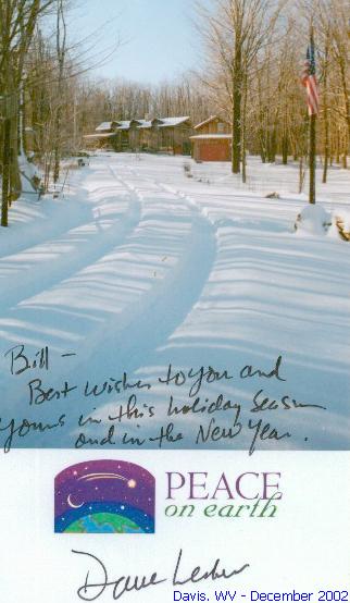
Davis - Dave writes: " The winter is off to a great start here at the summit of Canaan Mountain. I'm keeping my fingers crossed that this pattern holds until April. "

COLUMN DENOTATIONS:

A  maximum mean temperature T total precipitation (inches)
T1 Departure from normal
B  minimum mean temperature U maximum calendar day precipitation (inches)
C  monthly mean temperature
C1 Departure from normal
U1 date of maximum calendar day precipitation
D  maximum temperature V date(s) of maximum daily precipitation
E  date(s) of maximum temperature V1 maximum 24-hour precip. & date(s)
F  minimum temperature W number of days with precip. >= .01"
G  date(s) of minimum temperature  X number of days with precip. >= 1.0"
H  days with maximum temperature >=90 Y year-to-date precipitation (inches)
I  days with maximum temperature <=32 Z maximum calendar day snowfall (inches)
J  days with minimum temperature <=32 1 date of maximum calendar day snowfall (inches)
K  days with minimum temperature <= 0 2 number of days with snowfall
L  peak wind gust (miles per hour)  3 number of days with snowfall >= 1.0"
M  direction of peak wind gust 4  total snowfall for month (inches)
N  date(s) of peak wind gust  5 total snowfall for 2001-2002 season (inches)
O  number of days with thunder  6 maximum barometric pressure (inches)
P  number of days with hail 6A date of maximum barometric pressure 
Q  number of days with glaze 7 minimum barometric pressure (inches)
R  number of days with ice pellets 7A date of minimum barometric pressure
R1 number of days with dense fog [1/4 mile and less visibility] (i) incomplete data
S  local observation time for temps/precipitation (M) Missing, if listed in data table
 ~ "about" E estimated
 +  additional indeterminate number of days NR not recorded


For ACON VA/NC/SC Recent Weather News, Search CNN
http://www.cnn.com/WEATHER
 

National Weather Service Web Sites & Current Email Addresses
Within or Nearby the ACON VA/NC/SC Area Can Be Found At:

     NWS Washington/Baltimore, VA/MD
     NWS Wakefield, VA
     NWS Blacksburg, VA
     NWS Raleigh, NC
     NWS Newport/Morehead City, NC
     NWS Wilmington, NC
     NWS Greenville-Spartanburg, SC
     NWS Columbia, SC
     NWS Charleston, SC
     NWS Morristown, TN

     National Weather Service Homepages

     $$$ National Climatic Data Center, Asheville, NC $$$

STATION / LOCATION (MILES & DIRECTION FROM MAIN POST OFFICE)/OBSERVER / YEAR RECORDS BEGAN / EMAIL ADDRESS:

AHB   Ashburn, VA  - Gary Oldham  7/01 281' AMSL  n6skk@arrl.net ROK   Roanoke, VA 6SW Wendell Prillaman  4/76 wlprillaman@cox.net
ANN    Annandale, VA 1 3/4 ENE - Lowell Koontz  12/90  wwkoontz@bellatlantic.net AKQ    Wakefield, VA NWS Wakefield Municipal Airport 36-58-53N 077-00-04W 33M
DCA    Arlington, VA Washington, DC, Reagan Washington National Airport 38-50-54N 077-02-03W 18M WSH   Washington, VA  David Yowell runamok@runamok.com
BCB    Blacksburg, VA NWS Virginia Tech Airport 37-13N 080-25W WEE   Weems, VA 3WNW Francis J. Socey
BRI     Bridgewater, VA Clayton Towers Ctowers@rica.net WOO  Woodstock, VA 5NW Lauck Walton - 12/1/85 jwalton@shentel.net
CEN   Centreville, VA Paul Bassett 1985 m.psb@verizon.net  
CHO   Charlottesville, VA  Charlottesville-Albemarle Airport ASOS  (Rappahannock County) 38-08-18N 078-27-21W 192M AVL    Asheville, NC  Asheville Regional Airport 35-25-55N 082-32-15W 670M
DAN  Danville, VA, Danville Regional Airport, 36-34-22N 079-20-10W 175M  BRE    Brevard, NC 1SE Bob Keehn 1/1/90 Bob_Keehn@citcom.net
IAD   Dulles - Washington-Dulles International Airport  38-56-05N 077-26-51W 93M  CLT    Charlotte, NC NWS Charlotte/Douglas International Airpot 35-12-48N 080-56-55W 220M
FCH    Falls Church, VA Erica Page - 3/7/94 Windie1970@aol.com  
HAM    Hampton, VA 5NE Dave Kessel 1989 davidckessel@cox.net ECG  Elizabeth City, NC,  Coast Guard Air Station 36-15-47N 076-10-58W 11M
HRG    Harrisonburg, VA  Terry Slagle 5/2000 Altitude: 1306'  tslagle@adelphia.net FAY  Fayetteville, NC Fayetteville Regional Airport, 34-59-22N 078-52-48W 55M
HER    Herndon, VA R.M. Beall P- 10/76   T-  1/91 beall47@earthlink.net GSO   Greensboro, NC NWS Piedmont Triad International Airport 36-05-51N 079-56-37W 275M
HRN   Herndon, VA 4SW Russ Topping -  1985 weatherman@cox.net LBT    Lumberton, NC  Lumberton Municipal Airport 34-36-26N 079-03-36W 37M
LXI     Lexington, VA  Scott M. Lancey, WREL Radio -  06/1996 weather@wrel.com RAL    Raleigh, NC 7NNW  Bob Woodson -  6/1/93 kf4mmm@qsl.net
LKU     Louisa, VA 1N Joseph Bowers 1944 - NWS ID  44-5050-02jmbiii@earthlink.net RDU   Raleigh-Durham, NC Raleigh-Durham International Airport 35-52-14N 078-47-11W 130M
LOU     Louisa, VA 6S John Bullock (about 1970) INACTIVE 1/1/02 ROX    Roxboro, NC 2SE Merriell A. Jay 1/93
LYH     Lynchburg, VA NWS Lynchburg Regional Airport 37-19-15N 079-12-24W 295M ILM     Wilmington, NC NWS New Hanover International Airport 34-16-06N 077-54-22W 9M
NEW    Newmarket, VA 2W Joyce Winfree joywood@shentel.net CHS   Charleston, SC NWS Charleston Air Force Base 32-53-56N 080-02-26W 13M
NPN     Newport News, VA 7N Gary Leonard -  6/91 GaryMLeonard@aol.com CAE    Columbia, SC NWS Columbia Metropolitan Airport 33-56-31N 081-07-05W 73M 
NOR     Norfolk, VA 3NE Jim Fentress 6/1/77 FLO    Florence, SC Florence Regional Airport 34-11-16N 079-43-51W 44M
ORF     Norfolk, VA 5NE 36-54-13N 076-11-31W 14M  1871 GSP   Greenville-Spartanburg, SC NWS Greenville-Spartanburg Airport 34-53-02N 082-13-15W 286M 
POR     Portsmouth, VA 36.81° North 76.33° West 3S Bill Trotter -  7/1/76 wxr@cox.net CRE    North Myrtle Beach, SC Grand Strand Airport 33-48-42N 078-43-26W 10M
MEC     Mechanicsville, VA Glen Martin 11/19/91 OGB   Orangeburg, SC  Orangeburg Municipal Airport 33-27-50N 080-51-13W 59M
   
RIC     Richmond, VA Richmond International Airport 37-30-40N 077-19-24W 50M TRI     Tri-cities, TN  (Bristol / Johnson / Kingsport), Tri-City Regional Airport 36-28-47N 082-23-56W 474M 
ROA    Roanoke, VA Roanoke Regional Airport 37-19-01N 079-58-27W 362M DAV  Davis, WV Dave Lesher wvweather@mountain.net