...Cooler
and Drier Over Entire Region ...
...Tornadoes
Strike at Northern Virginia...
The big event
of an otherwise unremarkable "weather month" was the tornadic outbreak
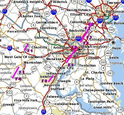
of the 24th. One summary is included below but your best look at
the storm can be found at the link provided below to NWS WBC's homepage.
Numerous pics, maps, and graphs as well as in-depth text coverage are presented.
On whole, the
month was pretty non-descript weatherwise... simply drier and cooler than
normal for most of us. A few exceptions in the rainfall category
are noted and generally result from excess rainfall coming in thunderstorms.
Without those downpours, everyone would have noted dry conditions.
But in a time
such as we continue to endure since September 11th, 2001, the weather is
of little importance. We do extend our sincere sympathies to the
families whose homes and property were destroyed in the 24th tornadoes
and to the families of the two students who died on campus at the University
of Maryland in College Park as the outbreak came to an end.
 9-24-01: Tornado Crosses Northern Virginia (online report
at
9-24-01: Tornado Crosses Northern Virginia (online report
at
http://205.156.54.206/er/lwx/924tornadofiles/September%2024,%202001%20Tornadoes.htm
)
Steven
Zubrick and Michelle Margraf, National Weather Service, Sterling, VA
...Tornado Details
from Culpeper and Fauquier Counties... A second national weather service
storm damage survey team from the Sterling office went to Culpeper and
Fauquier Counties in Virginia today (9/25). A ground survey was conducted
to assess damage caused by a tornadic thunderstorm that occurred Monday,
September 24th.
The worst tornado
damage occurred about 2 miles northeast of Rixeyville in north central
Culpeper County Virginia. There a large 3 story house located on
Indian Fork Road just off Oak Shade Road (Route 624) was completely leveled.
This house was solidly constructed having a brick wall exterior. The survey
team has rated this tornado as a minimal F-4 on the Fujita scale. An F-4
tornado has maximum winds between 207 and 260 mph but in this case winds
were likely near the lower range of this rating category. The first 911
call indicating the house had been struck by a tornado was received at
the Culpeper County Emergency Operations Center at 3:08 PM EDT. The tornado
was about 75 yards wide at this point. Significant pieces of the house...such
as upstairs roofing trusses...were found up to one half mile to the northeast.
This tornado
apparently had first set down in Rixeyville where a tree was blown onto
a home on Ryland Chapel Road (Route 640) shortly after 3 PM. The tornado
was rated F-0 (40-74 mph) at this point. The tornado continued moving northeast
and after demolishing the house on Indian Fork caused extensive damage
around the community of Jeffersonton. The tornado caused F-1 damage
(75-112 mph) in the Ponderosa Trailer Park on the south side of Jeffersonton
destroying three trailers and damaging four others. Four churches in town
were also damaged with two churches experiencing moderate roof damage.
The tornado was rated F-1 as well around Jeffersonton. Significant tree
damage also occurred along the path. As the tornado moved northeast...it
demolished a large garage and rear porch attached to a two-story house
on Springs Road (Route 802) about 1/4 mile northeast of Jeffersonton. This
house also lost a portion of its roof and an adjacent house lost the roof
to an attached sun room. The tornado was rated F-2 at this location. An
F-2 tornado has maximum winds between 113 and 157 mph.
Damage from
the tornado lessened about one half mile northeast of Jeffersonton as the
storm crossed the Rappahannock River into Fauquier County. Only scattered
minor tree damage (rated F-0) was noted in the 9100 block of Harts Mill
Road (Route 688) in Fauquier County.
Pieces of a
tin roof from a small utility shed or barn were found in an open field
along Route 211 about one-quarter mile east of Holtzclaw Road (Route 681)
in Fauquier County (F-0 damage here). The tornado appeared to lift after
it crossed Route 211 near Atherton Farms. At this time no damage reports
have been received along the path of the storm from where the tornado lifted
near Routes 211 and 681 until just west of The Plains Virginia.
The team surveyed
tornado damage in northeastern Fauquier County in the vicinity of The Plains
Virginia. A house near the intersection of John Marshall Hwy. (route 55)
and Bunker Hill Road...about one-half mile west of The Plains...was struck
by a tornado around 350 pm EDT. The tornado caused extensive tree and powerline
damage around a well-constructed 2-story brick house. The tornado ripped
off a large front porch from and blew it 50 feet away. Lumber pieces from
the porch were hurled into vehicles parked next to this residence. The
tornado was rated F-1 here and was between 50 to 100 yards wide. Many of
the slate shingles were blown off the roof and a small pool house was destroyed
at this location.
Damage...mainly
to trees...from this tornado was followed to the northeast along Whitewood
Road.
F-0 damage was
observed to a small horse barn on Milestone Road. The survey team also
found tree damage along Rock Hill Mill Road between Whitewood and Zulla
Road.
No survey was
conducted north of Rock Hill Mill Road but it is possible that the tornado
may have continued producing damage northward to the Fauquier-Loudoun Counties
line. At this time no damage has been reported in Loudoun County near the
path of this storm.
The team surveyed
tornado damage in northeastern Fauquier County in the vicinity of The Plains
Virginia. A house near the intersection of John Marshall Hwy. (route 55)
and Bunker Hill Road...about one-half mile west of The Plains...was struck
by a tornado around 350 pm EDT. The tornado caused extensive tree and powerline
damage around a well-constructed 2-story brick house. The tornado ripped
off a large front porch from and blew it 50 feet away. Lumber pieces from
the porch were hurled into vehicles parked next to this residence. The
tornado was rated F-1 here and was between 50 to 100 yards wide. Many of
the slate shingles were blown off the roof and a small pool house was destroyed
at this location.
Damage...mainly
to trees...from this tornado was followed to the northeast along Whitewood
Road.
F-0 damage was
observed to a small horse barn on Milestone Road. The survey team also
found tree damage along Rock Hill Mill Road between Whitewood and Zulla
Road.
No survey was
conducted north of Rock Hill Mill Road but it is possible that the tornado
may have continued producing damage northward to the Fauquier-Loudoun Counties
line. At this time no damage has been reported in Loudoun County near the
path of this storm. |

ACON
- VA/NC/SC
The Atlantic
Coast Observer Network:
Virginia,
North Carolina, South Carolina
http://www.pilot.infi.net/~bsmoot/acon.htm
SUMMARY OF
CLIMATOLOGICAL DATA
SEPTEMBER
2001
Patrick Maloit's SEPTEMBER
2001 Hydrological Report Narrative Summary http://tgsv5.nws.noaa.gov/er/akq/HYM/SepPre2001.htm
"September was
drier than normal across most of central...south central and eastern
Virginia, northeast North Carolina and the the lower Maryland eastern shore.
Dry September's are typical across the area without the impact of a tropical
system. The month was marked by several dry spells, punctuated by areas
of heavy rainfall associated with some of the seven cold fronts that moved
across the Mid-Atlantic states in September. September 2001 precipitation
totals ranged from 0.75 inches at Gordonsville (Louisa)...to 4.38 inches
at Hallieford (Mathews). A cold front crossed the area on the 1st...causing
scattered showers and thunderstorms with it. This precipitation caused
a 24 hour maxima for the month of 0.25 inches at Nurkeville (Nottoway).
High pressure built in from the Great Lakes behind the front...gradually
moving east to off the Canadian coast on the 3rd. A cold front moved from
the Great Lakes on the 4th to off the East Coast by the 5th...bringing
generally light precipitation with its passage. An area of high pressure
slowly moved from the lower Great Lakes late on the 5th to off the New
England coast on the 9th. Showers and thunderstorms developed in the deep
southerly flow that developed behind the departing high...and ahead of
a slow moving cold front on the 9th. With another batch with the passage
of the front from the 10th to the 11th. This 3 day period of scattered
showers and
thunderstorms
caused a few 24 hour rainfall maxima for September including: 1 inch at
Clarksville (Mecklenburg/9th)...0.73 inches at Lawrenceville (Brunswick/9-10th)...and
2.8 inches at Emporia Water Plant (Greensville/10-11th). On the 11th...a
high built in behind the front from the midwest. This high
slowly moved off the Mid-Atlantic coast by the 13th. A relatively dry cold
front moved across the area from the 13th to the 14th...causing mainly
scattered rain showers with it. Yet another high slowly built in from the
Great Lakes on the 14th...where it remained through the 16th. The high
then slowly moved east...to off the Eastern seaboard by the 19th.
Much like the
period from the 9th to the 11th...the period from the 19th to the 21st
saw several periods of showers and thunderstorms. This was in response
to deep southerly flow behind the high on the 19th and the passage of a
cold front from the 20th to the 21st. The precipitation that occurred over
these 3 days caused some 24 hour precipitation maxima for the month including:
1.47 inches at Back Bay Wildlife Refuge (Virginia Beach/19-20th)...1.52
inches at Ruther Glen
(Caroline/20th)...2.09
inches at Warsaw (Richmond County/20th-21st)...and 0.35 inches at Powhatan
(Powhatan/21st). Weak high pressure built in behind the front on
the 21st...followed
by a relatively
dry cold front passage on the 22nd. Behind this front...high pressure built
in to the Mid-Atlantic states by the 23rd...then offshore by the 24th.
A strong cold front crossed the
area from the
24th to the 25th...causing the majority of the reported 24 hour rainfall
maxima for September. This included Western Branch (Chesapeake/24th)...2.60
inches at the Milford Haven
Coast Guard
Station (Mathews/24-25th)...and 1.70 inches at Camp Peary (James City County/25th).
High pressure moved in from the upper Great Lakes on the 25th...then
moved southeast
to off the Georgia Coast by the 27th. A weak cold front crossed the region
from the 27th to the 28th...causing light precipitation with its passage.
Yet another high built in from the Great Lakes behind this front...sliding
slowly southeast to the Ohio Valley by the 30th. The passage of an upper
level low from the 29th into the 30th...spread light precipitation across
the Northern Neck and Eastern Shore to close the month. Summer 2001
rainfall totals were below normal to normal across most of central...south
central and eastern Virginia...northeast North Carolina...and the the lower
Maryland eastern shore. The totals ranged from 8.60 inches at Assateague
Island (Worcester)...to 20.08 inches at Camp Peary (James City County)."
Snowfall
Our first snowfall
measurements have come in from Dave Lesher in Canaan Heights. So,
'tis time to restart your totals for 2001-2002. We tally seasonal
snowfalls in these reports; so, if you keep yearly totals, please adjust
for seasonal amounts and report those as well.
And have you
read David Tolleris' (Wxrisk.com) winter 2001-2002 forecast? Check
this out: (get ready you snowbirds & "honkers"!)
http://www.wxrisk.com/Seasonalforcst/Winter01-02/Winter2001-02.htm
WREL Wants Your Storm Reports!!
Scott Lancey
writes from Lexington, VA: "I might mention we post current conditions
from our WeatherCenter at http://www.wrel.com/wx.htm.
We also have a email weather update service that ships out watches and
warnings along with a discussions of potential significant weather along
the mid-Atlantic. Our update readers often submit reports and on occasion,
photos (most recently of the MD tornado). Info on the updates is
at http://www.wrel.com/updates.htm.
I'd welcome any ACON reporters to sign up and submit storm information...it's
very helpful.
Skywarn
Bob Woodson
sends the local Skywarn Web address: http://www.centralcarolinaskywarn.net

|

For ACON
VA/NC/SC Recent Weather News, Search CNN
http://www.cnn.com/WEATHER
ACON
VA/NC/SC Member Station Extremes - September 2001
|
State
|
Maximum Temperature
|
Minimum
Temperature
|
Warmest
Average
Temperature
|
Coldest
Average
Temperature
|
Maximum
Precipitation
|
Minimum
Precipitation
|
|
Virginia
|
90°
Newport News, Hampton
|
35°
Lynchburg, Lexington, Newmarket
|
70.4°
Norfolk
|
61.3°
Blacksburg
|
4.77"
Ashburn
|
1.13"
Harrisonburg
|
|
North Carolina
|
94.2°
Concord
|
37°
Brevard
|
71.3°
Wilmington
|
62.7°
Brevard
|
4.73"
Brevard
|
0.86"
Raleigh (RDU)
|
|
South Carolina
|
96°
Orangeburg
|
42°
Greenville-Spartanburg
|
73.8°
Charleston
|
68.5°
Greenville-Spartanburg
|
6.74"
Greenville-Spartanburg
|
1.84"
Columbia
|
Virginia:
Annandale - "September
was cool with a -2.2°F mean temperature departure and a little on the
dry side with a precipitation departure of 0.85 inches. The highest temperature
for month was 83°F, which was the lowest maximum for September since
1992. The highest minimum temperature of 67°F was the lowest in September
since 1989 when it was 63°F. The highest temperature range for any
day of month was 22°F, which was the most in September since 1996 when
it was also 22°F. The mean temperature for month of 65.45°F was
the lowest in September since 1994. The highest mean temperature for any
day of month was 75°F, which was the lowest in September since 1989.
The highest wind for month was only 18mph on the 25th, which was the lowest
maximum wind speed for September since 1995. September 24th a tornado passed
only 3.25 miles to the SE of this station. What made the tornado
more unusual? 1. There was very little lightning associated with
the storm and then only at the tornado's passing to our SE
2. Having two strong tornadoes of F3 or F4 in late September --The other
tornado in Culpeper, and The Plains, Virginia 3. Having tornadoes
in this area to make such a long path of destruction 4. Having a
tornado of F3 to F4 strength in the Washington area 9-14-2001--Low
maximum temperature The maximum temperature today was 68°F, and equaled
the 21-year low maximum temperature record for the date; the old record
was set in 1996. 9-15-2001--Fall like weather The 47° minimum
temperature today was the lowest since May 14, 2001. It was also only two
degrees from equaling the 21-year record low minimum for the date
at this station. 9-16-2001--Cool weather The 49° minimum
was only four degrees from equaling the 21-year record low minimum for
the date at this station.The maximum temperature today was 66°F, a
new 21-year low maximum temperature record for the date; the old record
was 70°F in 1996. 9-26-2001--Record low minimum The minimum temperature
today was 43°F, a new 21-year low minimum temperature record for the
date; the old record was 46°F in 1983. It was also the
lowest minimum since 5-7-2001 when the minimum was 40°F." [ -
- ] - notes form Lowell
Arlington - NWS WBC reports:
"No new records were set in Washington this month. After a cooler
than normal summer...September continued on the same track. This
month was nearly two and a half degrees cooler than normal...which ties
it for the third coolest september in the past 25 years. This also
follows the pattern from last September which was the coolest September
in 25 years. There were no days that were 90 degrees or warmer this
month. This likely means that we will end up with sixteen 90 degree
days this year which is less than half of our normal of thirty eight.
Although summer was wetter than normal...the end of summer was relatively
dry...a trend that continued into September which had less than an inch
and a half of rain all month. This was almost two inches below the
normal and was our driest September in ten years. One notable weather
event this month was a tornado that tracked north across the metro area
and the District on Monday the 24th. An energetic system moving east
across the region spun up a tornado that tracked from Franconia in Fairfax
County Virginia...through Alexandria...past the Pentagon and into the District.
The tornado dissipated briefly before reforming around College Park Maryland.
It then tracked through Beltsville to Laurel Maryland. This storm
produced numerous injuries...two fatalities...and millions of dollars in
damages." The average winds speed was 8.3 mph. [ - -]
Ashburn - Notes from Gary:
"Needless to say, the two tornadoes that hit the area on the 24th were
certainly the highlight this month. Last month I gloated about being
out of town on business travel and missing the heat wave in early August;
this month I was on a train to Miami on business and missed the severe
weather on the 24th (though I did get to watch some strong thunderstorms
and high winds in south Florida.) We did get 3.06 of rain that day,
with an additional 1.16 the next day. Temperatures for the month
ran 1.5° F below normal, and rainfall was again above normal, this
time 1.41 above the norm. Quite a few days of dense fog (Im using
visibility of ¼ mile or less to define dense; if this is wrong,
please let me know... [Editor's note: That is the NWS standard; but
great variations in dense fog criteria persist!] ), but only two days
of thunder one of which produced the two tornados; one was less than
13 miles from my station. Wind is picking up just a bit, with more
breezy days than in the past two months, even though the average wind
speed remained at 1.2 mph (vs. 1.2 mph in July and 1.1 in August).
The 18th was kind of interesting in its normality; with a mean temperature
of exactly 65.0° F, there were 5.1 heating degree days and 5.1 cooling
degree days (using the integration method). Three days had their
lows at or around midnight rather than the more typical ~6:30 a.m.; the
10th, the 14th, and the 25th." [ - + ]
Blacksburg - Temps were 1.8°
below normal while precip was 1.77" below normal. - NWS Blacksburg [
- -]
Bridgewater - Clayton writes:
" The average temperature was 0.5° below normal. The precipitation
was 2.18 inches below normal. For the year, precipitation is 4.83 inches
below normal. There were no thunderstorms during the month.
Weatherwise, September was a rather dull month!." [ - -]
Centreville - Paul notes: "Since
the first of the year, seven months have had a 24-hour precipitation event
that exceeded one inch. Four of those nine months had occurrences
when accumulations accounted for over half of the monthly total.
September should be included as a major contributor to these facts with
the storm of the 24th and 25th producing 1.84 and 71% of the 2.60 monthly
total. Unfortunately, 2.60 was only 80% of our expected 3.26, being
0.66 short at the last tip of the bucket. The first half to September
held the majority of average highs and lows ranging from 76° to 52°.
A peak of 85° for the month was recorded on the 10th and 38°, the
lowest on the 26th. Even if the lowest temperature had come in at
the average expected low of 55.4°, the monthly average nightly low
would have still worked out to be below normal. After all the buttons
were pushed, we managed to be 2.7° below average. A near milestone
in weather keeping for the century and possibly worthy of a special on
P.B.S." [ - - ]
Charlottesville - Rainfall
for the month was 1.31" below normal. Average wind speed was 3.3 mph. -
NWS WBC [M -]
Dulles - NWS WBC reports
rainfall was in excess of the normal by 0.06". [ M +]
Falls Church - Erica notes:
"September 2001 was a cool and dry month. I had no days with and
inch or more of rainfall. On the 24th, severe weather and strong
tornadoes plagued our area. A warning was issued for Falls Church
around 4 PM. The tornado passed further SE of me and headed towards
Alexandria and the Pentagon. From there it gained strength to an
F4 and moved into College Park, MD." - notes from Erica [ - - ]
Harrisonburg - "The temperature
for the month of September averages .9° below normal. Rain for the
month totaling 1.13" made September the second driest month so far for
2001. This makes the yearly rain total 5.39" below normal." - notes from
Terry [ - - ]
Herndon - Russ sends these
email notes: "September rainfall was .21 inches below normal. I had
thunderstorms on the 10th and 20th. We had fog on the 22nd. Temperatures
were cool, averaging 2.3° below normal. Of note was the 1.79
inches of rain 24th, with no thunder heard, and
the absence of any 90° temperatures
in September. In fact, temperatures stayed below 85° for the
last summer month." [ - -]
Louisa - Continues to get dry
there reports Joe. Nothing of much significance to report in central
VA [M -]
Lexington - "Rather dry month
here in the Shenandoah Valley of Virginia. Devoid of tropical systems,
we usually are under 2.5 inches of rain in September. This month our total
was only 1.54 inches...well below average. Of note in September was the
fact we recorded measurable precipitation on only five days; again, below
the average of eight. September's mean temperature was 1.9° below
average and for the first time since March, 2001, we did not record a high
temperature of 90° or above. A colder than anticipated
FROPA on the 25th provided lows in the 30's from the 26th through
the 30th. I might mention we post current conditions from our
WeatherCenter at http://www.wrel.com/wx.htm. We also have a email weather
update service that ships out watches and warnings along with a discussions
of potential significant weather along the mid-Atlantic. Our update readers
often submit reports and on occasion, photos (most recently of the MD tornado).
Info on the updates is at http://www.wrel.com/updates.htm.
I'd welcome any ACON reporters to sign up and submit storm information...it's
very helpful." - Scott Lancey for WREL Radio
Lynchburg - The mean temp was
3.9° below normal while precip was 1.07" below the norm. - NWS Blacksburg
[
- -]
Newport News - Gary sends these
notes: "A lack of any tropical systems resulted in a dry month here at
Newport News. Only 1.65" for the entire month. Temperatures
were pretty much normal with a cool period the last 6 days of the month.
This gave us a record low of 47° on the 27th." [ +/-
- ]
New Market - Joyce notes: "We
are a couple of degrees cooler than normal for the month and about minus
2" below normal for precip." [ - - ]
Norfolk - From NWS AKQ:
The monthly precip was 1.43" below normal while the monthly mean temp was
1.5° below normal. The average wind speed was 8.4 mph. [ -
- ]
Portsmouth - A cool -4th coolest
in the database beginning with 1976- and drier than normal month here with
temps 2.2° below normal and rainfall -1.87" or only 60% of the norm.
No temps reached 90° in a month that usually has at least one day with
such a reading. Rainfall for the year continued well-below normal,
nearly 9". One of several cold fronts produced the bulk of the month's
local precip with 1.74" on the 24th. Station records for the month
included: A daily max wind gust of 26 mph on the 14th, daily minimum maximum
temps on the 15th (69°, previously 71° in 1983) and 30th (62°,
previously 63° in 1992), a daily minimum temp record of 51° on
the 27th, surpassing the previous record of 53° set in 1978, and a
daily precip record of 1.74" set on the 24th, previously 046" set in 1979.
Mostly northerly winds during the month with an average of 2.2 mph. [
- - ]
Richmond - From NWS AKQ:
Richmond's rainfall was 1.24" below normal. Rainfall totals for the
year-to-date were 4.21" below normal. Monthly temps averaged 2.2°
below the norm. The average wind speed was 6.4 MPH. [-
-]
Mechanicsville - Glen
writes: "Heavy showers moved through the area on the 20th. Conditions
remain dry in this area." [ M - ]
Roanoke - "Temperature
averages were 1.2° below normal. Rainfall was below normal (-1.38")
- notes NWS Blacksburg [+ -]
Roanoke - Wendell reports,
"Cool and dry with temps averaging 1.8° below normal while rainfall
measured 1.95" below normal." [ - - ]
Woodstock - "August was
close to my 16 year average---a little wetter, a little warmer, but nothing
notable." - notes from Lauck
[ + +]
North Carolina:
Asheville - From NWS GSP: The
monthly mean temp was 1.7° below normal while rainfall was 0.50"
above normal. The average wind speed was 4.4 mph. For the year, precip
was 6.76" below normal. [ - +]
Brevard - Bob sends these
notes via email: "September 2001 was a cool month with a mean temperature
of 62.7°, compared with a ten year
average of 68.8°, a very pleasant
month. The dry spell has persisted, with 4.73" of rain recorded in a month
that averaged 5.08" over a ten year period. Cumulative rainfall for the
end of September 2001 measured 38.92" compared with a ten year average
of 52.56". [ - - ]
Charlotte - NWS GSP reports
the mean temp here was 3.4° below normal while precip was 0.81" above
normal. For the year, rainfall continued well-below normal (-10.36").
The average wind speed for September was 5.4 mph. [- +]
Concord - After relocating
his station, Tom is back & reporting. "Rainfall was 0.80" above
average for the month with temperatures averaging 3.1° below normal.
The area still remains under drought restrictions although the last several
months have averaged above normal." [ - + ]
Greensboro - Temperatures at
the Piedmont Triad International Airport averaged 2.4° below normal
while precip was 1.46" below the norm. A daily minimum maximum temp
record on the 10th was tied. - From NWS RDU [- -]
Lumberton - The average wind
speed was 3.9 MPH. - from NWS ILM
Raleigh (RAL) - Bob emails
these notes: "After a fairly wet summer (June, July, August), little rainfall
fell in September. Rainfall for September was -1.27" below normal.
The average daily temperature was also below normal (-3.2°).
Seems like we are getting into a fall/winter pattern already with a fairly
persistent trough on the East Coast. No severe wx at this location
even though a tornado warning was issued on Sept 20th for this part of
the county. By the way, the skywarn web address for this area is http://www.centralcarolinaskywarn.net
." [ - - ]
Raleigh (RDU) - Cool and very
dry. The monthly mean temperature was 2.1° below normal and the
total precip was 2.33" below normal. September was the 4th driest
since records began at the airport location in 1944. The month also
was the 5th coldest during the records span, with the temps tied at 69°
(1874, 1958, and 1949). A high minimum temp of 71° was tied on
the 10th (previously 1985 and 1964). - from NWS RDU [ -
-]
Roxboro - Merriell reports:
"While September presented some beautiful late summer and early fall days,
the month was drier and cooler than normal." [ - - ]
Wilmington - "...Well below
normal temperatures for September...and continued drier than normal...
the average temperature for the month of September was 4.0° below normal.
The average high was 5.0° cooler than normal...and the average low
temperature was 2.8 degrees below normal. No temperature records
were broken for the month....although Wilmington did tie the record low
temperature of 53° on the 17th. This record was set first
in 1961. Total rainfall 2.00 inches below normal. A nearly
normal amount of sunshine was received in September. 59% of possible
sunshine was received...normal is 61%. the average wind speed was
5.8 mph." - excerpts from NWS ILM's monthly summary [ -
- ]
South Carolina:
Columbia
- NWS CAE reports the average relative humidity was 69% while the average
temperature was 1.5° below normal. Rainfall was 1.83" below normal.
For the year rainfall is running 14.44" below normal. - NWS CAE [-
-]
Charleston
- From NWS CHS: The monthly mean temp was 2.6° below normal while precip
was 0.17" above the norm. The average wind speed was 6.6 mph. At downtown
Charleston, temps average 1.2° below normal while rainfall was nearly
6/10ths inch below normal. [- +]
Florence
- NWS ILM reports the mean temp here was 3.2° below normal
while rainfall was 0.42" below normal. The average wind speed was
5.7 mph. A new record low of 49° on the 17th surpassed the old
record of 50° set in 1961. A new record low of 47° was set
on the 27th surpassing the previous record of 50° set in 1950. [-
-]
Greenville-Spartanburg-
The monthly temps averaged 2.7° below normal while total rainfall was
2.78" well-above normal. The average wind speed was 4.9 mph.
Yearly rainfall was running 6.71" below normal. For the year, average
temps were slight above normal (+0.3°) - NWS GSP [ - +]
North Myrtle
Beach - From NWS ILM: Rainfall was 1.47" below normal.
Temps averaged 2.6° below normal. The average wind speed was
5.6 MPH. Records: A new low temperature of 52° set on the
17th. The previous record was 54° set in 2000. A
record low was tied on the 27th with the old record (52°) set first
in 1956. [ - - ]
Orangeburg
- The average relative humidity was 73%. (from NWS CAE)
Nearby Cities:
Tri-cities/Bristol area noted
temps averaging 3.4° below normal with total rainfall below normal
( -1.06"). For the year, rainfall is 5.20" above normal. -
from NWS Morristown, TN [ - - ]
VIRGINIA
(Please
note the column denotations table below.)
TEMPERATURES / WIND / ELEMENTS
VIRGINIA
STN  A      B    C    D      E F     G    H I  J K L  M     N  O P Q R R1 S
------------------------------------------------------------------------------
AHB 74.2  53.3  65.9  87.2  13 40.3 26   0  0  0 0 18 SW   29  2 0 0 0  6 2400
ANN 73.63 57.27 65.45 83    10 43   26   0  0  0 0 18 WNW  25  1 0 0 0  0 2400
BCB             61.3  83     7 36 16,26            23      25             2400
BRI 78.0  53.1  65.6  88  4,13 38 26,30  0  0  0 0             0 0 0 0  0 0515/1600
CEN 75.5  52.7  64.1  85    10 38   26   0  0  0 0 27 360° 14  2 0 0 0  0 1200/2400
                                                   27 230° 26
CHO 77.1  52.6  64.8  88     4 39   30   0  0  0 0 23 160°  9  3 0 0 0  3 2400
DCA 77.8  60.0  68.9  87   4,9 46   26   0  0  0 0 30 350° 14  4 0 0 0  0 2400
IAD 77.3  53.4  65.4  85   4,9 40   26   0  0  0 0 27 360° 14             2400
                                                   27 230° 26
FCH 77.5  59.2  68.4  87  9,10 47   26   0  0  0 0             3 0 0 0  0 2400
HAM 78.0  59.1  68.5  90    10 47   27   1  0  0 0 25 ENE  15  3 0 0 0  1 2400
HRG 74.8  51.3  63.1  83.9   4 37.7 26   0  0  0 0 20 SSW  14  0 0 0 0  2 2400
HER 74.8  55.2  65.0  84.6  10 44.1 28   0  0  0 0 18      30  2 0 0 0 3+ 2400
HRN 74.8  55.0  64.8  84.0  13 39.9 26   0  0  0 0 26 N    14  2 0 0 0  1 2400
LKU 78.9  50.4  64.7  89     4 36   26   0  0  0 0 20 N    20  2 0 0 0  1 2400
LYH             64.2  85     4 35   26             36      24             2400
LXI 77.3  51.7  64.4  86.9   4 35.4 30   0  0  0 0 18 E    25  1 0 0 0  7 2400
NEW 77.50 50.40 63.95 88     7 35   30   0  0  0 0 24 NW   25  1 0 0 0 10 1700
NPN 78.0  59.1  68.5  90    10 47   27   1  0  0 0 25 ENE  15  3 0 0 0  1 2300
ORF 77.5  63.2  70.4  89    10 51   27   0  0  0 0 38 020° 30  2 0 0 0  1 2400
POR 77.6  62.8  70.2  89    10 51   27   0  0  0 0 30 N    30  2 0 0 0  2 2400
MEC 76.1  57.6  66.9  85    13 42   26   0  0  0 0             2 0 0 0  0 1800
RIC 78.4  57.2  67.8  88    10 43   26   0  0  0 0 31 010° 30  2 0 0 0  3 2400
RMD 78.2  60.2  69.2  88    10 47   26   0  0  0 0             0          2300
ROA             66.4  88   4,5 43 16,29  0  0  0 0 26   25,30             2400
ROK 77.7  53.9  65.8  88     5 40   16   0  0  0 0 19 NW   27  1 0 0 0  1 2200
AKQ 79.23 55.53 67.38 88 10,23 41 26,27                                   2400
WOO 74.3  56.4  65.3  83  1,10 41   26   0  0  0 0             0 0 0 0  5 0800
WSH 75.5  53.9  64.7  87.8   4 41.8 26   0  0  0 0 13 E    25  1 0 0 0  0 2400
NORTH
CAROLINA
STN  A      B    C    D      E F    G     H I  J K L  M     N  O P Q R R1 S
------------------------------------------------------------------------------
AVL 74.8  54.1  64.5  84     5 40   26   0  0  0 0 28 310°                2400
BRE 73.3  52.0  62.7  81  9,23 37   26   0  0  0 0 23      14  0 0 0 0 15 1600
CLT 79.8  58.2  69.0  89  5,23 42   26   0  0  0 0 30 360°                2400
CND 83.7  57.3  68.2  94.2   5 40.2 26   8  0  0 0 27 NNE  14  2 0 0 0  3 2400
GSO 77.1  57.5  67.3  86    23 41   26                                    2400
LBT 80.7  59.5  70.1  89    23 44   30   9  1  0 0 32 020  14  3 0 0 0  7 2400
RAL 79.6  56.2  67.9  89    10 40   26   0  0  0 0 19      20  4 0 0 0  1 1900
RDU 80.0  58.0  69.0  90 10,23 41   26   2  0  0 0                        2400
ROX 77.9  56.9  67.4  87 10,23 43.0 26   0  0  0 0 20 NW   25  4 0 0 0  2 2100
ILM 80.2  62.5  71.3  86  9,10 51 27,29  0  0  0 0 43 180° 24  6 0 0 0  5 2400
                            22
SOUTH
CAROLINA
STN  A      B    C    D      E F    G    H  I  J K L  M     N  O P Q R R1 S
------------------------------------------------------------------------------
CAE 83.0  62.4  72.7  92     2 46 17,27                                   2400
CHS 82.4  65.1  73.8  88 10,21 49   30   0  0  0 0 36 010° 15             2400
                            22
CRE 79.8  63.1  71.5  86     6 48   30   0  0  0 0 37 220° 24  0 0 0 0  4 2400
FLO 81.5  60.8  71.2  89 10,22 47 26,27  0  0  0 0 30 050° 14  3 0 0 0  7 2400
                                                           15
GSP 78.1  58.9  68.5  86  5,23 42   26   0  0  0 0 29 060°                2400
OGB 82.8  62.5  72.6  96  5,22 48   30                                    2400
NEARBY
LOCATIONS
STN  A      B    C    D      E F    G    H  I  J K L  M     N  O P Q R R1 S
------------------------------------------------------------------------------
TRI 76.3  52.6  64.5  86   6,7 36   26   0  0  0 0                        2400
CHW 60.5  45.6  53.0  72.3   7 32.7 26   0  0  0 0                        1900
(Please
note the column denotations table below.)
PRECIPITATION
/ BAROMETRIC PRESSURE
VIRGINIA
STN  T     U       V      V1   W X   Y      Z  1  2 3    4    5      6       7        S
-----------------------------------------------------------------------------------------
AHB  4.77  3.06 24 3.22 24-25  6 2 36.49  0.0          0.0  0.0  30.252 15 29.669 24 2400
ANN  3.34  1.27 24 1.55 24-25  7 1 32.68  0.0          0.0  0.0  30.27   6 29.72  24 2400
BCB  1.62                                                                            2400
BRI  1.42  1.00 24 1.00    24  4 1 24.95  0.0          0.0  0.0  30.26     29.84     0515/1600
CEN  2.60  1.65 24 1.84 24-25  5 1 35.61  0.0          0.0  0.0                      2400
CHO  2.79  2.36 24 2.42 24-25 10 1        0.0          0.0  0.0                      2400
DCA  1.41  0.42 20 0.61 24-25  8 0 28.22  0.0          0.0  0.0                      2400
IAD  3.42  2.17 24 2.17    24  8 1 32.23  0.0          0.0  0.0                      2400
FCH  2.10  0.83 20 0.83 20-21  5 0 31.43  0.0          0.0  0.0                      2400
HAM  3.66  2.06 18 2.06    18  8 1 27.25  0.0          0.0  0.0  30.35   2 30.10   6 2400
HRG  1.13  0.77 24 0.86 24-25  6 0 22.38  0.0          0.0  0.0  30.29  11 29.80  24 2400
HER  3.14  1.93 24 2.15 24-25  6 1 37.23  0.0          0.0  0.0  30.24   6 29.60  24 2400
HRN  3.15  1.79 24 2.03 24-25  8 1 34.64  0.0          0.0  0.0  30.267  6 29.728 24 2400
LKU  1.47  0.67 20 0.67    20  6 0 26.69  0.0          0.0  0.0  30.26     29.72     2400
LYH  2.17                                                                            2400
LXI  1.54  0.59 24 0.59    24  5 0 30.12  0.0          0.0  0.0  30.31  11 29.79  24 2400
NEW  1.75  0.56 24             6 0 30.18  0.0          0.0  0.0                      1700
NPN  1.65  1.05 24 1.26 24-25  6 1 29.49  0.0          0.0  0.0  30.20   6 29.69 23, 2300
                                                                                  24
ORF  2.47  1.40 24 1.56 24-25  8 1 30.70  0.0          0.0  0.0  30.23   6 29.75  24 2400
POR  2.75  1.74 24 1.92 24-25  6 1 28.87  0.0          0.0  0.0  30.218  6 29.761 24 2400
MEC  1.96  1.00 20 1.32 20-21  6 0 36.07  0.0          0.0  0.0  29.97  6, 29.63  24 1800
                                                                        14
RIC  2.10  1.14 20 1.31 20-21  5 1 28.99  0.0          0.0  0.0  30.27   6 29.75  24 2400
RMD  2.45  1.63 21             4 1 32.02  0.0          0.0  0.0                      2300
ROA  2.12                                                                            2400
ROK  2.25  0.92 24 0.92 23-24  7 0 29.28  0.0          0.0  0.0  30.24  11 29.80  25 2400
AKQ  2.64  1.44 24             9 1 31.42  0.0          0.0  0.0                      2400
WOO  2.54          0.85 24-25  7 0 28.86  0.0          0.0  0.0  30.58  6, 30.23 25, 0800
                                                                        12        27
WSH  2.46  1.62 24 1.79 24-25  9 1 30.15  0.0          0.0  0.0  30.34   6 29.82  24 2400
NORTH
CAROLINA
STN  T     U       V      V1   W X   Y     Z   1  2 3  4     5       6       7        S
-----------------------------------------------------------------------------------------
AVL  4.37  0.77 24 1.08 23-24 11 0 30.13  0.0          0.0  0.0  30.23  12 29.83  24 2400
BRE  4.73          1.34    24 12+1 38.92  0.0          0.0  0.0  30.30  11 29.87  24 1600
CLT  4.31  2.08 24 2.08    24  7 1 22.66  0.0          0.0  0.0  30.22   6 29.81  24 2400
CND  4.30  2.09 24 2.09    24  5 2 30.87  0.0          0.0  0.0  30.25   6 29.84  24 2400
GSO  2.06          0.73 24-25                                                        2400
LBT  2.42  1.78 24 1.81 24-25  9 1 32.26  0.0          0.0  0.0  30.20  12 29.81  24 2400
RAL  1.92          1.00    20  9 1 32.79  0.0          0.0  0.0  30.24   6 29.81  24 1900
RDU  0.86          0.55 24-25             0.0          0.0  0.0
ROX  2.21  0.60 24 0.60    24  7 0 30.03  0.0          0.0  0.0  30.30   6 29.83  24 2100
ILM  3.04  1.43  4 1.43     4 11 1 38.27  0.0          0.0  0.0  30.19   6 29.82  25 2400
SOUTH
CAROLINA
STN  T     U       V      V1   W X   Y     Z   1  2 3  4     5       6       7        S
-----------------------------------------------------------------------------------------
CAE  1.84                          25.94  0.0          0.0  0.0                      2400
CHS  4.90                     12 2 37.10  0.0          0.0  0.0                      2400
CRE  4.23  3.01  3 3.15   2-3 12 1 35.38  0.0          0.0  0.0  30.18   6 29.83  24 2400
FLO  2.97  0.80  4 0.99   2-3  8 0 29.00  0.0          0.0  0.0  30.19   6 29.80  24 2400
GSP  6.74  2.06  3 4.00   3-4  9 3 32.78  0.0          0.0  0.0  30.20   6 29.81  24 2400
OGB  2.40                          26.99  0.0          0.0  0.0                      2400
NEARBY
LOCATIONS
STN  T     U       V      V1   W X   Y     Z   1  2 3  4     5       6       7        S
-----------------------------------------------------------------------------------------
TRI  2.20  0.61 24 0.96   2-3  6 0 37.00  0.0          0.0  0.0                      2400
CHW  2.25  0.98 25            10 0         T 25,26      T     T                      1900
COLUMN
DENOTATIONS:
| A maximum mean temperature |
T total precipitation (inches) |
| B minimum mean temperature |
U maximum calendar day precipitation
(inches) |
| C monthly mean temperature |
U1 date of maximum calendar day precipitation |
| D maximum temperature |
V date(s) of maximum daily
precipitation |
| E date(s) of maximum
temperature |
V1 maximum 24-hour precip.
& date(s) |
| F minimum temperature |
W number of days with precip.
>= .01" |
| G date(s) of minimum
temperature |
X number of days with precip.
>= 1.0" |
| H days with maximum
temperature >=90 |
Y year-to-date precipitation
(inches) |
| I days with maximum
temperature <=32 |
Z maximum calendar day snowfall
(inches) |
| J days with minimum
temperature <=32 |
1 date of maximum calendar
day snowfall (inches) |
| K days with minimum
temperature <= 0 |
2 number of days with snowfall |
| L peak wind gust (miles
per hour) |
3 number of days with snowfall
>= 1.0" |
| M direction of peak
wind gust |
4 total snowfall for
month (inches) |
| N date(s) of peak
wind gust |
5 total snowfall for 2000-2001
season (inches) |
| O number of days with
thunder |
6 maximum barometric pressure
(inches) |
| P number of days with
hail |
6A date of maximum barometric pressure |
| Q number of days with
glaze |
7 minimum barometric pressure
(inches) |
| R number of days with
ice pellets |
7A date of minimum barometric pressure |
| R1 number of days with dense
fog [1/4 mile and less visibility] |
(i) incomplete data |
| S local observation
time for temps/precipitation |
(M) Missing, if listed in
data table |
| ~ "about" |
E estimated |
| + additional
indeterminate number of days |
NR not recorded |
STATION
/ LOCATION (MILES & DIRECTION FROM MAIN POST OFFICE) /OBSERVER / YEAR
RECORDS BEGAN / EMAIL ADDRESS:
| AHB Ashburn,
VA - Gary Oldhaam 7/01 281' AMSL Gary.Oldham@DynCorp.com |
ROK Roanoke,
VA 6SW Wendell Prillaman 4/76 wandlprillaman@home.com |
| ANN Annandale,
VA 1 3/4 ENE - Lowell Koontz 12/90 wwkoontz@bellatlantic.net |
|
| DCA Arlington,
VA NWS Webmaster (Sterling): james.decarufel@noaa.gov |
|
| BCB Blacksburg,
VA NWS Webmaster: William.Perry@noaa.gov |
AKQ Wakefield,
VA NWS Webmaster: Neil.Stuart@noaa.gov |
| BRI
Bridgewater, VA Clayton Towers Ctowers@rica.net |
WSH Washington,
VA David Yowell runamok@runamok.com |
| CEN Centreville,
VA Paul Bassett 1985 pbassett@sitestar.net |
WEE Weems, VA
3WNW Francis J. Socey |
CHO Charlottesville,
VA Airport ASOS (Rappahannock County)
Webmaster (Sterling): james.decarufel@noaa.gov |
WOO Woodstock, VA
5NW Lauck Walton - 12/1/85 jwalton@shentel.net |
| IAD
Dulles International Airport Webmaster (Sterling): james.decarufel@noaa.gov |
AVL Asheville,
NC NWS NWS GSP: bryan.mcavoy@noaa.gov |
| FCH Falls
Church, VA Erica Page - 3/7/94 Windie1970@aol.com |
BRE Brevard,
NC 1SE Bob Keehn 1/1/90 Bob_Keehn@citcom.net |
| FRB Fredericksburg,
VA 7SW Ken McKneely mckneelys@email.msn.com |
CLT Charlotte,
NC NWS NWS GSP: bryan.mcavoy@noaa.gov |
| HAM Hampton,
VA 5NE Dave Kessel 1989 dckessel@home.com |
CND Concord, NC 3
W, Highway 73, 2 miles E of I85. stormwatch@vnet.net |
| HRG Harrisonburg,
VA Terry Slagle 5/2000 Altitude: 1306' tslagle@adelphia.net |
GSO Greensboro,
NC NWS Webmaster (Raleigh/RAH): Richard.Jones@noaa.gov |
| HER Herndon,
VA R.M. Beall P- 10/76 T- 1/91 beall47@earthlink.net |
RAL Raleigh,
NC 7NNW Bob Woodson - 6/1/93
kf4mmm@qsl.net |
| HRN Herndon,
VA 4SW Russ Topping - 1985 weatherman@cox.rr.com |
RDU Raleigh-Durham,
NC NWS Webmaster: Richard.Jones@noaa.gov |
| LXI
Lexington, VA Scott M. Lancey, WREL Radio - 06/1996 weather@wrel.com |
|
| LKU
Louisa, VA 1N Joseph Bowers 1944 - NWS
ID 44-5050-02 jmbiii@earthlink.net |
LBT Lumberton, NC FAA Lumberton 34o
37'N 79o 04'W nwsilm@wilmington.net |
| LOU
Louisa, VA 6S John Bullock (about 1970) |
ROX Roxboro,
NC 2SE Merriell A. Jay 1/93 |
| LYH
Lynchburg, VA NWS Webmaster (Blacksburg): William.Perry@noaa.gov |
ILM
Wilmington, NC NWS nwsilm@wilmington.net |
| NEW Newmarket,
VA 2W Joyce Winfree joywood@shentel.net |
CHS Charleston,
SC NWS, Webmaster: Theodore.Rodgers@noaa.gov |
| NPN
Newport News, VA 7N Gary Leonard - 6/91 GaryMLeonard@aol.com |
CAE Columbia,
SC NWS caewx@noaa.gov |
| NOR
Norfolk, VA 3NE Jim Fentress 6/1/77 |
OGB Orangeburg, SC NWS
caewx@noaa.gov |
| ORF
Norfolk, VA 5NE NWS 1871 Webmaster (Wakefield): Hugh.Cobb@noaa.gov |
GSP Greenville-Spartanburg,
SC NWS bryan.mcavoy@noaa.gov |
| POR
Portsmouth, VA 3S Bill Trotter - 7/1/76 pwrs@infi.net |
|
| MEC
Mechanicsville, VA Glen Martin 11/19/91 |
FLO Florence,
SC nwsilm@wilmington.net |
| RMD Richmond,
VA Roy Britt 8/22/83 roybritt@earthlink.net |
CRE North
Myrtle Beach, SC nwsilm@wilmington.net |
| RIC
Richmond, VA NWS Webmaster (Wakefield): Hugh.Cobb@noaa.gov |
TRI
Tri-cities/Bristol, TN NWS Webmaster (Morristown):W-Mrx.Webmaster@noaa.gov |
| ROA Roanoke,
VA Webmaster (Blacksburg): William.Perry@noaa.gov |
CHW Canaan Heights,
WV Dave Lesher wvweather@mountain.net |